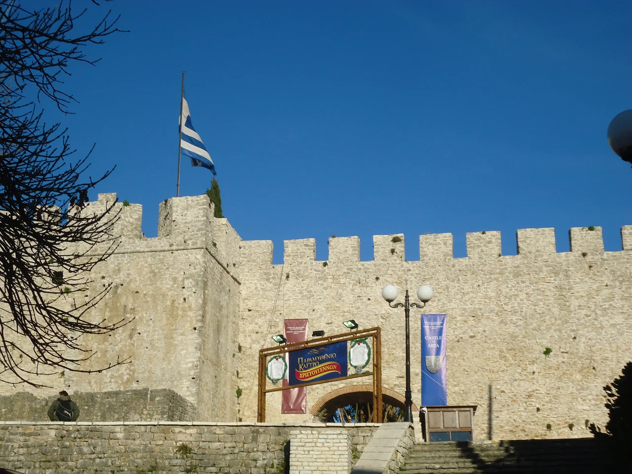
![Photo: Dimitris Kamaras [2] Uploaded from wikimedia user Dodos2013. | CC BY 2.0](https://commons.wikimedia.org/wiki/File:Arta_Castle_Greece_16.jpg)
Castle of Arta
Before this was a castle, it was a city. Ancient Ambracia — a prosperous Greek polis, capital of the Molossian kingdom, and later the seat of Pyrrhus of Epirus — stood here on the bend of the Arachthos river. In 31 BC, the Roman emperor Augustus founded Nicopolis nearby and drained Ambracia of its population. The site went quiet for centuries. When it came alive again, it came alive as a fortification — and the walls that rose on Ambracia's ruins would spend the next thousand years absorbing the ambitions of Normans, Byzantine emperors, Serbian kings, Albanian lords, Angevins, Ottomans, Venetians, and French administrators, each leaving their mark in stone.
The Layers Beneath
Stones from ancient Ambracia are still visible in the castle's eastern wall — squared ashlar blocks worked by Greek masons who were building a city, not a fortress. The site passed through long abandonment after Nicopolis's foundation, and it is unclear exactly when someone decided this bend in the Arachthos was worth fortifying again. By 1082, when Norman forces besieged the place, there were already walls worth attacking. That Norman siege is the earliest documented reference to the castle, but it implies a settlement with some defenses already in place. The Normans were not the last to find this location strategically obvious.
Capital of a Principality
After the Fourth Crusade shattered the Byzantine Empire in 1204 and Western powers carved up its territory, a successor state emerged in the west: the Despotate of Epirus, with Arta as its capital. The castle became the citadel of a ruling court. Most scholars attribute its current form — or at least its 13th-century core — to Michael II Komnenos Doukas, the third ruler of the Epirote state, who governed from the mid-13th century. A monogram attributed to him survives in a tower near the main gate, a carved signature in stone. The castle sheltered a dynasty that held off Byzantine reconquest for decades and negotiated with Angevins from Naples, Serbs from the north, and Albanians from the mountains — a tiny state maintaining its footing between enormous powers.
Contested Ground
The history of the Castle of Arta is largely a list of who took it and who took it back. Byzantine forces captured Arta in 1338 or 1339. The Serbian Empire absorbed it shortly afterward. Nikephoros II Orsini briefly restored the Epirote state in 1356 or 1357. The Serbian ruler Simeon Urosh held the city from around 1359 until it fell to the Albanian Peter Losha, who established his own Despotate of Arta. The Albanians held it until 1416, when Carlo I Tocco captured the city after a long siege and restored Epirote rule. In 1449, the Ottoman Empire conquered Arta definitively — or nearly so. During the Morean War, Venetian forces occupied the city from 1684 to 1699. The castle's walls bear modification after modification: towers raised, parapets rebuilt, embrasures cut for artillery by Ottomans and Venetians with different tactical problems in mind.
What the Walls Contain
The castle occupies a low hill at the northeastern edge of the city. Its irregular footprint stretches roughly 280 meters along its long axis and up to 175 meters wide. Originally, the Arachthos ran directly below its eastern wall; today the river flows about 200 meters to the east, leaving the castle slightly inland from what was once a natural moat. Two walls survive on the exposed western, northern, and southern sides: an inner wall about 10 meters high with towers, and a lower outer wall that enclosed the towers within its circuit. The inner wall stands largely intact. The outer wall survives only in stretches. Average wall thickness is about 2.5 meters. Remains of a Byzantine church and an associated building inside the enclosure may represent the palace and palace chapel of the Despots of Epirus — a royal residence whose precise form was mostly obliterated when a Xenia hotel was built inside the castle in the 1960s. The hotel is gone, but so is much of what it destroyed.
Reading the Walls
There is a particular pleasure in walking a fortress like this one — not the pleasure of a preserved monument but of accumulated time, where every repair era left evidence. An ancient ashlar block sits next to a Byzantine patch, which sits next to an Ottoman modification and a Venetian embrasure. The castle does not present a single unified vision; it presents a record of everyone who needed it to work. Today the castle occupies a quiet corner of modern Arta, the city growing around it while the hill it sits on remains distinct. Aktion National Airport (LGPZ) lies roughly 40 kilometers southwest across the Gulf of Ambracia. From the air, the castle's outline on its hill near the bend of the Arachthos is recognizable, the river looping below.
From the Air
The Castle of Arta sits at approximately 39.1647°N, 20.9865°E, on a low hill at the northeastern edge of Arta city, near the bend of the Arachthos River. Nearest major airport is LGPZ (Aktion National Airport), approximately 40 km to the southwest. The castle is best viewed at 2,000–4,000 feet; the river bend and the castle's hillside position are visible in clear conditions. The Gulf of Ambracia opens to the south, and the Pindus foothills rise to the northeast.
Nearby Stories
- Battle of Karpenisi 13 km away
- Castle of Santa Maura 17 km away
- Prousou Monastery 21 km away
- Paxos 22 km away
- Dodona 22 km away
- Meteora: The Monasteries Built on Impossible Pillars 42 km away
- Achilleion (Corfu) 47 km away
- SM UC-38 67 km away