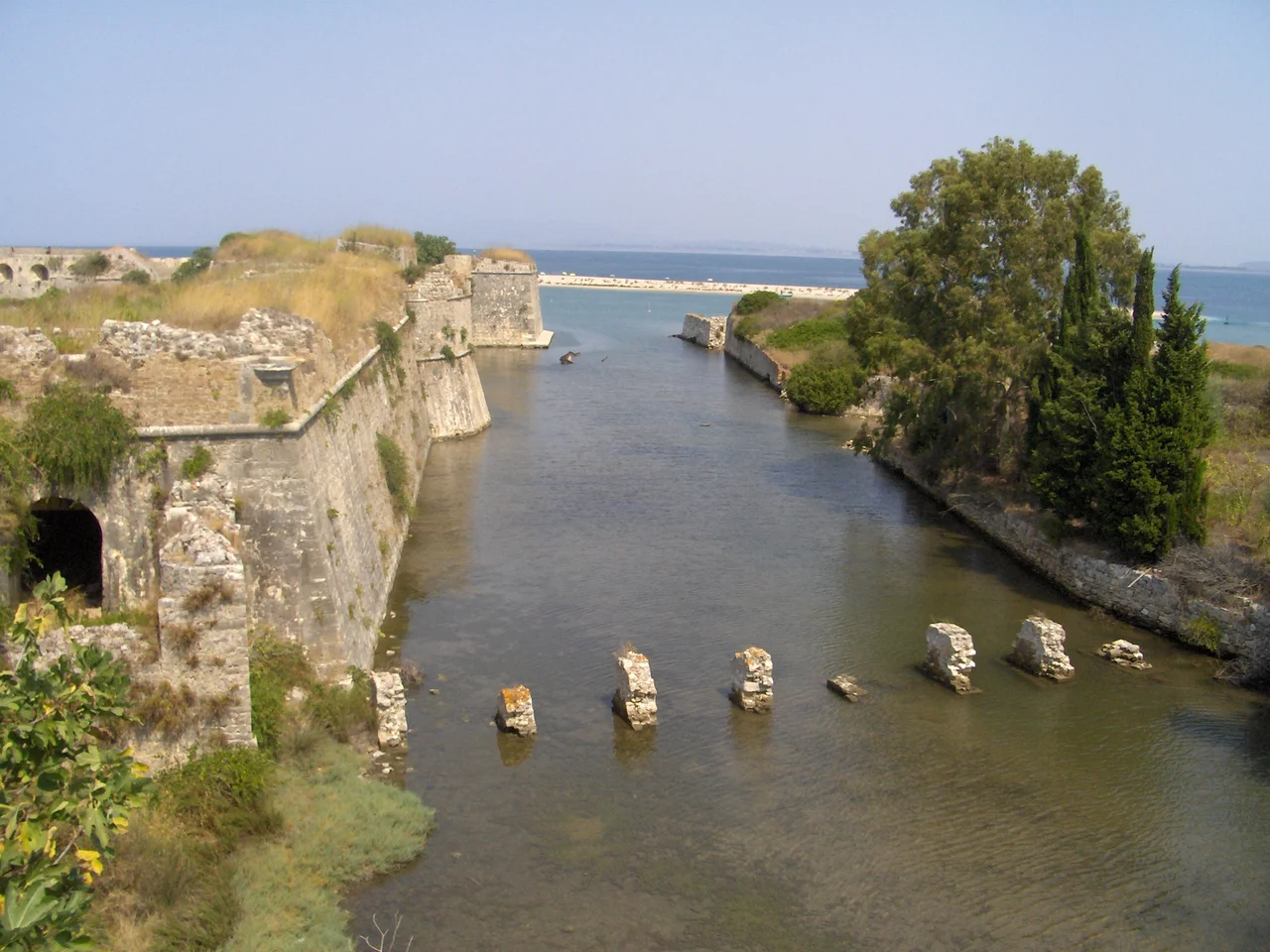

Castle of Santa Maura
Stand at the northeastern tip of Lefkada and you see the castle projecting into the channel on a long, narrow spit of land — separated from the island by a moat, separated from the mainland by water, guarding the strait between the two. It is an odd, solitary position for a fortress, and it suited the purpose perfectly. For six centuries, whoever held the Castle of Santa Maura held the approaches to one of the Ionian Islands' most strategic harbours. The castle was not merely a fortification; for much of its history it was also a town, home to hundreds of families, a marketplace, mosques, churches, and an aqueduct that brought water 3 kilometres from the island's interior.
Built on a Sandbar, Claimed by Many
The first fortification here was probably erected around 1300 by John I Orsini, Count Palatine of Cephalonia and Zakynthos, who had received the island — then known as Santa Maura — from his father-in-law, the Despot of Epirus. That early fort occupied the northeastern corner of what would become a much larger structure. Over the following century and a half, ownership changed repeatedly: the Orsini family lost Lefkada in 1331 to Walter VI of Brienne, who sold it to the Venetian Graziano Giorgio in 1343. Leonardo I Tocco seized the island in 1360 or 1362, and his successor Carlo I Tocco made the castle the capital of a domain that included Cephalonia, Zakynthos, and much of the Epirote mainland, enlarging the walled town within the walls. The Ottomans raided several times before finally taking the island in 1479.
The Ottoman Town Inside the Walls
Under Ottoman rule the castle became a proper walled settlement, known as Aya Mavra. A survey compiled between 1523 and 1536 counted 194 households — around a thousand people — all of them Greek Christians, alongside a garrison of 111 soldiers and 9 artillerymen. By 1670, when the traveller Evliya Celebi visited, the balance had shifted: the stone houses inside the walls were now exclusively occupied by Muslim families, while the Christians lived in two wooden suburbs outside. A footpath ran along the top of the aqueduct built in 1564, making it the only land route onto the island. After the Ottoman defeat at the Battle of Lepanto in 1571, the castle was completely rebuilt by the Kapudan Pasha Kilic Ali Pasha in 1572-1574, reshaped into an irregular hexagon with nine large round cannon bastions, a form it largely retains today.
Sixteen Days in August
In 1684, at the opening of the Morean War, the Venetian commander Francesco Morosini led a fleet of 38 galleys and 8 galleasses against the fortress. The siege lasted sixteen days. Morosini's bombardment set fire to the timber buildings inside the walls. A bastion collapsed on 31 July. On 6 August the Venetians launched a direct assault on the breach, and were repulsed with 40 soldiers killed. That same evening, the Ottoman garrison commander Bekir Agha offered to surrender, with the garrison and approximately 3,000 civilian residents receiving safe passage. After the surrender, Morosini made a stark decision: he demolished both the walled town and the two suburbs immediately outside, erasing the residential settlement that had stood there for generations. The cleared ground became the fortress's glacis — open firing-ground. The island's capital moved to a surviving suburb on the island itself, which grew into the modern city of Lefkada.
Passed Between Powers, Finally Abandoned
The Venetians modernised the castle through the early 18th century, thickening the eastern ramparts and adding bastions and outworks. When the Republic of Venice collapsed in 1797, the fortress passed to France, then to a Russo-Turkish expedition in 1799, then to Napoleon's forces again in 1807, then to the British in 1810. Each power garrisoned it. After 1864, when the Ionian Islands united with Greece, the Greek army held it until 1922, when Asia Minor refugees were temporarily housed within the walls. The fortress was then abandoned. In 1938 most of the interior structures were demolished. What remains today on the sandbar is a shell of walls, the ruined piers of a wooden bridge, the eastern moat open to the sky — and, if you stand quietly in the right light, the trace of everything that was once here.
From the Air
The Castle of Santa Maura sits at approximately 38.84°N, 20.72°E, on a narrow spit of land at the northeastern corner of Lefkada island, visible from the air as a rectangular mass projecting into the channel between the island and the Greek mainland. The moat on the eastern side is distinguishable at lower altitudes. The nearest major airport is Aktion National Airport (LGPZ), near Preveza on the mainland, approximately 12 km to the northeast. Recommended viewing altitude is 2,000-4,000 feet; at this height the relationship of the castle to the causeway joining Lefkada to the mainland and to the town of Lefkada just to the south becomes clear. The channel is narrow enough that the castle's strategic function is immediately legible from the air.
Nearby Stories
- Fiskardo 4.2 km away
- Oeniadae 13 km away
- Campsite Memorial of Augustus 15 km away
- Battle of Olpae 22 km away
- Battle of Karpenisi 42 km away
- Achilleion (Corfu) 61 km away
- Hellenic Trench 78 km away
- Corfu 95 km away