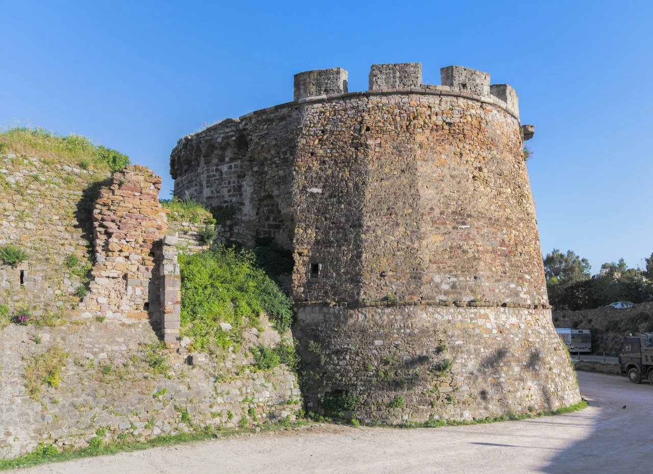

Castle of Chios
Walk through the gate of the Castle of Chios and you are not entering one fortress but several, layered into the same stone. A church that began as Byzantine became a Genoese chapel, then an Ottoman mosque, then a church again. Vaulted Turkish baths sit a short walk from a Crusader-era cistern. The walls have faced the sea for a thousand years, and almost every empire that mattered in the eastern Mediterranean left a mark on them before moving on.
Stone Against the Sea
The castle rises right at the edge of the harbor, its eastern flank washed by the Aegean. This was never decoration. Chios sits in a narrow channel between the Greek islands and the Anatolian coast, a chokepoint on the sea roads, and whoever held the island wanted walls that could turn back a fleet. So the castle was built as a walled town - not a single keep but an entire inhabited quarter wrapped in stone, ready to shelter its people through siege and bombardment. People lived inside those walls for centuries, and a small community still does. The fortifications you see today were raised to defend against attack from the water, and for most of their history that is exactly where the danger came from.
Byzantines and Genoese
The first walls went up in the tenth century under the Byzantines, but the castle that survives is largely the work of the Genoese. From the fourteenth to the sixteenth century, Chios belonged to Genoa - more precisely to the Maona, a chartered company that ran the island as a commercial enterprise, and to the Giustiniani family who held it for nearly two centuries. Their interest was trade: Chios produced mastic, the aromatic resin found almost nowhere else on Earth, and the Genoese guarded that monopoly behind these very walls. The church of Saint George on the castle's main street tells the layered story in miniature. It began as a Byzantine sanctuary, became the Genoese church of San Domenico, and holds the grave of Giovanni Giustiniani.
The Ottoman Centuries
In 1566 the long Genoese tenure ended. The Ottoman admiral Piyale Pasha took the castle for Sultan Suleiman the Magnificent, and Chios passed into an empire that would hold it for more than three centuries. The new rulers did not erase what they found - they adapted it. Piyale Pasha converted the western part of the church of Saint George into the Eski, or Old, Mosque, and Ottoman life settled into the fortress alongside what remained of the Genoese town. The mosque was rebuilt after the destructive Chios earthquake of 1881, and in time the building came full circle, serving once again as the church of Aghios Georgios. Few structures anywhere record a change of religion and ruler so plainly in their own walls.
Baths and Cisterns
Toward the north of the enclosure stand Ottoman baths roofed with the low vaults of the classic hammam, where steam and ritual washing followed forms carried across the empire. Nearby waits the Kria Vrisi - the Cold Fountain - a large semi-underground reservoir from the Genoese era. Its roof is divided into four quarters by a stone cross, supported on eight shafts, and water was once drawn up through a long arcade that ran along its eastern side. In 1920 the mayor of Chios set workers to clean it out, and the scholarship of Greek architectural historians has since pieced together how it worked. To stand in that cool, dim space is to touch the unglamorous machinery that let a fortified town survive a siege: not the walls, but the water behind them.
From the Air
The Castle of Chios sits at the edge of Chios town harbor at roughly 38.37°N, 26.14°E, on the east coast of the island facing the Çeşme peninsula of Turkey about seven nautical miles across the channel. From the air the walled quarter is distinct against the modern town and the harbor breakwater. Nearest airport is Chios Island National Airport (LGHI) just south of town; Izmir Adnan Menderes (LTBJ / ADB) lies about 40 nm east on the mainland. Best viewed from 3,000-6,000 feet in clear Aegean light, with the harbor and old town laid out below.
Nearby Stories
- Psara 18 km away
- Battle of the Oinousses Islands 28 km away
- St. Helena Church 35 km away
- Battle of Corycus 35 km away
- Greek Islands 60 km away
- Temple of Artemis at Ephesus 61 km away
- Adramyttium 94 km away
- Skyros 101 km away