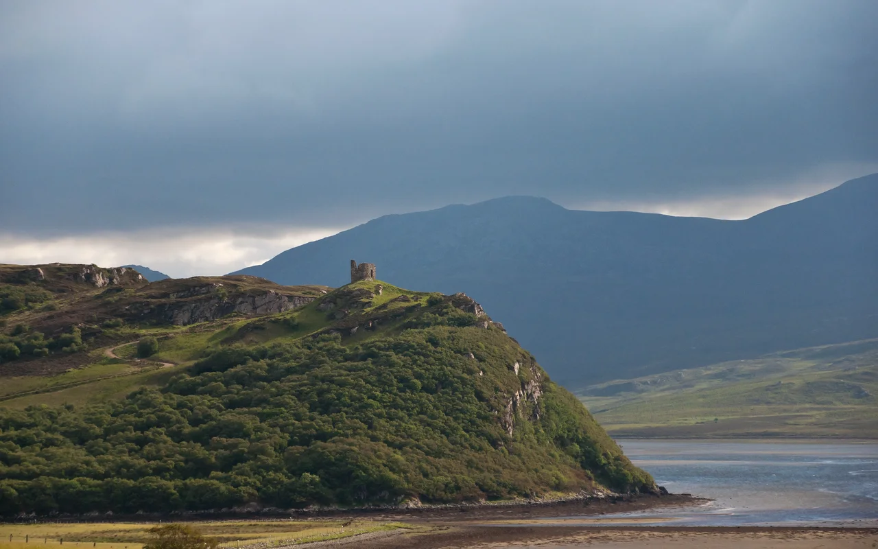

Castle Varrich
Nobody knows when Castle Varrich was built. It stands on a high point of rock above the Kyle of Tongue, walls 1.4 metres thick, drystone construction without mortar - and the people who would have remembered are long gone. Local tradition says the Mackays built their first stronghold here in the 14th century, on top of a Norse fortification that was already old by then. Some accounts push the original date back a thousand years. The walls themselves are no help; they were laid in roughly squared blocks of metamorphosed sandstone, faces and core consistent throughout - the work of someone who knew what they were doing - and they have survived a millennium of Sutherland weather with so little damage that they refuse to give up their age.
The Mackay Seat
Castle Varrich was the ancient seat of the chiefs of Clan Mackay - the most powerful Highland clan in this corner of Scotland, whose territory ran from Assynt to Cape Wrath, Loch Shin to Strath Halladale, in a swath known for centuries as Mackay Country. Tradition holds that caves under the castle were once inhabited by the Mackays themselves, before the keep above was raised. The most likely sequence is that an early Norse settlement claimed the rock during the centuries when the north coast of Scotland was Viking ground; the Mackays then took over and rebuilt in the 14th century, dressing the old foundations with the metamorphosed sandstone they could quarry from the nearby cliffs. Eventually the chief's seat moved down the hill to Tongue House - a less defensible, more comfortable address - and Varrich was abandoned to the sheep and the wind.
Two Floors and No Stair
The keep had two floors plus an attic, but here is the curiosity: there were no internal stairs between the floors. The ground floor was entered through a door on the north wall and was probably used as stables for horses or cattle. The upper floor had its own entrance on the south side, accessed by a ladder or removable stair - the medieval equivalent of pulling the drawbridge up at night. A window faced east. A fireplace warmed the west wall. Both have now collapsed past recognition. The arrangement only makes sense as defence: an attacker who got inside the ground floor was trapped there with the animals while the family pulled up the ladder and waited out the siege from above. The view from the upper floor takes in Ben Loyal and Ben Hope - 764 and 927 metres of granite, immediate landmarks of warning whenever a war party crossed the high ground.
The Steel Staircase
In 2017 the castle was given a careful and slightly surreal modern upgrade. A galvanised steel spiral staircase now climbs through the interior, and a viewing platform at the top lets visitors look down over the Kyle of Tongue from roughly the height the medieval upper floor would have occupied. The 19th-century approach of leaving ruins to crumble picturesquely has been replaced, here, by a working compromise: the original stones are protected, the public can climb, and the view that the Mackay chiefs once watched for trouble can now be admired by anyone who walks the marked footpath up from the village of Tongue. It is a short hike - signed, well-trodden, and about an hour each way - and the panorama from the platform takes in the bridge across the Kyle, the village below, Ben Loyal to the south, and the wide curve of the kyle running north to the open sea.
From the Air
Located at 58.48 degrees north, 4.44 degrees west, on a rocky height above the Kyle of Tongue. Nearest controlled airfield is Wick (EGPC) approximately 45 nautical miles east; Inverness (EGPE) is about 80 miles south-east. From the air, look for the long narrow Kyle of Tongue running north to the sea, crossed near its head by the Kyle of Tongue Causeway and Bridge. The castle sits on the high rocky outcrop on the western side of the village of Tongue. Ben Loyal rises immediately to the south at 764 metres, and Ben Hope to the south-west at 927 metres - both dominant terrain features for navigation. Weather typical for north Sutherland: persistent low cloud, frequent showers, and gales from the open Atlantic.
Nearby Stories
- Ardvreck Castle 4.7 km away
- Kinlochbervie 7.8 km away
- HMS King Edward VII 11 km away
- Loch Shin 12 km away
- Helmsdale 14 km away
- Flow Country 15 km away
- Old Man of Hoy 32 km away
- The Laki Eruption: The Volcano That Changed World History 923 km away