
Chaitén Volcano
For thousands of years it had done nothing. Chaitén is a broad volcanic caldera, three kilometers across, its rim rising to 1,122 meters above the rainforests and fjords of southern Chile. Radiocarbon dating once suggested its previous eruption lay more than nine thousand years in the past, and the people who built the town of Chaitén ten kilometers to the southwest had no reason to think of the green caldera as a threat. Then, in the first days of May 2008, the mountain came violently back to life for the first time in roughly four centuries. Within days a town of more than four thousand people would be evacuated, and within weeks much of it would be gone, buried under ash and swept away by a river that changed its course.
The Mountain Wakes
The eruption began in the early hours of May 2, 2008, after only about a day of warning earthquakes, an unusually short prelude for so large an event. A column of ash climbed kilometers into the sky and drifted east across the Andes, dusting towns in Argentina's Chubut province and the village of Futaleufú. Chile's geological survey and emergency agency moved fast. Around five thousand residents were evacuated from Chaitén and the surrounding villages, most of them within the first days, and the nearby town of Futaleufú was cleared as well. The human cost could have been catastrophic; instead a single elderly person died, at sea, while being evacuated toward Puerto Montt. For a disaster of this scale in such a remote place, that the town emptied in time was its own kind of achievement.
A River Rewrites the Town
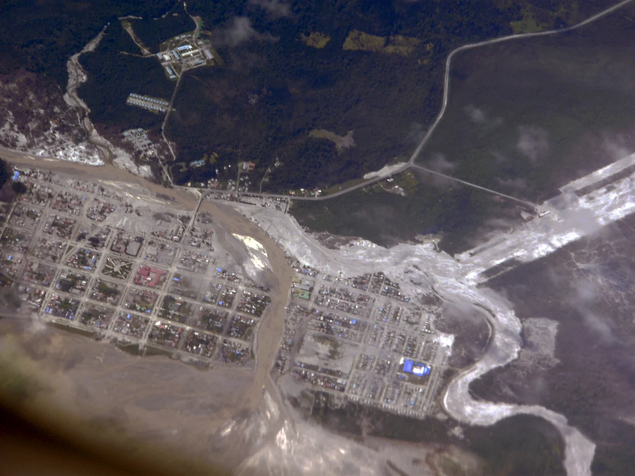
The ash was only the beginning. Beginning around May 12, heavy rain mixed with the deep volcanic ash to form lahars, fast-moving slurries of mud and debris that poured down toward the coast. The mud flooded Chaitén, burying parts of the town under a meter or more of grey sludge and choking the original channel of the Chaitén River. With its old course blocked, the river simply carved a new one straight through the middle of town. Over the following weeks the water excavated a fresh channel where streets and houses had stood, destroying a significant part of Chaitén by July. The settlement was not merely damaged. It was partly erased and rearranged by a river that the volcano had set loose.
An Eruption Scientists Had Been Waiting For
What made Chaitén remarkable was not only its violence but its chemistry. The volcano erupted rhyolite, a thick, silica-rich magma that tends to produce especially explosive eruptions and that geologists rarely get to watch in action. Chaitén's 2008 event was the first major explosive eruption of rhyolite anywhere in nearly a century, the previous one being the great 1912 eruption of Novarupta in Alaska. This time scientists had modern instruments. They tracked the growing lava dome in the crater, measured ash that spread across Argentina and Chile, and documented details no one had been able to capture before, including delicate mineral fibers that formed in the violence of the blast. A catastrophe for the town became, for volcanology, a once-in-a-century window.
Coming Back to a Changed Place
The danger did not end with the first eruption. In February 2009 part of the lava dome collapsed, sending pyroclastic flows down the river valley to within about five kilometers of the town, and the roughly 160 people who had drifted back were urged out again. The government considered abandoning Chaitén entirely and building a new town to the north, but the plan was tangled by residents who refused to leave the place they knew, and the relocation was never fully carried out. Slowly, stubbornly, Chaitén has come back. Today around 900 people live there, a fraction of the old population, rebuilding in the shadow of a volcano that everyone now knows can wake again. It is a town that survived being half-buried and chose, against official advice, to stay.
From the Air
Chaitén volcano stands at roughly 42.83 degrees south, 72.65 degrees west in Chile's Los Lagos Region, about 10 km northeast of the town of Chaitén near the Gulf of Corcovado. The nearest airfield is Chaitén Airport (ICAO: SCTN); Puerto Montt's El Tepual Airport (ICAO: SCTE) lies to the north. From the air the caldera reads as a circular basin beside the much larger ice-capped Michinmahuida volcano, with the rebuilt town and the rerouted Chaitén River visible toward the coast. The region is wet and often cloud-covered, and volcanic ash can affect aviation during periods of unrest; clearest conditions come in summer, December through February.
Nearby Stories
- Los Alerces National Park 14 km away
- Futaleufú River 35 km away
- Church of San Francisco, Castro 53 km away
- Churches of Chiloé 62 km away
- El Bolsón 78 km away
- Parque Tantauco 88 km away
- Trevelin 92 km away
- Battle of Mocopulli 94 km away