
Chalandriani
The tombs are small — barely a metre and a half across, each one sealed with a capstone over a corbelled dome of flat stones, each doorway framed in green schist. Most of them held a single person, placed in a crouched position with their head resting on a stone pillow, grave goods arranged in front of their face. More than 600 of these tombs are scattered across the Chalandra plateau on the northeastern coast of Syros. They date mostly to the Early Cycladic II period, roughly 2800 to 2300 BCE. No other single Early Cycladic cemetery approaches this number. Chalandriani is the place where we know, better than anywhere else on earth, how the early Aegean islanders buried their dead.
A Community of the Living
The people who used Chalandriani were not many. Archaeologist Cyprian Broodbank, drawing on the density and distribution of the graves, estimates that the community numbered between 75 and 100 at its peak — perhaps no more than a village by any standard. Yet the scale of the cemetery suggests that it served this community across many generations, accumulating burials over centuries. The cemetery is divided into two halves, western and eastern, each composed of clusters of graves that may reflect different family or social groupings. Some tombs contained richer grave goods than others: marble vases, metal tools and pins, obsidian blades, painted pottery vessels. The differentiation is modest but visible. Even in a community this small, some families appear to have held more status than others.
Most of the tombs predate the fortified settlement of Kastri, which was built nearby and occupied in the period immediately following Early Cycladic II. The cemetery may have served a second, as yet unexcavated, prehistoric village in the area of the modern village of Chalandriani. The relationship between the living settlement and the dead field remains only partially understood.
The Frying Pans and the Longboats
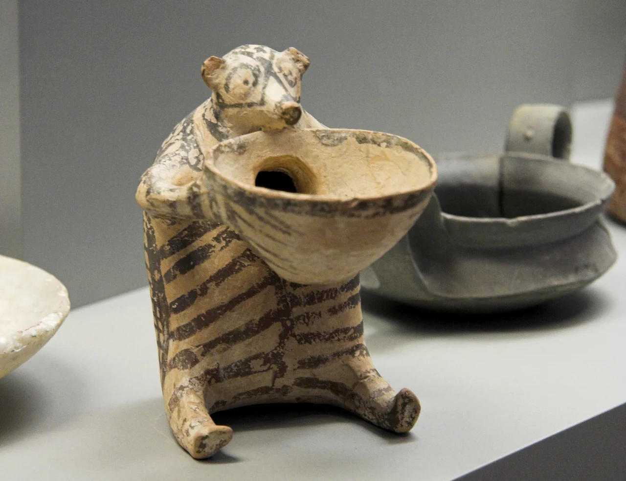
Among the grave goods at Chalandriani are objects archaeologists call 'frying pans' — flat ceramic vessels whose function remains unknown. Their name is descriptive rather than functional; no one knows what they were actually used for. What distinguishes the ones found here is their decoration. Frying pans from other Cycladic sites occasionally show longboat motifs — the narrow, high-prowled vessels that the Early Cycladic islanders used to move through the Aegean. At Chalandriani, these longboat images appear far more frequently than anywhere else in the Cyclades.
Broodbank reads this as a clue to how the community understood itself. Longboats were not just tools for fishing or trade; in the Bronze Age Aegean, they were instruments of power, capable of moving people and goods — and of threatening those who lacked them. His argument is pointed: the community at Chalandriani may have maintained its position in the island network partly through the coercive use of longboats against smaller communities that could not respond in kind. The people buried here were seafarers, and the decoration on their grave goods says so.
A Word Is Coined: 'Cycladic Culture'
The site was mentioned as early as 1842 by a local historian named P. Zolontas, who excavated some of the tombs informally. A formal excavation followed in 1861, but the archaeologist in charge incorrectly dated the tombs to the Roman period, believing them to be graves of exiles from the nearby island of Gyaros. In 1872–1873, a doctor and anthropologist from Ermoupoli, Klon Stephanos, correctly identified the cemetery as older than the Mycenaean civilisation.
The decisive excavation came in 1898–1899, when Christos Tsountas arrived on behalf of the Archaeological Society of Athens. Over the course of his dig, he unearthed around 649 graves. His 1898 article on the findings was among the first systematic studies of the economic life of an archaeological site. More durably, Tsountas used his work at Chalandriani to define what he called Cycladic culture — the term that has described the distinctive Bronze Age material culture of the Cyclades ever since. The site is, in this sense, the type-site of a civilisation: the place where the concept was born.
Kastri and the Protected Zone
Adjacent to the cemetery — a short walk to the north — stands Kastri, the fortified prehistoric settlement that followed the Early Cycladic II period. Its walls are visible on a rocky promontory above the coast. The Kastri phase is distinct from the culture that used the Chalandriani cemetery; it represents a later, different community, possibly connected to changes in Aegean trade routes and the arrival of new populations.
Further excavations at Chalandriani took place in the 1960s under Christos G. Doumas, and again in 1989 when Jan Jakob Hekman conducted a surface survey. In 1992, the Greek government designated the whole Chalandriani–Kastri area a protected archaeological zone. Finds from the site are now held in the National Archaeological Museum in Athens, the Louvre, and the British Museum — the scattered legacy of a small community that lived on a Cycladic plateau more than four thousand years ago, left their dead in small stone rooms, and were named by a man who came from Athens in 1898.
From the Air
Chalandriani is located at approximately 37.483°N, 24.934°E on the northeastern coast of Syros. The nearest airport is Syros National Airport (LGSO), approximately 8 km to the south-southwest. From the air, Syros is a distinctive island shape in the central Cyclades, roughly triangular, with Ermoupoli visible on its eastern side and the hills of Ano Syros rising steeply behind. The Chalandra plateau where the cemetery is located sits on the lower northeastern slopes. Flying from LGSO northward along the east coast at low altitude — around 1,500 ft — the plateau and the visible ruins of the Kastri fortification on the promontory above it can be identified. The island of Kea is visible to the northwest on clear days, roughly 40 km distant.
Nearby Stories
- Battle of Mykonos 8.8 km away
- Andros 14 km away
- Temple of Apollo (Naxos) 18 km away
- Massacre of the First Sapper Battalion 22 km away
- Brauron 28 km away
- Serifos 28 km away
- SS Heraklion 46 km away
- Emporio, Chios 77 km away