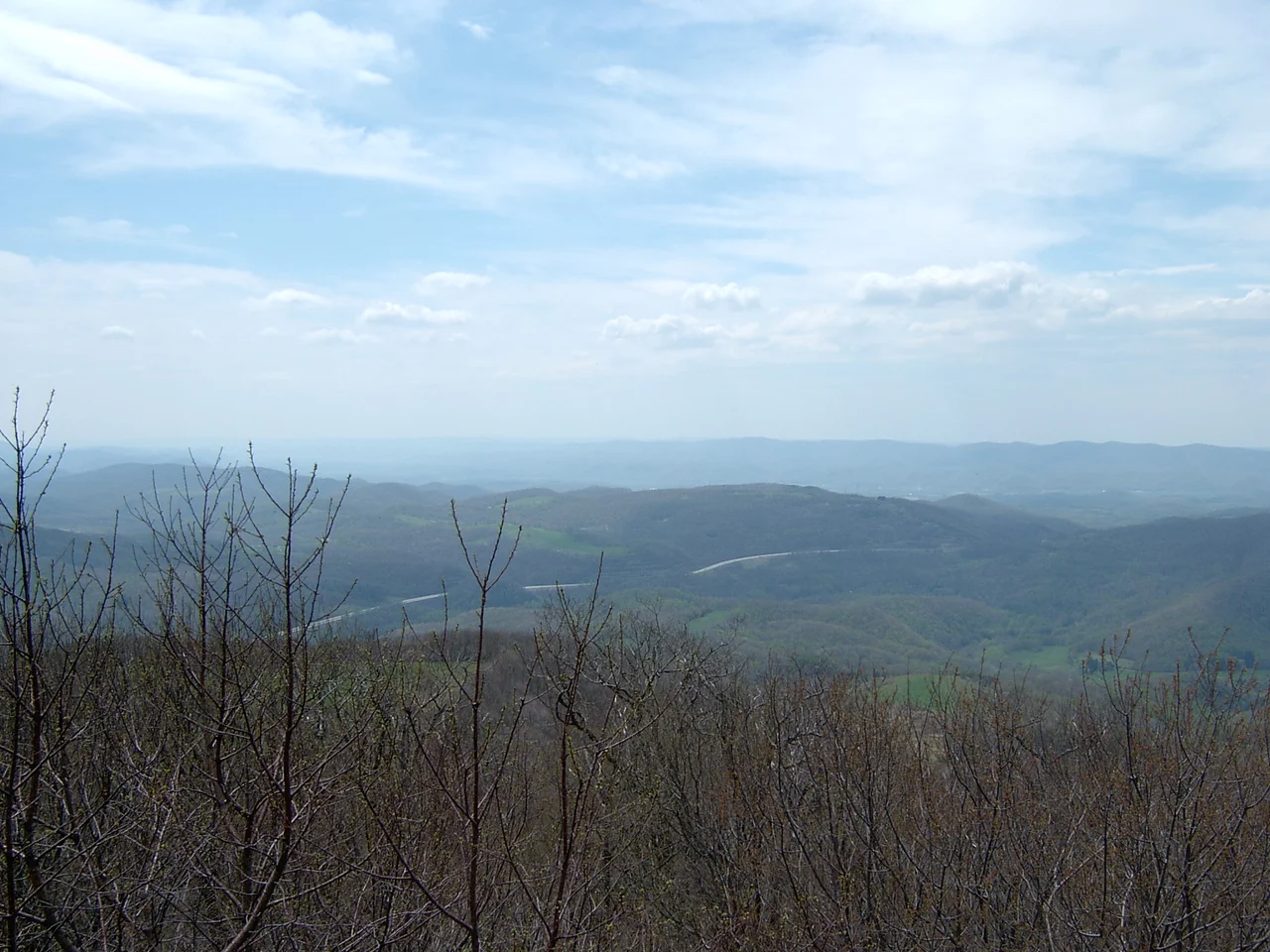

Cheat Mountain
In September 1861, Robert E. Lee directed his first offensive of the Civil War against a Union force entrenched on the top of Cheat Mountain. He believed he was attacking a few hundred men. His subordinate Colonel Albert Rust, who led the actual assault, became convinced he was facing an overwhelming Federal army. He was not - the Union garrison numbered only about 300 determined soldiers. The Confederate attacks were so uncoordinated and the Federal defense so stubborn that Lee called off the attack on September 15 and retreated. It was an inauspicious beginning to a military career that would, three years later, send the same general into Pennsylvania. Lee was recalled to Richmond on October 30, 1861, having achieved nothing notable in western Virginia.
A 50-Mile Ridge
Cheat Mountain runs about 50 miles north to south through eastern West Virginia, more than five miles wide at its broadest. The high point is at the southern end, at Thorny Flat - 4,848 feet above sea level. Several other knobs along the ridge rise above 4,000 feet. The mountain traverses the length of central Randolph County, from a northern terminus just west of Parsons to a southern terminus near Stony Bottom, where it merges with Back Allegheny Mountain. The western flank is skirted by U.S. Route 219, which connects a string of Tygart Valley communities including Elkins, the largest. The eastern flank, overlooking the Shavers Fork valley, is more remote and is followed by the Western Maryland Railroad rather than a highway. Two federal highways cross the mountain east-to-west: U.S. Route 33 in the north, U.S. Route 250 in the south.
The Lost Red Spruce Forest
Before the loggers came, Cheat Mountain held the largest red spruce forest south of Maine - a high-elevation conifer ecosystem that descended from the last Ice Age, when boreal forests reached far south of their current range. The trees were enormous. Some red spruces on Cheat were measured at more than 200 feet tall and several centuries old. The West Virginia Pulp and Paper Company and its Cass operation, the West Virginia Spruce Lumber Company, began industrial logging in the early 1900s. By 1905, loggers had reached the summit. By 1960, the mountain was virtually barren. W. E. Blackhurst's 1965 book Of Men and a Mighty Mountain chronicles how difficult life was on Cheat for the mostly immigrant lumber workers - the cold, the snow, the exhaustion, the company-town economics. The red spruce never came back at scale. The Monongahela National Forest now protects most of the ridge, and red spruce is slowly recolonizing the highest elevations, but it will be centuries before the forest resembles what was there in 1900.
Camp Allegheny and Cheat Summit Fort
The Civil War's western Virginia campaign produced more military activity on Cheat than the failed Lee offensive of September 1861. On the night of October 2-3, Union Brigadier General Joseph Reynolds advanced from Cheat Mountain with two brigades to reconnoiter the Confederate position at Camp Bartow on the Greenbrier River. He drove in the Confederate pickets, opened with artillery, attempted to turn the Confederate right flank, and withdrew when the attempt failed. In December 1861, Confederate forces under Colonel Edward Johnson occupied the summit of nearby Allegheny Mountain to defend the Staunton-Parkersburg Turnpike. On December 13, Union Brigadier General Robert Milroy attacked Johnson's position. Fighting continued for much of the morning. The Union troops were finally repulsed and retreated to their camps near Cheat. Cheat Summit Fort - also known as Fort Milroy, or White Top - was the highest Union camp of the entire war. It was occupied from July 16, 1861 until April 1862, when the Federal command finally abandoned it due to extreme weather and strategic developments. Ambrose Bierce, the journalist and writer who later became famous for his Civil War stories, wrote an account of the Cheat Mountain campaign in his article "On A Mountain."
From Clearcut to State Park and Ski Resort
When the last commercial timber operations ended on Cheat around 1960, the mountain entered a long period of recovery. The Monongahela National Forest absorbed most of the ridge. The Cass Scenic Railroad State Park opened in 1963, using the same Shay-locomotive logging railroad to take tourists up the mountain - actually up the connected Back Allegheny Mountain to Bald Knob, despite local belief that the train climbs Cheat itself. In 1974, the Snowshoe Mountain ski resort opened on the southern end of Cheat near Thorny Flat. The Cheat Mountain salamander, an endemic species found only on this ridge and a few neighboring peaks in the high Alleghenies, has become a focus of conservation work. The mountain that supplied lumber for paper mills and a battleground for Lee has spent the last half-century reinventing itself as a place people come to ski, hike, ride trains, and stay quiet in the National Radio Quiet Zone, which covers its southern end.
From the Air
Cheat Mountain stretches from about 38.95 degrees north (near Parsons) southward 50 miles to about 38.40 degrees north (near Stony Bottom), with the centroid around 38.64 degrees north, 79.91 degrees west. Highest point Thorny Flat at 4,848 feet MSL is at the southern end. Best viewed from VFR altitudes of 7,500 to 10,500 feet AGL where the entire ridge can be appreciated. The closest airports are Elkins-Randolph County (KEKN) on the west flank, Marlinton (W99) on the east. The southern end is within the National Radio Quiet Zone affecting Green Bank Observatory - check NOTAMs. Watch for significant mountain wave activity, rotor turbulence, and rapidly changing high-altitude weather.
Nearby Stories
- Pocahontas County, West Virginia 2.6 km away
- Battle of Rich Mountain 4.5 km away
- Fort Edward Johnson 5.8 km away
- Potomac Highlands 7.8 km away
- North Fork Mountain 9.4 km away
- Richwood, West Virginia 11 km away
- Mountains and Lakes Country 19 km away
- Glenville State University 30 km away