
Chiloé National Park
The western coast of Chiloe Island faces the open Pacific with almost nothing in between, and that exposure is the whole story of Chiloe National Park. Behind a shoreline of long beaches and shifting dunes lies a wall of dense, evergreen rainforest climbing into the coastal mountains, and just offshore, in waters most of the world never sees a whale in, the largest creatures alive come to feed.
Two Worlds Along One Coast
The park covers about 430 square kilometers, split into separate sectors. The smaller, Chepu, sits in the commune of Ancud to the north; the larger, Abtao, spreads across the communes of Dalcahue, Castro, and Chonchi to the south. Most of it climbs the foothills of the coastal range here called the Cordillera del Piuchen, and packs an unlikely range of landscapes into a narrow band: shifting coastal dunes, dense rainforest, swamps, and peat bogs. Just offshore lies the islet of Metalqui, half a square kilometer of rock, and a haul-out for sea lions. The park draws a steady stream of travelers willing to make the journey to Chile's wet western edge; in 2019, the last full year before the pandemic, just over 48,000 visitors came.
The Whales of the Gulf
What makes this coast famous reaches its full size out in the water. The sea off Chiloe and the neighboring Gulf of Corcovado is one of only a handful of known feeding grounds in the entire Southern Hemisphere for pygmy blue whales, and researchers from the Cetacean Conservation Center have long studied them here through the Blue Whale Project. The whales are known to slip into the narrow fjords to feed or rest. They are not alone: humpbacks, fin whales, and sei whales work these waters too, and the area may even support some of the critically endangered Chilean-Peruvian southern right whales, of which only a few dozen are thought to remain. From the southern shore, near Caleta Zorra, whales can sometimes be seen close in.
A Forest of Giants and Rhubarb
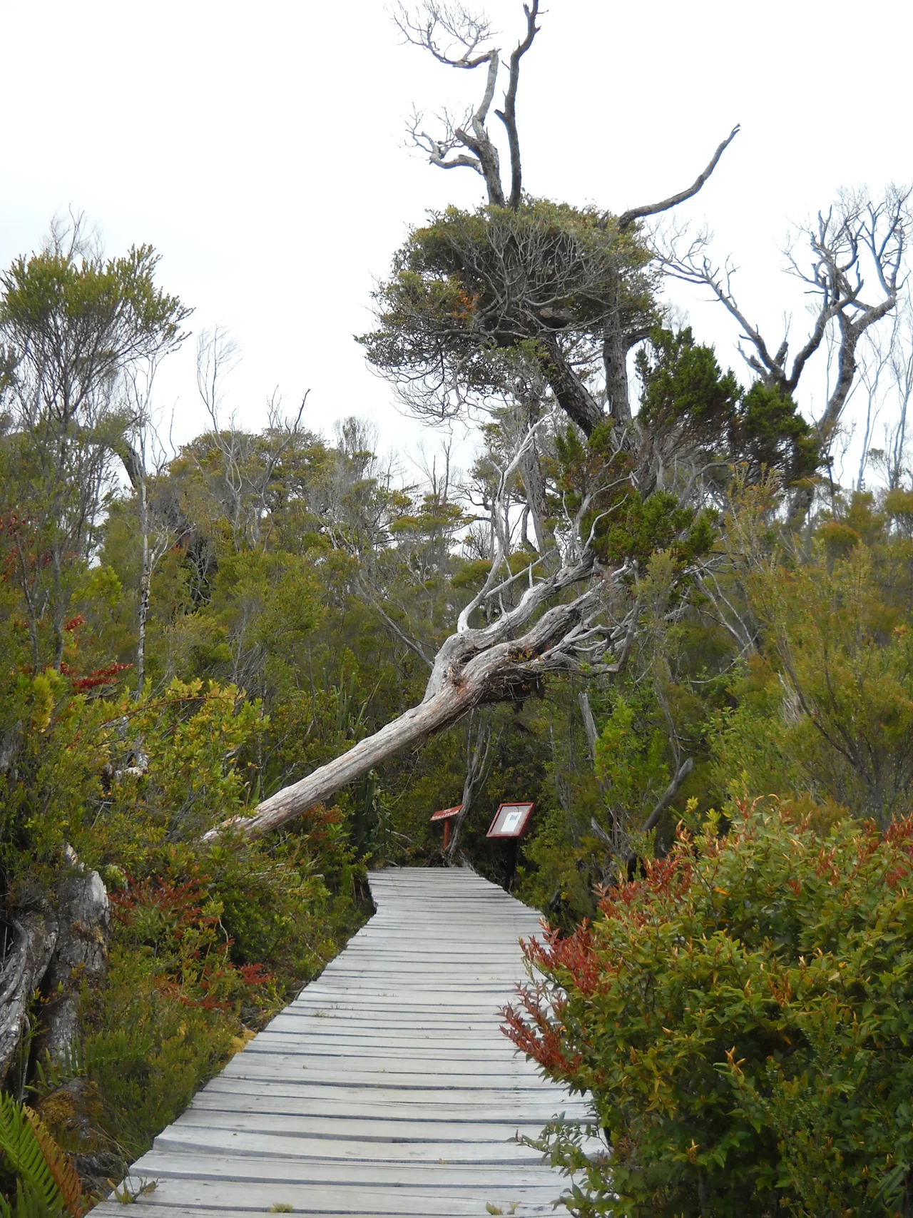
Ashore, the dominant cover is Valdivian rainforest, a dense tangle of perennial trees, shrubs, and climbing plants that thrives on near-constant rain. Evergreen southern beech forms the backbone, but the showpiece is the alerce, a towering native conifer that can live for thousands of years and counts among the longest-lived trees on the planet, a relative of the giant sequoia clinging on at the bottom of the world. The hills hold extensive bogs and swamps, and the giant-leaved Chilean rhubarb, its leaves broad enough to shelter under, grows almost everywhere. Rain feeds all of it. Average temperatures hover around a cool 11 degrees Celsius, and more than 3,000 millimeters of rain fall on the Pacific coast each year, nearly 5,000 in the heights of the Piuchen, easing only on the rain-shadowed eastern slopes.
Trails That Argue With the Map
Hiking here means accepting that the map and the ground may disagree. The most popular route, the trek to Cole Cole from the village of Cucao, follows beaches, fords rivers, and crosses farmland where dogs bark and livestock graze, more a long ramble down a working coastline than a marked wilderness path. Travelers have warned for years that the trail is poorly signed; the only real marker on the way to Cole Cole is a single hand-painted board near the mouth of the rio Denal. The route to Anay, by contrast, has fallen into disuse and turned into a hard, overgrown bushwhack. The honest advice is the oldest: when in doubt, follow the shore.
Rain, Horses, and the Edge of the Pacific
This is a place that rewards patience and waterproofs. A bus runs from Castro several times a day, and locals near the park rent out horses, an old chilote way to cover the muddy coastal ground. Simple lodging waits in Cucao, where a farmhouse hostel takes in hikers, and you can camp in designated spots or on a resident's land for a small fee. Even the campsites here carry the island's slightly anarchic charm: a man may still appear on horseback at dusk to collect a few pesos. The weather is the one fixed rule. Storms, even rare summer ones, can roll in off the ocean fast, and the reward for braving them is one of the wildest, least tamed coastlines in South America.
From the Air
Chiloe National Park runs along the Pacific (western) coast of Chiloe Island in Chile's Los Lagos Region, with its southern sector near Cucao around 42.5 degrees S, 74.0 degrees W and the separate Chepu sector to the north near Ancud. From the air it appears as a band of dark rainforest backed by the Cordillera del Piuchen, fronted by pale beaches, dunes, and the offshore islet of Metalqui, with the open Pacific stretching west and the whale-rich Gulf of Corcovado to the southeast. The nearest airport is Mocopulli, serving Castro and Dalcahue (ICAO SCPQ), with the mainland hub of El Tepual at Puerto Montt to the north (ICAO SCTE). This is one of the wettest, cloudiest coasts on the continent; clear views are uncommon and brief, with rain and Pacific storms possible in any season.
Nearby Stories
- Ancud 38 km away
- Battle of Abtao 46 km away
- Parque Tantauco 57 km away
- Chaitén Volcano 69 km away
- Pumalín Douglas Tompkins National Park 82 km away
- 1687 Peru Earthquake 3002 km away
- The Nazca Lines: Art Made for the Sky 3082 km away
- West Antarctica 4179 km away