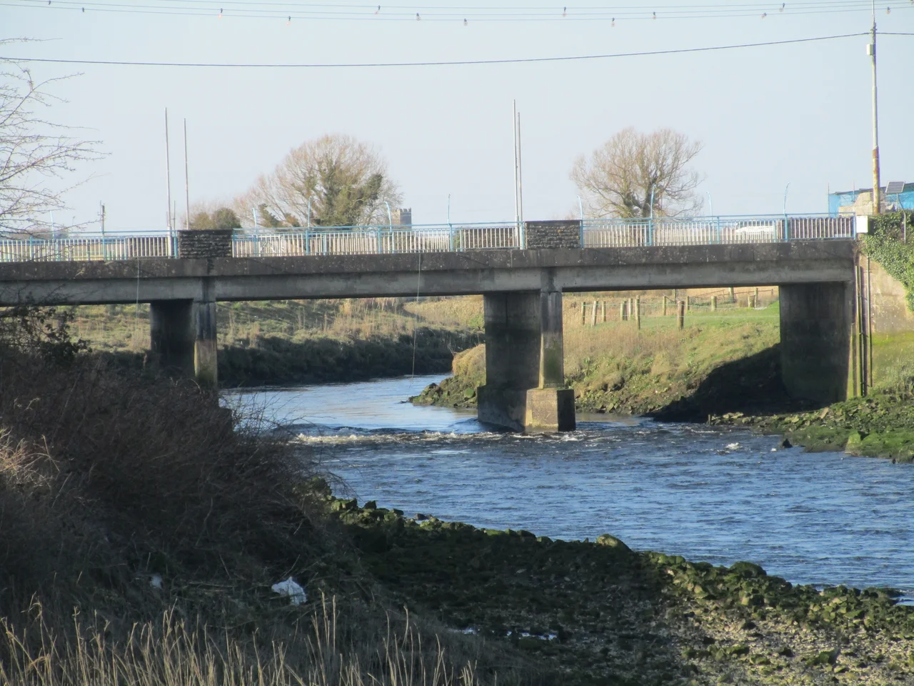

Clarecastle
Most counties take their names from cities. Clare took its name from a village. In 1590, the newly demarcated county of Clare was named after Clare Castle, a Norman fortification standing on a midstream island where the River Fergus narrows to its last navigable bend. The castle's name came either from the Irish Clár - a wooden board, often used for bridges, suggesting the older name Clár adar da choradh, "the bridge between two weirs" - or from the de Clare family of Norman lords who acquired land here in the 13th century. Either way, an entire county now wears the name of a small bridge crossing.
The Port of Ennis
For most of its commercial history, Clarecastle existed because Ennis - the county town, two kilometres north - could not be reached by sea. The River Fergus, navigable from the Shannon Estuary up to Clarecastle, runs over a series of weirs and shallows above the village that vessels of any size could not pass. So Clarecastle became Ennis's port: a transshipment point where goods coming up from the Shannon Estuary were unloaded onto smaller craft, carts, or warehouses for the final journey inland. Exports of cattle, butter, grain, and locally produced beer and whiskey flowed downstream. Imported wine, coal, iron, and salt flowed up. The arrangement worked for centuries.
Thomas Rhodes Builds the Quay
The main quay structure - 155 metres of stone facing - was completed in 1845 under the supervision of Thomas Rhodes, Principal Engineer to the Shannon Commissioners. Rhodes was the same civil engineer who built much of the Shannon navigation system in the 1830s and 1840s, working on locks, bridges, and dredging across the country's longest river. The Clarecastle quay sits on the Fergus's tidal reach, with a macro-tidal range that leaves the berths almost dry at low water springs. Even in its commercial heyday, the approach from the Shannon and Fergus estuaries was complicated by mudflats, rhythmites, and shifting channels - tricky enough that maritime pilots were used routinely and the largest vessels could never make it to the quay at all.
The Slobland Scheme
In 1873, an Act of Parliament empowered the Clare Slobland Reclamation Company to drain approximately 579 hectares of tidal mudflat south of Clarecastle, between Islandavanna and Islandmagrath. The plan was to convert the slob - the soft estuarine intertidal land - into pasture by walling it off with embankments and seawalls. Clarecastle was the logistics hub: stone and rubble flowed through the village to the construction sites. The reclamation succeeded in part. The embankments still exist; the reclaimed land remains pasture in places. But the broader scheme to transform the Fergus estuary into a network of polders was never fully realised, and the engineered changes to sediment transport still influence the lower river today.
The Quay Goes Quiet
Commercial shipping at Clarecastle declined through the 20th century as road transport replaced the river. A flood-control barrage built north of the quay - the Clarecastle Barrage - now blocks tidal influence beyond the village, regulating water levels in the Fergus through Ennis. The quay still serves small craft and recreational boats. The village holds an annual community regatta in June which brings crowds of 2,000 to 3,000 from across the county. The old castle that gave the place its name now stands ruined on its riverbank, alongside the former military barracks that watched the port through the colonial era. The big factory that became the main local employer was Hoffmann-La Roche's Clarecastle plant, which manufactured pharmaceutical intermediates for decades.
The Magpies and the Pilgrim Path
Clarecastle's GAA club, founded in 1884, plays in black and white and goes by the nickname "the Magpies." Hurling is the dominant sport, as it is across much of east Clare. The composer Gerald Barry - whose operas The Importance of Being Earnest, Alice's Adventures Under Ground, and others have been performed worldwide - was born here in 1952. Clarecastle sits in the parish that also contains Clare Abbey, the ruined Augustinian priory founded in 1189 by Donal Mór O'Brien, King of Thomond. From Clare Abbey, the medieval Pilgrim's Road runs through Ballybeg forest to Killone Abbey to the south, the ruined nunnery that O'Brien founded a year later. Walk the path now and you cross a landscape that has been Christian for almost a thousand years, and inhabited for several thousand more.
From the Air
Coordinates 52.82°N, 8.97°W. Clarecastle sits on the River Fergus 2 km south of Ennis in County Clare. Shannon Airport (EINN) is 18 km southeast - the principal regional airport with daily transatlantic and European services. The N18 motorway and the Limerick-Galway railway both pass near the village. From altitude the Fergus widens visibly south of Clarecastle into a broad estuary that joins the Shannon Estuary 15 km to the south. The Clarecastle Barrage and the curve of the river through the village are identifiable landmarks at 1,500 ft AGL. Best viewed in clear weather; the estuary tends to attract sea mist.
Nearby Stories
- Kinvara 6.1 km away
- William Smith O'Brien 9.3 km away
- Newport, County Tipperary 13 km away
- Aran Islands 14 km away
- Portumna 15 km away
- Kilkee 19 km away
- Tipperary (town) 21 km away
- Kilflynn 25 km away