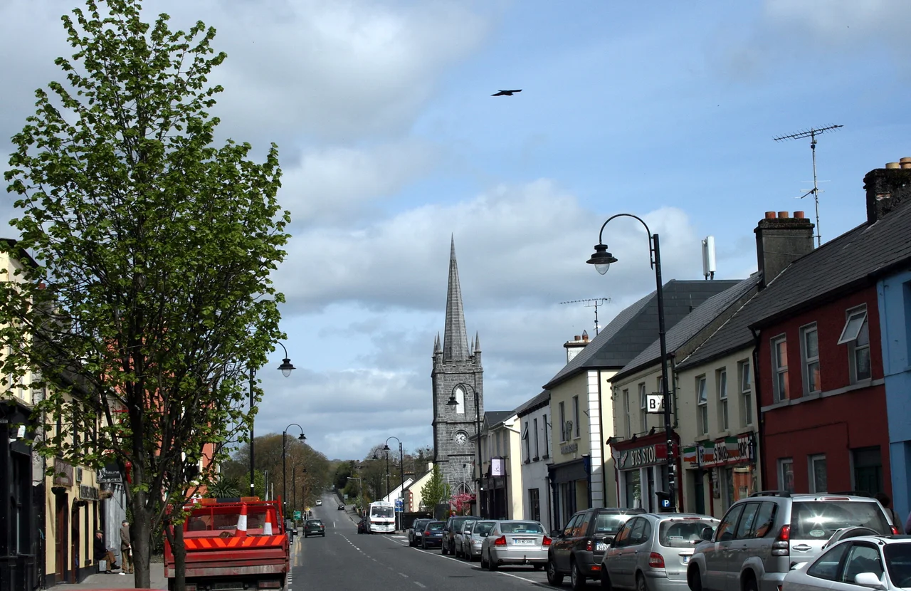

Claremorris
Claremorris sits in a bowl. Every road into it descends a hill - the old Knock road, Courthouse road, the rest - and yet, against everything you would expect of a town in that posture, it does not flood. There is no major river through the centre. Two lakes hold their water at the heart of the town, Clare Lough and Mayfield Lough, with a small river running between them. And here, at the junction of the N17 from Galway to Sligo and the N60 from Castlebar to Roscommon, a Mayo market town with 3,857 people at the 2022 census has been quietly growing faster than anywhere else in the county.
The Name and the Norman
Claremorris takes its name from Maurice de Prendergast, a Norman who came to Ireland in the 12th century. The first town that grew around the Prendergast presence eventually became the place we know today. The town as a properly laid-out settlement was an 18th-century creation. In 1822 a Roman Catholic chapel was built; later demolished to make way for the town hall. The present St Colman's Church went up in 1911. St John's Anglican Church, completed in 1828, is now the town library - a quiet adaptive reuse that is rather more common in Ireland than it might first appear. The Browne family were the dominant landlords. The most notorious of them, Denis Browne, served as High Sheriff of Mayo during the 1798 Rebellion and earned the nickname Donnchadha an Ropa - Denis the Rope - for his treatment of captured United Irishmen.
Land of the Giants
Today the dominant feature in the public landscape is McMahon Park beside Clare Lake, with its tree-lined walks, its angling platforms, and a children's attraction called Land of the Giants. Claremorris has long been known to anglers for its coarse fishing - Northern Pike, European Perch, European Eel, Bream, and Roach, in the many small loughs around the town. The River Robe and its tributaries hold wild brown trout. The annual Claremorris Open Exhibition - an art show running since 1978 - and the Claremorris Drama Festival, running since 1970, keep the town's cultural life going. Tesco anchors the northern end of town now; the old market role has been augmented by the kind of suburban retail any growing Irish town has acquired.
The Weather Station and D-Day
Two kilometres outside the town centre is Claremorris Weather Station, one of Ireland's eight inland weather observation posts. It opened in November 1943 and was staffed by a local family. During the Second World War Ireland provided detailed weather reports to the Allies despite its formal neutrality, and the reports from Claremorris and from Blacksod Lighthouse on the west Mayo coast were among the data points the Allies used to choose the date of the D-Day landings in June 1944. The forecast that pushed Eisenhower toward the 6th of June drew on observations from this stretch of the Atlantic-facing west of Ireland - including Claremorris. After 1949 the station was staffed full-time by professional Met Eireann personnel. In 1996 the staff were moved to Ireland West Airport and the station automated. It still records, with data uploaded to Dublin.
The Bypass and the Railway
By the late 1990s, with more than 13,000 vehicles passing through the town every day, the old bank corner on the N17 had become one of Ireland's most infamous traffic bottlenecks. The N17 Claremorris bypass, planned from 1994, finally opened in July 2001 and cut journey times on the Galway-Sligo route by half an hour at peak. The town's railway station, opened in 1862, still operates on the Dublin-Westport line and the Ballina Branch line. The proposed phase 3 of the Western Railway Corridor would relink Claremorris to Athenry via Tuam, but as of December 2023 no firm date had been set, with the all-island strategic rail review recommending only that related work begin by 2030. Claremorris waits, as Claremorris has waited for the railway for over a century.
Who Came From Here
Claremorris's notable sons and daughters span an unusual range. John Cardinal D'Alton, Primate of All Ireland and Archbishop of Armagh from 1946 to 1963. The composer Patrick Cassidy. The sculptor Edward Delaney. The singer Delia Murphy, collector of Irish ballads. The judge Conor Maguire, who served as Chief Justice of Ireland and on the European Court of Human Rights. John Hegarty, 44th Provost of Trinity College Dublin. Lucinda Creighton, former Minister of State for European Affairs. The footballer Greg Maher. The senator Catherine Noone. In the climate - temperate oceanic, less than 1,200 hours of sunshine a year, December and October the wettest months - and in the slow ascent from the valley toward each road that leaves it, the town shapes its people steadily. As of 2017 it was the fastest-growing place in County Mayo. It is still climbing.
From the Air
Claremorris lies at 53.717 N, 9.000 W, in central County Mayo at the junction of the N17 (Galway-Sligo) and the N60 (Castlebar-Roscommon). Ireland West Airport Knock (EIKN) sits roughly 15 km north and is the most convenient airport for the town. Galway (EICM) lies about 60 km south. From the air the two lakes, Clare Lough and Mayfield Lough, sit at the town centre as small reflective markers, with the N17 bypass curving around the western edge. Weather at low altitudes typically features the cloud cover that gives Claremorris its under-1200-hour sunshine record - clear days are the exception.
Nearby Stories
- Ahascragh 8.1 km away
- Aclare 8.7 km away
- Annaghdown 8.9 km away
- Battle of Curlew Pass 9 km away
- Westport 11 km away
- Bellanagare Bog 14 km away
- Bellacorick 18 km away
- Acadamh na hOllscolaíochta Gaeilge 21 km away