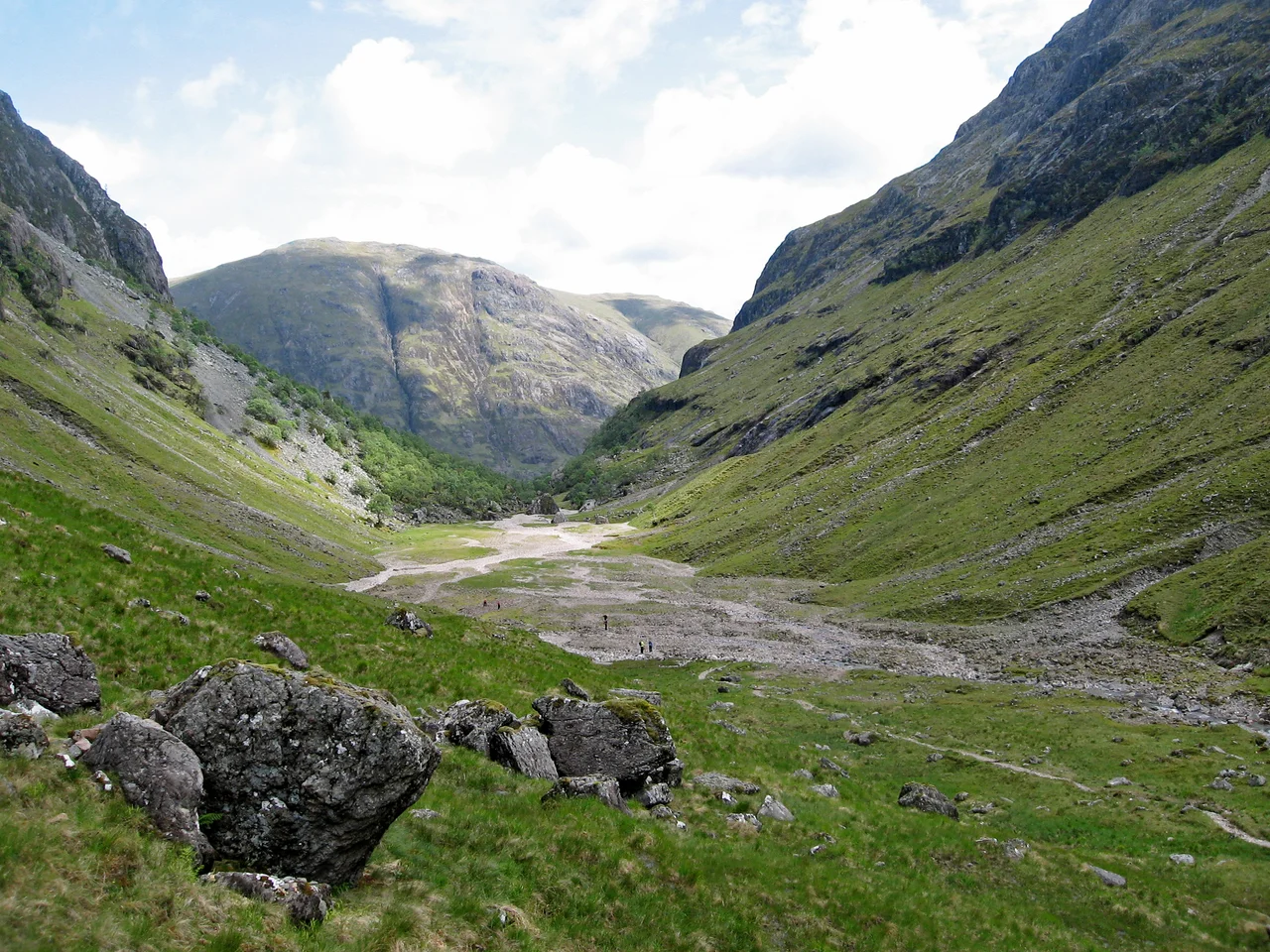

Coire Gabhail
From the road through Glen Coe it looks like nothing. A narrow gorge climbs steeply between two of the Three Sisters, choked with trees, the kind of cleft you would walk past in any other country. Two hundred and thirty metres up, the slope levels out and the world opens. A flat alluvial plain stretches southwest for the better part of two kilometres, ringed by cliffs and the high peak of Stob Coire Sgreamhach. This is Coire Gabhail. In Gaelic the name means the Corrie of the Bounty, or the Hollow of Capture. The locals call it the Hidden Valley. For generations Clan MacDonald used it to conceal cattle, their own and other people's. In 1692 it concealed something else.
Geology Made by Ice
Coire Gabhail is a hanging valley, one of the cleanest examples in Scotland. During the last glaciation, the principal glacier in Glen Coe below was heavier and deeper than the tributary glacier flowing out of Coire Gabhail. When the ice retreated, the main valley had been carved a long way down while the side glen was left high above it, perched. Moraine debris dammed the mouth of the corrie. A lake formed behind the dam and slowly filled with sediment. Eventually the water cut a way out and drained, leaving the lake bed as a flat alluvial plain, the floor of the corrie today. The route up is along that gorge the water cut on its way down. You can read the whole sequence of events as you climb: glacial trough below, hanging valley above, moraine ridge at the lip, flat lake floor behind.
Three Sisters and a Hidden Floor
Coire Gabhail runs southwest between the steep sides of two of Glencoe's Three Sisters. On the east is Beinn Fhada, the Long Hill, the easternmost sister. On the west is Gearr Aonach, the Short Ridge, the central sister. Further west still, beyond Gearr Aonach, lies Coire nan Lochan, enclosed by Aonach Dubh, the Black Ridge. The southern end of Coire Gabhail is held by the peak of Stob Coire Sgreamhach, from which the ridge slopes down westwards to its low point at Bealach Dearg before climbing again over the cliffs to the summit of Bidean nam Bian, the highest mountain in Argyll. From Glen Coe the corrie is invisible. It looks like a normal v-shaped glen approached only by a narrow gorge. That is precisely why it was useful.
The Cattle Were the Point
Highland clan economies ran on cattle. Herding and raiding were the same activity from different angles, and young men sang boastful songs about the cows they had got from the Mearns, far to the east. A hidden glen with a flat floor, surrounded by cliffs, accessible only through a gorge so narrow you had to use your hands to climb up: this was a perfect cattle store. Clan MacDonald of Glencoe used Coire Gabhail to hide herds, whether their own beasts or those they had lifted from neighbouring clans. The name carries the ambiguity. Corrie of the Bounty if the cattle were yours. Hollow of Capture if they were not.
February 1692
On the morning of 13 February 1692, government soldiers quartered on Clan MacDonald hospitality turned on their hosts and began killing them. The order had been signed by Robert Campbell of Glenlyon. Thirty-eight MacDonalds were killed in the village. More died in the snow as they fled. Some of those who escaped climbed up the narrow gorge that morning, away from the burning houses below, and reached the hidden floor of Coire Gabhail. They sheltered there through the winter night in a blizzard. The next morning, fearing the soldiers would return, they left Glen Coe altogether. The corrie that had hidden their cattle for generations hid them for one night, and that was enough. Today the path up beside the gorge is a popular three-kilometre walk, rough in places, with stepping stones across the River Coe and views of waterfalls. People climb it now to see the geology. The corrie remembers what else it saw.
From the Air
Coire Gabhail sits at 56.654 N, 4.994 W, hidden in the Bidean nam Bian massif south of Glen Coe in the Highland council area. Recommended viewing altitude 4,000-6,000 ft AGL to clear the Glencoe peaks. Visual references: the Three Sisters ridges running south from the A82 through Glen Coe, Bidean nam Bian as the highest peak in Argyll, and the Aonach Eagach ridge on the opposite side of Glen Coe. Nearest ICAO airport is Oban (EGEO) about 25 nm southwest; Inverness (EGPE) is the regional alternate to the northeast. Glencoe is notorious for rapid weather changes, severe turbulence, and orographic cloud. Maintain safe terrain clearance.
Nearby Stories
- Falls of Cruachan derailment 3.6 km away
- River Morar 12 km away
- Morvern 12 km away
- Great Glen Way 13 km away
- Easdale 15 km away
- Ben Alder 15 km away
- Glendoe Hydro Scheme 16 km away
- Lochearnhead 18 km away