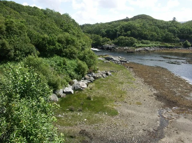

River Morar
Half a mile. That is the entire length of the freshwater portion of the River Morar, from the western shore of Loch Morar to the bridge that carries the A830. After that the river fans out across tidal sands and meets the Sound of Sleat. It is one of the shortest rivers in Scotland, but the loch it drains is the deepest in Britain, and the small drop between them - sixteen feet over a rock bar known as the Falls of Morar - hides one of the most ambitious public projects in twentieth-century Scotland.
Three Bridges in Half a Mile
Within that short course, the river is crossed three times. The uppermost is a four-arched concrete railway viaduct completed in 1897, now Category B listed, carrying the West Highland Line that opened to Mallaig in 1901. The main arch spans 90 feet; smaller arches step down at both ends. Just below it sits the B8008 road bridge, which once carried the main Fort William road; the bridge replaced an older crossing further downstream around 1915. The third bridge, an A830 span built in 1997 when the road was upgraded, bypasses the village entirely. Below the road bridges, the channel widens onto the Silver Sands of Morar, where on a falling tide the river writes a single slow curve across blinding white quartz.
Let Light Come to the Crofts
On 21 December 1948, a local crofter named Catherine MacKenzie stood beside the Falls of Morar and turned a ceremonial wheel. Water rushed into Kaplan turbines beneath her, and she spoke in Gaelic: "Gun tigeadh Solus agus Neart an dealain dhionnsuich gach crout" - Let light and power come to the crofts. The Morar hydroelectric station, a small thing of 750 kilowatts, had just become the first generating station of the North of Scotland Hydro-Electric Board to enter operation. It was conceived as a demonstration. The Board's grand plans involved the much larger Loch Sloy scheme to supply Clydeside; but Morar and Kyle of Lochalsh were built first, the visible promise that remote highland crofts would not be left behind.
The Architect of Stone
The original plans called for brick. James Shearer, one of the Board's architectural advisors, noticed that every building in the highlands was made of local stone and suggested the power stations be too - despite the cost, despite the fact that stoneworking was a dying craft. Edward MacColl, the Board's deputy chairman and chief executive, agreed at once, and the policy spread across the Board's later projects. The Morar station itself sits in a cavern near the falls; only the doorway and a retaining wall are visible from outside. A small dam raises Loch Morar by three feet, which sounds modest until you remember the loch covers 10.36 square miles - that small rise represents a vast reservoir of stored energy. A fish ladder was built around the dam so trout and salmon could still reach the spawning grounds upstream.
Tom Johnston's Vision
The Hydro-Electric Development Act of 1943, which created the Board, was championed by Tom Johnston during his time as Secretary of State for Scotland. His idea was elegant: profits from selling bulk power to the Scottish lowlands would subsidise the cost of connecting individual highland houses, where running a line might cost ten times more than the electricity could ever recoup. The Board would treat remote connections not as a commercial proposition but as the point. Morar still runs - tiny by modern standards, but quietly significant. Between 2005 and 2007 it generated enough Renewable Obligation Certificates to bring its operator over £332,000. Catherine MacKenzie's wheel turned to let light come to the crofts, and the crofts have had light ever since.
From the Air
Coordinates 56.9626°N, 5.8171°W. From 2,500-3,500 ft AGL, the river's compact geography is striking: the deep dark trough of Loch Morar to the east, the bright white wedge of the Silver Sands estuary to the west, and barely half a mile of freshwater in between. The Morar railway viaduct is a clear visual feature alongside the A830. Power station is hidden in a cavern near the Falls of Morar. Nearest fields: Plockton (EGPO) 22 nm north, Oban (EGEO) 50 nm south. Tidal range can shift the visible river channel substantially across Morar Bay.
Nearby Stories
- Rùm 4.7 km away
- Eden (2016 TV Series) 6.2 km away
- Plockton 9.7 km away
- Wiay, Inner Hebrides 11 km away
- Ballachulish 14 km away
- Stand-off at the Fords of Arkaig 19 km away
- Coll 22 km away
- Affric-Beauly hydro-electric power scheme 29 km away