
Glendoe Hydro Scheme
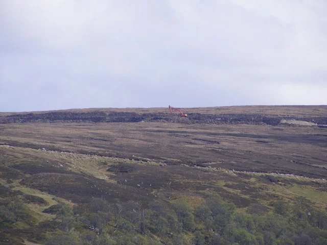
Queen Elizabeth pressed the button on 29 June 2009, and water that had been falling from the Glendoe plateau for thousands of years suddenly had a job to do. Six weeks later, somewhere deep inside a tunnel boring through nearly 2,000 feet of Highland rock, the job stopped. A section of headrace collapsed, the turbines fell silent, and one of Scotland's most ambitious hydro projects became one of its longest legal disputes. The Glendoe scheme sits in the Monadhliath Mountains above Fort Augustus, invisible from any road or house in the area. From the air, only the dam across the River Tarff hints at the engineering hidden beneath the heather.
A Scheme the 1960s Almost Built
The North of Scotland Hydro-Electric Board mothballed Glendoe in the 1960s along with most of its remaining big-scheme ambitions. The political climate had soured on flooding glens; amenity objections killed nearly every project the Board had on its drawing boards. Glendoe was the rare exception that no one really objected to, but without funding incentives, it sat in a filing cabinet for forty years. The Renewables Obligation of 2001 changed the arithmetic. Suddenly schemes above 10 megawatts qualified for subsidies they never had before, and Scottish and Southern Energy began reviewing what its predecessor had abandoned. By October 2001 Glendoe had been chosen. By June 2005 it had planning consent. By January 2006 the German contractor Hochtief had started construction with 750 workers housed in camps high on the plateau.
The Highest Head in Britain
Hydropower lives or dies on hydraulic head—the vertical distance water falls before hitting the turbine. Glendoe drops 2,000 feet (600 metres) from reservoir to powerhouse, the highest of any scheme in the United Kingdom. That altitude difference, combined with Highland rainfall, lets a relatively modest catchment of 5.8 square miles do extraordinary work. Fourteen intakes scattered across another 23 square miles funnel streams into a network of underground pipes. The dam across the River Tarff stretches 3,150 feet but reaches only 115 feet high at its tallest point, and it is faced with concrete on the upstream side, rough rock on the downstream. The quarry that supplied most of the rock filled with water as the reservoir rose, vanishing beneath its own contribution. From the surface, almost nothing of the scheme is visible. The turbine cavern lies underground, accessed through an 0.8-mile tunnel from the B862.
Operation Bathplug and Beyond
A refurbished Herrenknecht boring machine, named Eliza Jane after a competition by local schoolchildren, chewed through Highland gneiss to cut the headrace. The Pöyry engineers convinced Hochtief that the rock was sound enough to leave largely unlined—less than one per cent of the finished tunnel received concrete reinforcement. Inspectors signed it off. Tony Blair and First Minister Jack McConnell detonated a ceremonial charge to mark the formal start. Alex Salmond, by then First Minister himself, started the reservoir filling on 1 September 2008. Queen Elizabeth opened the completed scheme nine months later. Eight months after that, in August 2009, 233 feet of tunnel collapsed in the Conagleann Fault Zone, 1.2 miles from the top. The fault had been visible at the surface; the tunnel boring machine had simply driven through it without anyone noticing.
The Andritz Pelton and Its Six Jets
Engineers debated between a Francis turbine and a Pelton wheel for months. A Francis turbine starts and stops faster, but it requires a surge shaft to manage pressure changes, and the slope between reservoir and powerhouse offered no good site for one. A Pelton turbine is slower to respond, but its deflectors can stop the wheel before the water stops, sharply reducing pressure surges. SSE chose simplicity over speed. The installed Andritz six-jet vertical-axis Pelton generates up to 100 megawatts from a peak flow of 18.6 cubic metres per second—roughly 280 cubic feet per second, all of it falling six hundred metres straight down. The scheme produces about 180 gigawatt-hours annually at a load factor near 20 per cent, enough to cover roughly five per cent of Glasgow's electricity consumption.
The Court of Appeal Splits Two to One
BAM Nuttall built a diversion tunnel around the collapse, fully lined with 20 inches of waterproof concrete. Generation restarted in August 2012. The argument over who should pay took longer than the repair. Robert Galbraith QC, appointed to adjudicate in 2011, sided with Hochtief: the collapse was an operational risk for SSE to bear. The Scottish Court of Session agreed in 2016, dismissing SSE's £130 million claim. The Inner House split two to one on appeal in 2018, awarding SSE more than £107 million. Hochtief took the case to the Supreme Court. Whatever the lawyers ultimately decided, the scheme they were fighting over keeps generating, its dam invisible from the road, its turbine spinning quietly inside the mountain.
From the Air
Located at 57.093N, 4.556W in the Monadhliath Mountains southwest of Loch Ness. Inverness Airport (EGPE) lies 23 nm northeast. The Tarff dam runs across the plateau visible above Fort Augustus; the village itself sits at the southern end of Loch Ness, where the Caledonian Canal locks step down to the water. Recommended viewing altitude 3,500 to 5,500 ft AGL on clear days; Highland cloud cover is frequent and visibility variable. The scheme's surface infrastructure is deliberately minimal—look for the dam and access track rather than the powerhouse, which is buried under the mountain.
Nearby Stories
- Blair Castle 0.7 km away
- Urquhart Castle 3.6 km away
- Kinlochleven Hydroelectric Scheme 7.5 km away
- Stand-off at the Fords of Arkaig 11 km away
- Cairngorm Plateau Disaster 13 km away
- Rannoch Railway Station 15 km away
- Grantown-on-Spey 16 km away
- Lochalsh 31 km away