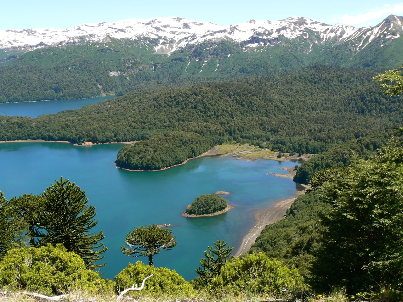

Conguillío National Park
When the BBC needed a landscape primeval enough for Walking with Dinosaurs, they came here. It is easy to see why. At Conguillio, ancient monkey puzzle forests rise from fields of black lava beneath the smoking cone of Llaima, and the scene looks less like the present than like a window onto deep time. The park's name comes from a Mapuche word meaning "water with araucaria seeds," and that name holds the whole place at once: the trees, the volcano, the lake that gathers it all together.
The Living Mountain
Llaima dominates everything. At 3,125 metres it is one of the largest and most active volcanoes in all of Chile, and it does not sit quietly. It erupted as recently as 2008, sending ash and lava spilling across its flanks, and its restlessness has shaped the park over thousands of years. Vast lava flows spread across the valley floor, hardened now into black rock, and out of that rock rise islands of forest, patches of green that the lava flowed around or that grew back in the centuries since. To stand here is to watch creation and destruction holding the same ground.
The Sacred Pewen
The araucaria gives Conguillio its soul. Known as the monkey puzzle to the world and the pewen to the Mapuche, the tree is a living fossil, its lineage stretching back more than 200 million years, and individuals can live a thousand years or longer. For the Pehuenche, the people whose name means "people of the pewen," these forests were sustenance and sanctuary; the seeds were a staple food, gathered each autumn, and the tree itself was held sacred. Their distinctive silhouette, branches splayed like spokes from a tall bare trunk, earned the park another nickname: Los Paraguas, the umbrellas. The araucaria is now endangered, which makes these old stands a treasure as much as a wonder.
Rivers Through Scoria
Water cuts through the volcanic rock in ways that reveal the park's violent geology. The Truful-Truful river crosses beds of dark scoria, the loose cindery rubble that an eruption throws out, before draining into Lake Conguillio, and not far from the village of Melipeuco it tumbles over the Saltos del Truful-Truful, a series of falls where rainbow trout gather in the pools. The Lonquimay River drains the high country and eventually joins the great Biobio. Between the lava fields and the forests lie smaller lakes, still and cold, mirroring the araucaria crowns and the white peak above them.
A Refuge Recognized
Chile declared Conguillio a national park in 1950, and the wider world has acknowledged its worth more than once since. In 1983 UNESCO folded the park, together with the Alto Bio Bio reserve, into the Araucarias Biosphere Reserve. Then in 2019 the surrounding region was recognized as the Kutralkura Geopark, part of UNESCO's Global Geoparks Network, honoring a landscape where four volcanoes and their lava fields tell the story of how the southern Andes were built. The protection is layered, like the lava itself, each designation adding another shield over the same irreplaceable ground.
When to Come
The park reveals different faces with the seasons. Between November and March, the austral spring and summer, the climate softens and the roads firm up, opening the trails that climb toward Sierra Nevada and wind through Las Araucarias. The forest fills with wading birds and waterfowl on the lakes, while condors and the great crimson-crested Magellanic woodpecker work the higher ground. In winter, snow blankets the araucarias and a small ski centre opens on Llaima's western flank, the slopes facing away from the lake. Whenever you arrive, the scale of the place, deep time written in rock and root, comes through.
From the Air
Conguillio National Park lies at 38.67 degrees south, 71.65 degrees west, in the Andes of Chile's La Araucania Region, about 120 km east of Temuco. The unmistakable landmark is Llaima volcano (3,125 m), a frequently active, snow-capped stratovolcano on the park's southwestern side; Sierra Nevada rises to the northeast, and Lake Conguillio lies between them. A viewing altitude of 8,000 to 11,000 feet frames the volcano, the dark lava fields, and the islands of araucaria forest in a single sweep. The nearest major airport is La Araucania International (ICAO: SCQP) near Temuco, about 130 km west. Note that Llaima is an active volcano; in eruptive periods, expect ash and adjust routing and altitude accordingly. Clearest flying conditions come November through March.
Nearby Stories
- Tolhuaca National Park 28 km away
- Kingdom of Araucanía and Patagonia 33 km away
- Huerquehue National Park 34 km away
- Villarrica 48 km away
- Malleco Viaduct 51 km away
- Vaca Muerta 72 km away
- Espacio Lejano Station 77 km away
- Zapala 83 km away