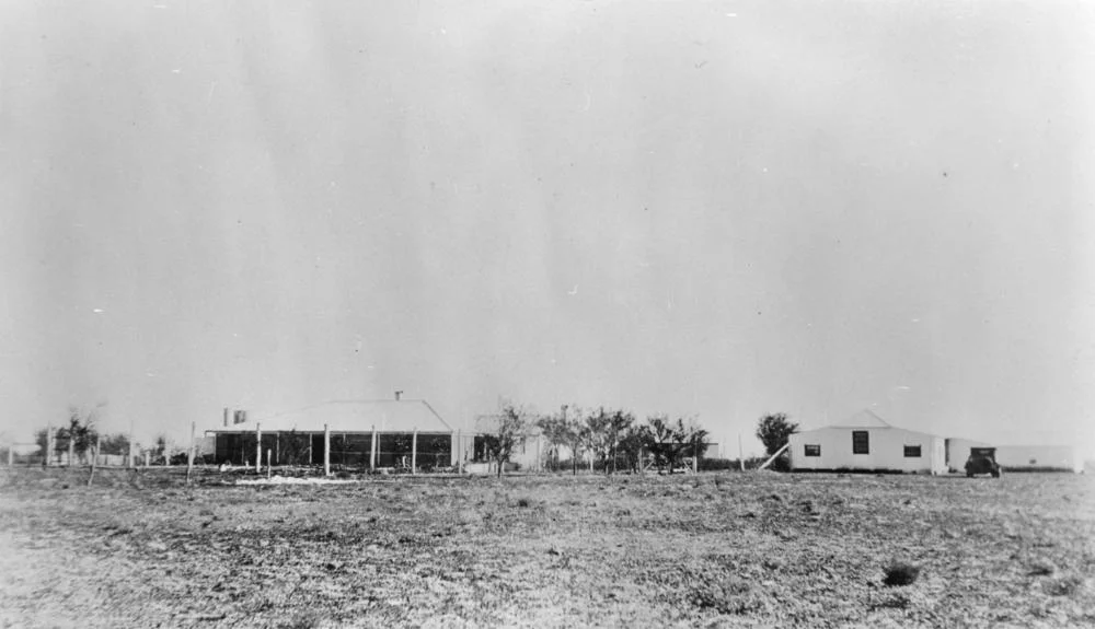

Coorabulka
Somewhere over the dark plains between Boulia and Winton, a light appears. It hovers above the horizon, fuzzy and disc-shaped, sometimes white, sometimes shifting toward red or green. It seems to follow travellers, keeping its distance, never letting itself be reached. This is the Min Min light, the most famous unexplained phenomenon in the Australian outback, and the country around Coorabulka Station sits squarely within the haunted ground where it has been reported for more than a century. Coorabulka is a working cattle run between the Diamantina and Georgina Rivers. It is also a place where the land itself seems, on certain nights, to glow.
The Light That Will Not Be Caught
The Min Min light takes its name from a locality between Boulia and Winton, and accounts of it stretch back to at least 1912, with a widely told sighting by a stockman around 1918. For the Aboriginal people of this country, the lights are older still, understood in some traditions as the spirits of ancestors. The phenomenon is real enough that the town of Boulia now calls itself the Home of the Min Min Light. What it actually is remains genuinely unknown. The most compelling scientific explanation comes from the neuroscientist Jack Pettigrew, who argued that the light is a Fata Morgana, an inverted mirage in which light from a real but distant source, a campfire, a vehicle, a homestead, is bent by layers of air at different temperatures and lifted into view far over the horizon. It is an elegant theory that fits many sightings. But it has never fully closed the case, and the Min Min light keeps its mystery.
Between Two Rivers
Coorabulka lies 99 kilometres south-east of Boulia, set in the Channel Country between the Diamantina and Georgina Rivers. It runs to 6,370 square kilometres and can carry around 8,000 head of cattle, mostly across open downs of Mitchell and Flinders grass, with about a quarter of the property given over to floodplain. Today it serves as a grower property for weaners within the North Australian Pastoral Company, bordered by Marion Downs to the west and Monkira to the south. By 1890 the run was in the hands of Wellington, Woods and Ferguson, who trucked mobs of cattle south to market after good seasons. It is unremarkable, productive cattle country by day. The strangeness belongs to the night, and to the long flat horizons that let a distant light masquerade as something hovering just beyond the next fence.
Water From Far Below
In a land this dry, the most valuable thing on Coorabulka came from beneath it. In 1901 the new owners sank the station's first bore, driving down 680 feet until they struck the Great Artesian Basin and released a flow of over a million gallons. Three years later, a sixth bore hit what the papers of the day called a sensational flow, artesian water rising six feet above the casing and gushing an estimated three million gallons a day. For early graziers, this was close to miraculous: reliable fresh water in country where rain might fail for years. But the basin is not bottomless. By 2007 the thinking had reversed entirely, and ten bores on Coorabulka were capped to stop the waste, part of a 1.5-million-dollar program of new pipework and storage tanks. The same artesian water that made the station possible is now something to be guarded, drop by drop.
Up to the Roof
For all its dependence on water, Coorabulka has nearly drowned more than once. In 1904 it was nearly washed away when nine inches of rain fell in a week and both the Diamantina and Farrar Creek ran in big flood. The most harrowing episode came in 1949, when the Green family, living at the homestead, were trapped by rising floodwater for 36 hours. A fading telephone call carried their plight to the outside world: they were up to their armpits in water and trying to reach the roof. Two rescue parties set out, one on horseback and one aboard an improvised raft cobbled together from a cattle water trough and petrol drums, and reached the family in time. It is the defining image of this country in miniature, ordinary people clinging to a rooftop while the same floods that fatten the cattle threaten to carry the house away.
From the Air
Coorabulka Station lies at 23.73°S, 140.31°E, about 99 km south-east of Boulia in the Channel Country between the Diamantina and Georgina Rivers. From altitude the property reads as open Mitchell-grass downs broken by floodplain channels, with the two great river systems framing it east and west. This is the heart of Min Min light country: on dark nights, distant ground lights can be lifted and distorted by inverted mirages over the long flat horizons, the very effect blamed for the legend. Nearest airport is Boulia (YBOU/BQL) to the north-west; Bedourie (YBIE/BEU) lies south-west and Birdsville (YBDV/BVI) further south. Expect minimal ground lighting, vast sightlines and, after rain, broad sheets of floodwater across the channels.
Nearby Stories
- Davenport Downs Station 15 km away
- Georgina River 15 km away
- Diamantina Lakes Station 18 km away
- Astrebla Downs National Park 19 km away
- Diamantina National Park 27 km away
- Elizabeth Springs 27 km away
- Bedourie 55 km away
- Marion Downs Station 57 km away