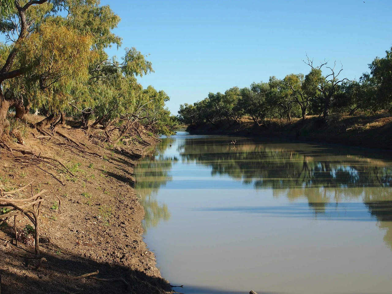

Georgina River
Stand on the Georgina River Bridge at Camooweal in winter and you will look down at sand. The riverbed below runs bone dry for months at a stretch, and it is hard to believe the structure above it needed to be 417 metres long and built unusually high. Then the summer monsoon arrives somewhere far to the north, and the Georgina becomes one of the widest rivers in inland Australia, spilling across kilometres of floodplain, cutting off the only sealed road between Queensland and the Northern Territory for weeks at a time. This is a river of two complete personalities, and the gap between them is among the most extreme of any river on Earth.
A River Named Twice
The Georgina is the north-westernmost of the three great rivers of the Channel Country, the others being the Diamantina and Cooper Creek. All three drain south toward Kati Thanda-Lake Eyre across one of the largest internally draining basins on the planet. For its first decades on colonial maps this river was the Herbert, until 1890, when it was renamed to avoid confusion with another Queensland Herbert and given the name of Georgina Mildred Kennedy, daughter of the Queensland governor Arthur Kennedy. But the river holds a third identity too. As it flows south and the Burke River joins it near Marion Downs Station, the Georgina becomes Eyre Creek, running down the eastern edge of the Simpson Desert toward Goyder Lagoon. One waterway, three names, marking the stages of its long descent toward the lowest point in Australia.
The Arithmetic of Drought
The Georgina basin covers around 232,000 square kilometres, roughly the size of the state of Victoria, and yet its mean annual flow is only about 0.7 cubic kilometres. That figure conceals everything important about this river, because the Georgina almost never does anything average. There have been years, 1905, 1928 and 1961 among them, when meteorologists are confident the entire basin produced essentially zero runoff. Then come years like 1974, 1977 and 2000, when runoff surged to 6.28 cubic kilometres or more, nearly ten times the long-term average. Rain falls overwhelmingly in summer, and from May to September it is entirely normal for no measurable rain to fall at all. The heat is relentless: most of the basin tops 30 degrees Celsius on more than 225 days a year. Frost is rare enough to be remarkable. To live with the Georgina is to plan for nothing and prepare for both extremes.
When the Water Comes
In flood the Georgina transforms the country. The river can sprawl tens of kilometres wide across its lower reaches, and inundation can last for months, severing roads and rail. The greatest flood on record came in January 1974. Decades earlier, in 1901, Lake Nash Station in the Northern Territory caught more than ten inches of rain in a single day and the Georgina ran at almost record levels. In 1953 the river rose more than 23 feet, its highest in 36 years, and the floodwaters were expected to reach Lake Eyre. There is intriguing evidence that, despite being the driest of the three Channel Country rivers, the Georgina may once have reached the lake more often than either the Diamantina or Cooper. Wave-built shingle terraces hint that during the Medieval Warm Period, Lake Eyre may have held permanent water, perhaps fed regularly by this very river. The evidence is too thin for certainty, but it suggests the Georgina once kept an inland sea alive.
The Camping Ground of the Rainbow Serpent
For the people who have lived along the Georgina for tens of thousands of years, the river is far older than any of its colonial names. When a new bridge was built at Camooweal in 2002 to keep the Barkly Highway open through floods, the engineers faced a problem: the riverbed itself was culturally significant to the local Indjalandji-Dhidhanu people, who did not want pylons driven into it. The solution was an unusual arch design that spanned the river without piercing its bed. The Indjalandji-Dhidhanu people named the new bridge Ilaga Thuwani, meaning the Camping Ground of the Rainbow Serpent. It is a quietly perfect name for a structure over a river that is dry one season and a torrent the next, watched over by the great ancestral being who, in the stories of this country, made the waterways and still moves through them.
From the Air
The Georgina River system threads across roughly 23.5°S, 139.78°E through the Channel Country of western Queensland and the eastern Northern Territory, draining a basin near 232,000 km2. From altitude its braided, anastomosing channels are unmistakable, a fan of interlacing watercourses spreading across pale floodplains. In drought the channels read as dry sand traces; in flood they merge into broad sheets of water visible for tens of kilometres and useful as a major navigation reference. Headwaters rise in the Barkly Tableland near Camooweal (the Barkly Highway bridge is a landmark); downstream the river becomes Eyre Creek along the eastern Simpson Desert. Nearest airports include Boulia (YBOU/BQL) and Bedourie (YBIE/BEU) to the south-east, with Birdsville (YBDV/BVI) further south. Clear, dry winter skies offer exceptional visibility.
Nearby Stories
- Coorabulka 3.3 km away
- Elizabeth Springs 35 km away
- Boulia Stone House 36 km away
- Glenormiston Station 53 km away
- Bedourie 75 km away
- Ethabuka Reserve 99 km away
- Pilungah Reserve 106 km away
- Cannington Mine 163 km away