
Crooked Harbour
Stand on the western coast of Kat O Island and look north, and you can see Shenzhen. The container terminals of Yantian fill the horizon to the northwest, cranes rising above the waterline like sentinels. Below you, in the sheltered water of Kat O Hoi — Crooked Harbour — small fishing vessels rest at anchor in a quiet that the distant city skyline makes feel all the more unlikely. This is the northeastern edge of Hong Kong, where the New Territories meet the sea.
A Harbour of Many Islands
Crooked Harbour earns its English name from the irregular shape of the water body, pinched and curved by the islands and peninsulas that frame it. The harbour is enclosed primarily by Crooked Island — Kat O in Cantonese — and the smaller island of Ap Chau to the northeast, with the mainland New Territories forming the southern and western shores. Beyond the harbour's northern opening lies Double Haven, and beyond that, the broader expanse of Mirs Bay. The islands within and around the harbour form a miniature archipelago: Ap Chau and its cluster of attendant islets, Fun Chau, Siu Nim Chau, Tai Nim Chau, Lo Chi Pai, and others. Each one is distinct — different shapes, different histories, different relationships to the water around them.
Stone Shelves at the Water's Edge
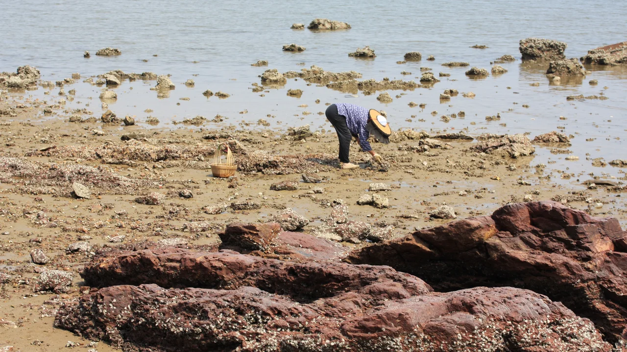
The rocky shores of Crooked Harbour display a feature geologists find unusual: wave-cut benches, flat ledges six to ten metres wide, cut horizontally into the rock along sediment layers exposed at the waterline. These benches form where the sea erodes softer rock between more resistant strata, producing a staircase effect at the base of the cliffs that is uncommon elsewhere in Hong Kong's coastline. The same feature appears at nearby Ping Chau. The rocks here are sedimentary — laid down in ancient shallow seas and later compressed and uplifted — and their layered structure makes them particularly susceptible to this kind of patterned erosion. Walking the foreshore at low tide, you can read the geology directly in the rock beneath your feet.
The Eelgrass and the Shrimp
Beneath the surface of the harbour, the ecology is equally distinctive. Eelgrasses were discovered at Lai Chi Wo — a village on the mainland shore of the harbour — in 1977, and the Agricultural and Fisheries Department of the Hong Kong government moved to protect them. These submerged meadows provide habitat and nursery grounds for the harbour's marine life, filtering the water and stabilizing the seabed. Among the residents of the eelgrass beds is Periclimenes demani, a small and translucent shrimp that depends on the grass for shelter. The protected status of the eelgrass reflects the broader ecological sensitivity of the Crooked Harbour area, which lies adjacent to the Lai Chi Wo Special Area and the Double Haven conservation zone.
At the Edge of Two Worlds
What makes Crooked Harbour feel singular is the contrast it embodies. From the water, the Shenzhen skyline is visible to the north — the towers and container infrastructure of one of China's largest cities rising just beyond the border. The harbour itself remains quiet, its islands largely undeveloped, its waters still fished by small boats in traditional fashion. The restricted zone status of the Sha Tau Kok area on the mainland shore has helped preserve that quiet: access requires permits, and the bureaucratic barrier has, inadvertently, kept the kind of mass tourism that transforms coastal Hong Kong at bay. Crooked Harbour sits close to one of the most intensely developed urban corridors on earth, and yet it looks, at times, like it belongs to a much earlier century.
From the Air
Crooked Harbour is centered at approximately 22.54°N, 114.28°E, in the northeastern New Territories of Hong Kong, just south of the Shenzhen border. From the air, the harbour is recognizable as the sheltered water body enclosed between Kat O (Crooked Island), Ap Chau, and the mainland shore, with Double Haven visible to the north. The Yantian container terminals on the Shenzhen shore are a prominent landmark to the northwest. Nearest major airport is Hong Kong International (VHHH), approximately 45 kilometres to the southwest. The border between Hong Kong and Shenzhen runs directly north of the harbour.
Nearby Stories
- Basalt Island 7.1 km away
- Ngong Ping 360 7.5 km away
- China Southern Airlines Flight 3456 11 km away
- Huizhou (Guangdong) 27 km away
- Dongguan 27 km away
- Battle of Penghu 471 km away
- Penghu Air Raids 477 km away
- Checheng Fu'an Temple 593 km away