
Curicó
In the main square of Curicó, two very different men stand cast in bronze. One is José Antonio Manso de Velasco, the Spanish governor who founded the city. The other is Lautaro, the young Mapuche toqui who fought to drive men like Manso de Velasco out of Chile and was killed in battle on the Mataquito River just to the west. That a colonial wine town would honor the Indigenous war leader who resisted the colonizers says something about how Chile has come to remember its own beginnings, and about the layered history packed into one shady plaza of palms.
Founded by a Future Viceroy
Curicó was born on October 9, 1743, as San José de Buena Vista de Curicó, established under the authority of José Antonio Manso de Velasco, then governor of Chile. He was an ambitious administrator who would go on to become Viceroy of Peru, the highest Spanish office in South America, and Curicó was one of a string of towns he chartered across the Central Valley. The city sits in the Maule Region, between the Andes and the Coastal Range, on land that has been worked for agriculture for centuries. Today around 147,000 people live in the commune, making it one of the larger cities of the region.
Sixty Palms and an Iron Kiosk
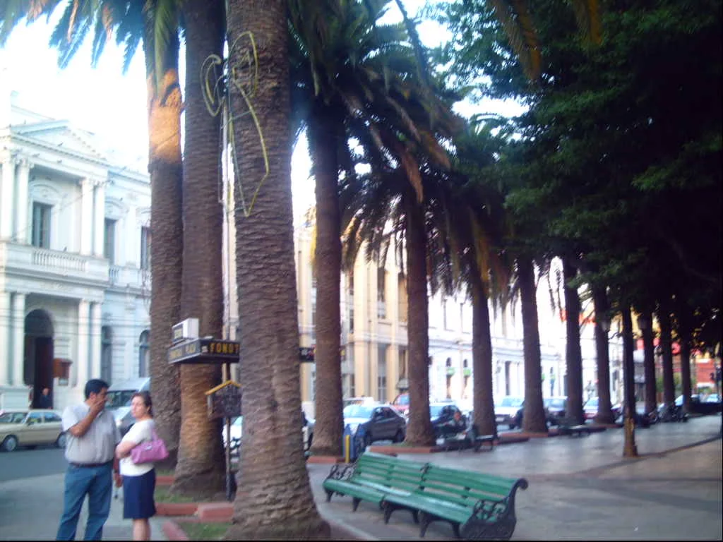
The heart of Curicó is its Plaza de Armas, a square so distinctive it has been declared a Typical Zone. Sixty phoenix palms, brought from the Canary Islands, rise over its walkways and fountains. At its center stands an ornate iron bandstand in the manner of Gustave Eiffel, a delicate piece of nineteenth-century engineering that is itself a National Monument. Among the sculptures is the monument to Lautaro, carved by the Chilean sculptor Heraclio Calquín, honoring the toqui whose final battle was fought on the nearby Mataquito. The square is the kind of place where the whole city seems to pass through on a warm evening.
Wine and a World-Record Cake
Curicó is a wine town to its core. Winemaking has shaped the valley for close to five centuries, and every year in mid-to-late March the city throws its Fiesta de la Vendimia, the Wine Harvest Festival, a celebration of grape and Creole tradition. A wine route threads through the surrounding valley, past vineyards that have made the Curicó name on bottles around the world. The city has a sweeter claim to fame, too: its bakeries are known for tortas curicanas, traditional layered cakes, and in 1995 a local bakery, Tortas Montero, earned a Guinness World Record for baking what was then the largest cake on earth.
Hills, Heroes, and the 2010 Quake
Above the city center rises Cerro Condell, a hill topped by a monument to the Immaculate Conception and laced with paths that fill with people on Chile's national holidays, offering panoramic views over the rooftops and vineyards. The region produces its share of heroes; the city remembers Luis Cruz Martínez, a young soldier of the War of the Pacific honored across Chile. But Curicó also carries scars. The massive earthquake of February 2010 struck hard here, collapsing the San Francisco church and the offices of La Prensa de Curicó, one of the oldest newspapers in the country, founded in 1898. The city has rebuilt around its losses, and the palms in the plaza still stand, as they have for generations, over a square where two cast-bronze adversaries keep their permanent, silent peace.
From the Air
Curicó lies at roughly 34.99°S, 71.24°W, in the heart of Chile's Maule wine country, on the floor of the Central Valley between the Andes to the east and the Coastal Range to the west. From the air, look for the city's regular grid, the green crown of the Plaza de Armas, and the prominence of Cerro Condell near the center, with vineyards quilting the surrounding valley. The local airfield is General Freire aerodrome at Curicó; Santiago's Comodoro Arturo Merino Benítez International Airport (SCEL) lies about 95 nautical miles north, and the Talca area airfields are a short hop south. A viewing altitude of 3,000-6,000 feet AGL frames the valley floor against the rising wall of the Andes. Visibility is sharpest on dry, clear days from late spring through summer (November-March), the same season that culminates in the March harvest festival.
Nearby Stories
- La Frontera (Chile) 20 km away
- Radal Siete Tazas National Park 20 km away
- Vichuquén 33 km away
- Uruguayan Air Force Flight 571 35 km away
- Santa Olga 53 km away
- Pichilemu 54 km away
- Las Leñas 54 km away
- Witches' Cave 92 km away