
Dapeng Peninsula
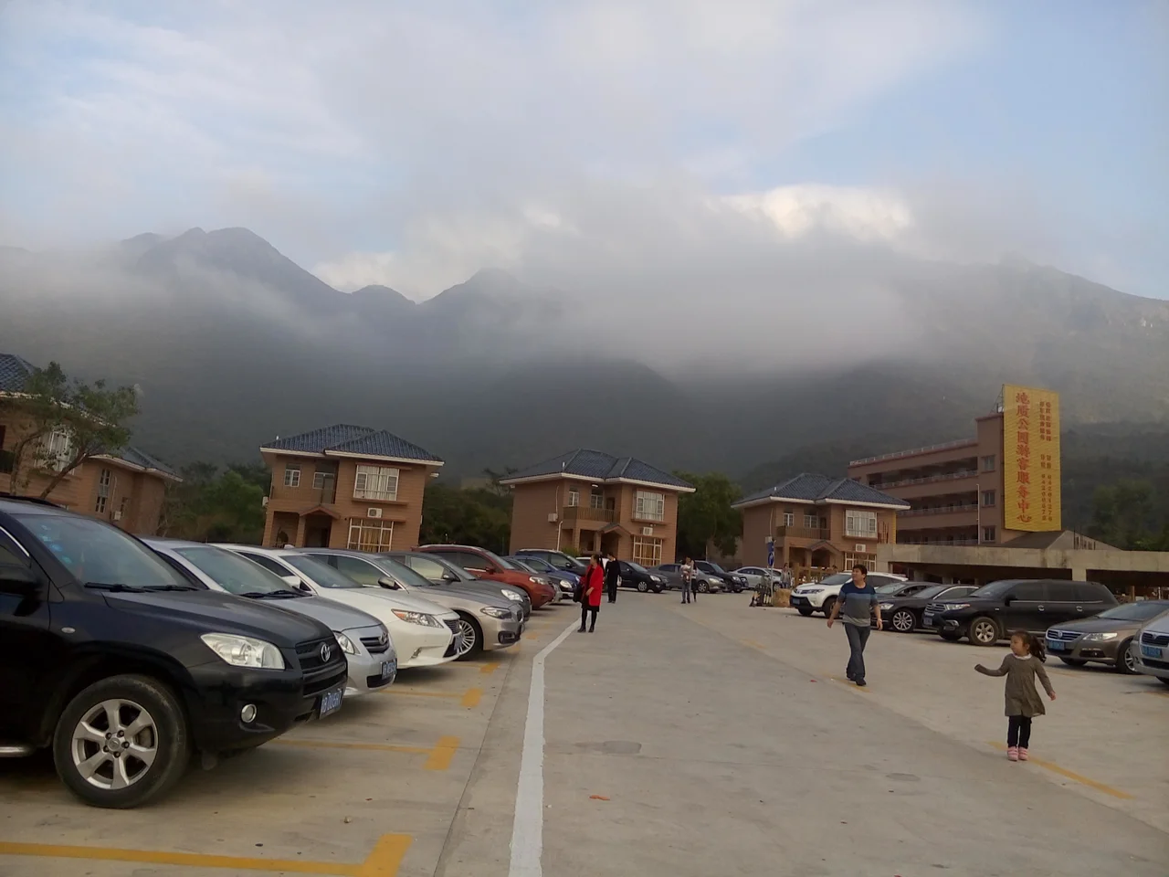
Where Shenzhen ends, the Dapeng Peninsula begins. The city's gleaming skyline fades into the rearview mirror and the road narrows between forested ridges and fishing villages that predate the Special Economic Zone by centuries. The peninsula pushes southward into the South China Sea, caught between Mirs Bay to the west and Daya Bay to the east, its 133-kilometer coastline curling around coves and beaches that Chinese National Geography once selected among the most beautiful in the country. It is, improbably, one of the least industrialized stretches of land in one of the most industrialized cities on Earth.
Stone Walls and Sea Raiders
Long before Shenzhen existed as a concept, the Dapeng Fortress stood guard over this coast. Built during the late Ming Dynasty, the walled garrison town of Dapengcheng was constructed specifically to repel the wokou — Japanese pirates who raided coastal communities throughout the 14th to 17th centuries. The fortress walls remain standing today, enclosing a historic core where the Dapeng dialect is still spoken: a linguistic remnant of the garrison soldiers who settled here and never left. During the Second Opium War in the 1850s, British negotiators raised the possibility of extending colonial Hong Kong to include the peninsula, but the annexation never happened. The peninsula remained Chinese, shaped instead by successive centuries of fishing culture, Ming military architecture, and the rhythms of the tides.
Two Bays, One Peninsula
The geography here is the story. Mirs Bay opens to the west, its calm waters forming the marine boundary with Hong Kong — on a clear day, the rocky outline of Tung Ping Chau, a Hong Kong island, is visible just offshore from the peninsula's western flank. Daya Bay stretches to the northeast, its shores eventually reaching the nuclear power complex that has reshaped the region's identity in the modern era. Between these two bodies of water, the peninsula covers 294 square kilometers of terrain that rises sharply from its beaches toward the interior. Qiniangshan — Seven Maiden Mountain — reaches 869 meters, the highest point on the peninsula and the anchor of a country park that draws hikers from across Guangdong. The Yanba Expressway threads through the northern reaches, but much of the peninsula's interior remains forested and steep.
The Beach at Xichong
Xichong, near the peninsula's southern tip, offers a particular kind of surprise: a wide, clean arc of sand and turquoise water that seems to belong to a different geography entirely — somewhere tropical and unhurried rather than this corner of one of China's busiest metropolitan regions. The beach has become the peninsula's most celebrated destination, drawing visitors who arrive by the Yanba Expressway and provincial highway S359, which runs the full length of the peninsula from north to south. Xichong's appeal is precisely its contrast: the high-rises of Shenzhen are an hour away, but on the beach you hear waves and wind rather than construction cranes. The peninsula's selection by Chinese National Geography as one of the country's most beautiful coastal areas was, in part, a recognition that this contrast had been worth preserving.
Living Through History
The 20th century pressed hard on the peninsula, as it did on all of rural Guangdong. The Cultural Revolution brought famine to this region alongside ideology — the hardships of those years left marks that older residents still carry. Then came Shenzhen's transformation from fishing village to global manufacturing hub, a metamorphosis so rapid that it reshaped not just the economy but the landscape of the entire Pearl River Delta. The Dapeng Peninsula was partly insulated from the most intense development pressures by its mountains and its distance from the main urban core, and partly by deliberate policy decisions to protect its natural assets. The result is a place that exists in productive tension: administratively part of Shenzhen, ecologically distinct from it, historically rooted in a world that predates the city entirely.
At the Edge of the Delta
From the peninsula's heights, the view stretches in every direction. South, the South China Sea opens wide. West, across Mirs Bay, the hills of Hong Kong's New Territories. East, the cooling towers of the Daya Bay nuclear plant mark where Guangdong's industrial ambitions extend even to this quiet coast. North, on a clear day, the towers of Shenzhen proper are visible on the horizon. The peninsula feels like a hinge point — between mainland China and Hong Kong, between mountain and sea, between ancient garrison town and the 21st-century city pressing from the north. Its 133 kilometers of coastline contain multitudes: fortresses and beaches, fishing communities and hiking trails, the Dapeng dialect spoken by descendants of Ming soldiers who never went home.
From the Air
The Dapeng Peninsula is located at approximately 22.52°N, 114.53°E, forming the easternmost arm of Shenzhen. At 3,000–5,000 feet, the peninsula's shape is clearly visible — the narrow landmass extending south between two bays, with Qiniangshan's 869-meter peak visible in the interior. The coastline's beaches and coves are visible at lower altitudes, particularly the curved bay at Xichong near the southern tip. Nearest major airport is ZGSZ (Shenzhen Bao'an International), approximately 50 km to the west. The border with Hong Kong runs through Mirs Bay to the southwest, with VHHH (Hong Kong International) about 60 km to the west. Look west on approach and you may see Tung Ping Chau, the outlying Hong Kong island that sits just offshore from the peninsula's western coast.
Nearby Stories
- Basalt Island 7.1 km away
- Ngong Ping 360 7.5 km away
- China Southern Airlines Flight 3456 11 km away
- Huizhou (Guangdong) 27 km away
- Dongguan 27 km away
- Battle of Penghu 471 km away
- Penghu Air Raids 477 km away
- Checheng Fu'an Temple 593 km away