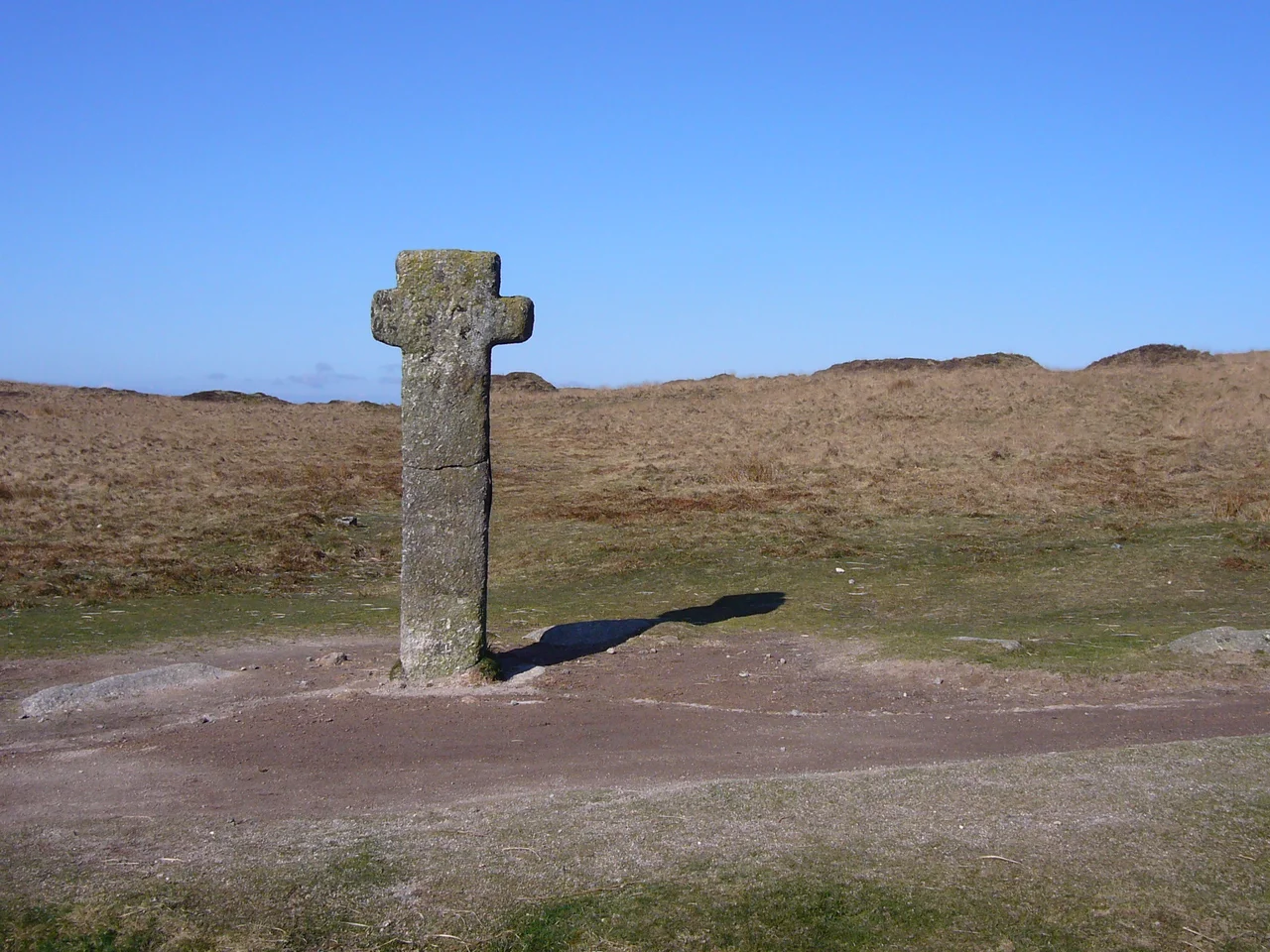

Dartmoor Crosses
There are 132 known stone crosses on Dartmoor, scattered across 368 square miles of moorland and bog. The oldest, Siward's Cross, has stood at the junction of two medieval pilgrim paths since the reign of Edward the Confessor in the eleventh century. The most recent went up about a hundred years ago. Many of them were once navigation aids, the medieval equivalent of cairns on a Himalayan pass: stone landmarks that told a soaked, freezing traveller which way to walk to avoid dying in a mire. By 2005 the National Park Authority had begun microchipping the most vulnerable of them. Granite is durable. Theft is not.
The Legend of the Drowned Monks
The local explanation for why the crosses exist is more memorable than the historical one. According to the legend, four medieval monks at a Dartmoor abbey resented their abbot's rules on austere living. When the abbot left for Italy, the four robbed and murdered a wealthy Jewish man for money to celebrate. That same evening, a messenger called them out onto the snow-covered moor. When they reached the rendezvous, they saw it was the ghost of the man they had killed. The ghost hypnotised them. They wandered onto the mire, fell through the ice, and were swallowed by the bog. The abbot, returning home to find them gone and assuming they had fled in guilt at his arrival, ordered crosses raised along the moorland routes so that no future monks would ever stray from the path. It is a folk-tale, of course. The crosses pre-date and post-date any single act of conscience. But the story preserves a real truth: people did die on these moors, and the crosses were raised to stop them dying.
Siward's Cross, the Eldest
Siward's Cross, also known as Nun's Cross, is the largest and oldest recorded cross on Dartmoor. It is mentioned in the 1240 Perambulation of the Forest of Dartmoor, but it is certainly older than that. The cross was probably erected during the reign of Edward the Confessor between 1042 and 1066, named after Siward, Earl of Northumbria, who was Lord of the Manor of Tavei (probably modern Mary Tavy) and witnessed the founding charter of Exeter Cathedral in 1050. It stands at the junction of the Monks' Path and the Abbots' Way, the two medieval east-west tracks that linked Buckfast Abbey in the east to Tavistock Abbey and Buckland Abbey in the west. Pilgrims, monks, traders, drovers, and tin miners all passed it. It was knocked down in 1846 and the shaft broken. Sir Ralph Lopes paid for it to be restored two years later. The eastern face may still bear the worn inscription SIWARD or SYWARD.
Bennett's Cross and the Hunger of Time
Bennett's Cross stands beside the road from Moretonhampstead to Two Bridges, about 900 metres north-west of the Warren House Inn. Nothing is known of its early history, but its crudely-cut shape suggests great age. Over the centuries it served different purposes: as a route marker, then as a parish boundary stone between Chagford and North Bovey, and as a boundary marker for both Headland Warren and the Vitifer Mine. The letters 'WB' carved on one face stand for Warren Bounds. The name 'Bennett' was once thought to refer to a local Benedictine community or to William Bennet, a sixteenth-century miner at the Stannary Parliament on Crockern Tor. The truth turns out to be more recent: the cross was rediscovered fallen in the 1860s and re-erected by Ellery Bennet, a Plymouth solicitor. Two similar crosses along the same road were removed in the nineteenth century. Bennett's survived because someone had bothered to use it as a boundary marker, which gave it a legal reason to stand.
Lost, Found, and the One They Refused to Believe In
Goldsmith's Cross, on the Monks' Path between Childe's Tomb and Nun's Cross, was discovered in 1903 by Lieutenant M. Lennon Goldsmith, who found the socket, head, and lower shaft. It was the last major discovery of a cross on the moor. Goldsmith reported the find to William Crossing, the great Dartmoor antiquarian, whose definitive book on the crosses had only just been published. Crossing refused to believe the cross existed. Goldsmith, undeterred, re-erected it himself with the help of four sailors from his ship. Crossing eventually conceded, and added Goldsmith's Cross to the 1910 edition of his Guide to Dartmoor. The cross is short and stumpy because the upper part of the shaft was never found. Other crosses have similar stories. Mount Misery Cross was lying on the ground when Crossing first saw it, was standing again in 1879, fallen by 1881, and re-erected in 1885 with Crossing's help. Horn's Cross was restored with one of its arms still mutilated, and the iron tie-pieces holding its head to the new shaft are clearly visible. A deed of Amicia, Countess of Devon, dated 1280, mentions five Dartmoor crosses now completely lost: Copriscrosse, Wolewille, Maynstoncross, Smalacumbacrosse, and Yanedonecross. The moor keeps some secrets. Others it gives back.
From the Air
The Dartmoor crosses are scattered across the moor between roughly 50.4 N to 50.7 N and 3.7 W to 4.1 W, covering most of central and southern Dartmoor National Park in central Devon. From the air the crosses themselves are far too small to see, but the moorland topography of granite tors, blanket bog, and the cleared monastic tracks shows up clearly as a patchwork of brown heather, green grass, and dark mire. Plymouth City Airport (EGHD) is closed; Exeter (EGTE) is on the moor's eastern edge about 15 nm from the highest tors, and Newquay Cornwall (EGHQ) is 50 nm west. Best low-level viewing is 2,000 to 4,000 feet AGL in clear conditions, with low sun raking across the moor to reveal the tracks and ancient enclosures.
Nearby Stories
- Bodmin Moor 4.1 km away
- South Devon Railway sea wall 4.8 km away
- Tiverton Castle 12 km away
- Hope Cove Lifeboat Station 14 km away
- Caerhays Castle 20 km away
- Holsworthy 22 km away
- HMS Formidable (1898) 32 km away
- HMS Montagu 41 km away