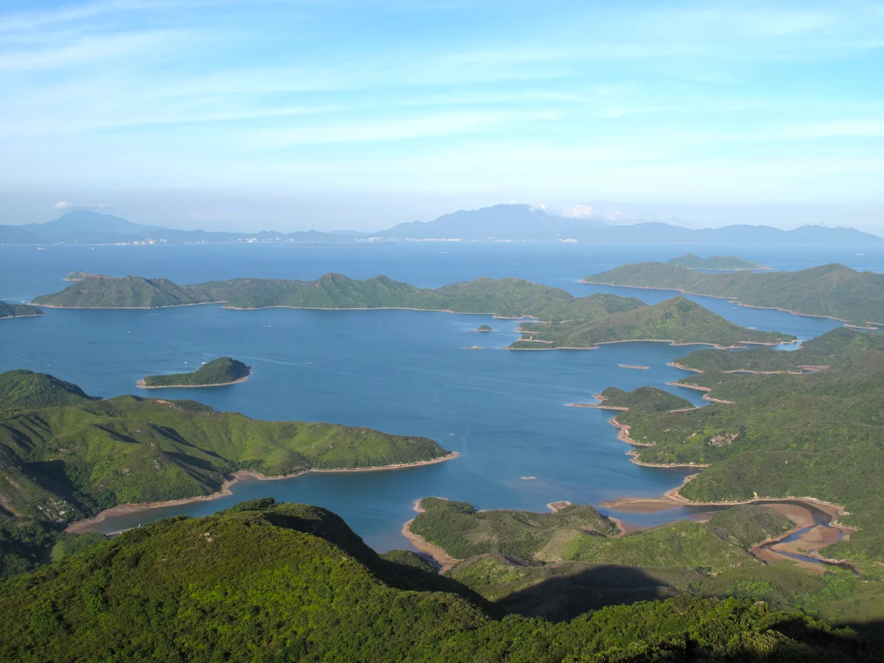

Double Haven
The calm that names it is real. Double Haven — Yan Chau Tong in Cantonese — earns its English name from the stillness of its enclosed waters, sheltered on three sides by islands: Double Island, Crescent Island, and the hook of Crooked Island. This is Hong Kong's northeastern edge, as far from the towers of Kowloon as the territory gets, tucked into the New Territories near the Shenzhen border. Hikers know the hillside trails. Kayakers know the channels between islands. Geologists know the rocks.
Red Rocks and Deep Time
The most immediate visual feature of Double Haven is its color. The rocks here run deep red, stained by iron oxide — an unusual hue that makes the coastline unmistakable. The geology underneath explains why this place is a UNESCO Global Geopark site and part of Hong Kong's Northeast New Territories Sedimentary Rock Region. The formations here date to the Jurassic and Cretaceous periods, sedimentary layers compressed and lifted over hundreds of millions of years into the cliffs and outcrops that now line the haven's shores. Walking along these coasts, you are looking at rock laid down when dinosaurs were alive. The Double Haven Special Area, designated in 2011 and covering 0.8 hectares, was partly created to protect this geological record. It encompasses the islets of Pak Ka Chau and Yan Chau within the haven, as well as Ap Lo Chun and part of Ap Chau in neighboring Crooked Harbour.
What Mangroves and Seagrass Do
Below the geological spectacle, a quieter ecology sustains the haven. Two habitats define it: mangroves and seagrass beds. Mangroves here, as elsewhere along subtropical coasts, do the unglamorous but essential work of trapping sediment, stabilizing shorelines, and providing nursery habitat for fish and invertebrates. Seagrass beds serve a similar function — slow-growing, sensitive to disturbance, and critically important as feeding grounds for marine animals and as carbon sinks. Together, they make Double Haven one of Hong Kong's most ecologically significant nearshore environments. Plover Cove Extension Country Park was designated in 1979 specifically to protect this ecology, and the Yan Chau Tong Marine Park adds an additional layer of protection over the water itself. The haven's sheltered position makes it calmer than the open coastline, giving these habitats better conditions to persist.
Islands of the Haven
Seven named islands shape the geography of Double Haven: Chap Mo Chau, Double Island (Wong Wan Chau), Fu Wong Chau, Kat O (Crooked Island), Ngo Mei Chau (Crescent Island), Pak Ka Chau, and Yan Chau. Kat O — Crooked Island — is the largest and supports a small village community, one of Hong Kong's increasingly rare inhabited outlying islands. Lai Chi Wo, a Hakka village on the mainland shore of the haven, is notable for its well-preserved traditional architecture and its mangrove forest. These places are reachable but not easily so: a ferry from Ma Liu Shui pier runs only on Saturdays, Sundays and public holidays. The difficulty of getting here has helped keep the haven from the development pressures that transformed so much of Hong Kong's coastline in the latter half of the 20th century.
On the Edge of Two Territories
Double Haven sits in an unusual position — geographically at the northeastern limit of Hong Kong, looking across toward Shenzhen's eastern districts. The frontier character of this corner of the New Territories shaped its history: the area was part of the closed border zone during the decades when unauthorized crossings between Hong Kong and the mainland were a pressing security concern. That closure, paradoxical as it sounds, helped preserve the landscape. Fewer roads were built, fewer developments proposed. When the border restrictions eased, the haven had retained something that other parts of Hong Kong had lost. A hiking route from Wu Kau Tang to Lai Chi Wo passes along ridges overlooking the haven, offering views down to the red-rock shore and the quiet islands. From above, the enclosed water is strikingly still — the haven living up to its name, even from a distance.
From the Air
Double Haven (Yan Chau Tong) is located at approximately 22.52°N, 114.30°E in the northeastern New Territories of Hong Kong. At 3,000 feet, the enclosed harbour is visible as a cluster of islands sheltering a calm inner body of water, with the red-toned sedimentary cliffs identifiable along the shorelines. The haven sits near the Hong Kong–Shenzhen border. Nearest major airport is VHHH (Hong Kong International), approximately 45–50 km to the southwest. ZGSZ (Shenzhen Bao'an International) is roughly 50 km to the northwest. The terrain rises toward the Plover Cove Country Park hills to the west, with the haven's islands clearly separated from the mainland shore at low altitude. Look for the distinctive reddish rock coloring along the cliff faces.
Nearby Stories
- Basalt Island 7.1 km away
- Ngong Ping 360 7.5 km away
- China Southern Airlines Flight 3456 11 km away
- Huizhou (Guangdong) 27 km away
- Dongguan 27 km away
- Battle of Penghu 471 km away
- Penghu Air Raids 477 km away
- Checheng Fu'an Temple 593 km away