Drachten
The traffic lights came down, and almost nothing happened. That was the point. In the centre of Drachten, where eight collisions a year had been the steady average, the Dutch traffic engineer Hans Monderman convinced the town to try something that sounded reckless: strip away the signals, the signs, the painted lanes, the visual scaffolding that tells drivers exactly what to do. In the first two years after the experiment began, the accident count fell to one. Drachten, a Frisian town of around 46,000 people on the eastern edge of the province, had quietly become a case study read by planners from Bristol to Brisbane.
A Town Dug Out of Peat
Drachten began with mud and patience. A small settlement sat on the east bank of the Drait river, where farmers slowly drained the surrounding peat bogs and pushed inland a field at a time. Around 1200 they built a small stone church; rising water eventually drove them further east. The town as it exists today was effectively born in 1641, when farmers from Drachten North and South cut a deal with wealthy investors from The Hague, the so-called Drachten Associates. The Associates wanted peat for Holland's hungry hearths and workshops, and they were willing to fund the digging. For a year, 800 workers cut the Drachtster Compagnonsvaart canal, a long straight artery through the bog. Around it sprouted houses, hostels, rope-walks, smithies, and the small economic universe of a working canal town.
Peat, Ships, and Philips
The peat boom was brutal and brief. Most of the money flowed back to The Hague rather than to the cutters who waded out into the bog each morning; one of the principal investors, Passchier Hendriks Bolleman, eventually went bankrupt anyway. But the canal stayed, and the canal pulled in ships. In 1746 a yard on the Langewijk began building wooden flatboats, then iron hulls after 1895; a second yard opened in 1902. When the peat ran out, many of the cutters tried to stay on as small farmers and largely failed. Real growth came after the Second World War, when the electronics giant Philips established a major plant in Drachten. Between 1950 and 1991 the town added roughly a thousand residents every year. Today its factories make electrical goods, machinery, food, furniture, chemicals, transport equipment - the unglamorous backbone of a Dutch industrial town.
Water Is Life, Painted in Blue
In the 1960s, planners filled in the section of the Drachtstervaart that ran through the heart of town. Boats could no longer reach the centre. It seemed like progress at the time. By 1996, residents had decided it was a mistake, and a long, slow project began to dig the water back out again. While the engineers worked, the artist Henk Hofstra made the point in paint. In April 2007 he covered a street called Moleneind in deep blue, then added white lane markings and the words Water is Leven - water is life - lettered across the surface where boats had once moved. The road read as a river. The reborn waterway eventually returned to the town centre in 2013, and small craft once again tie up where shoppers walk.
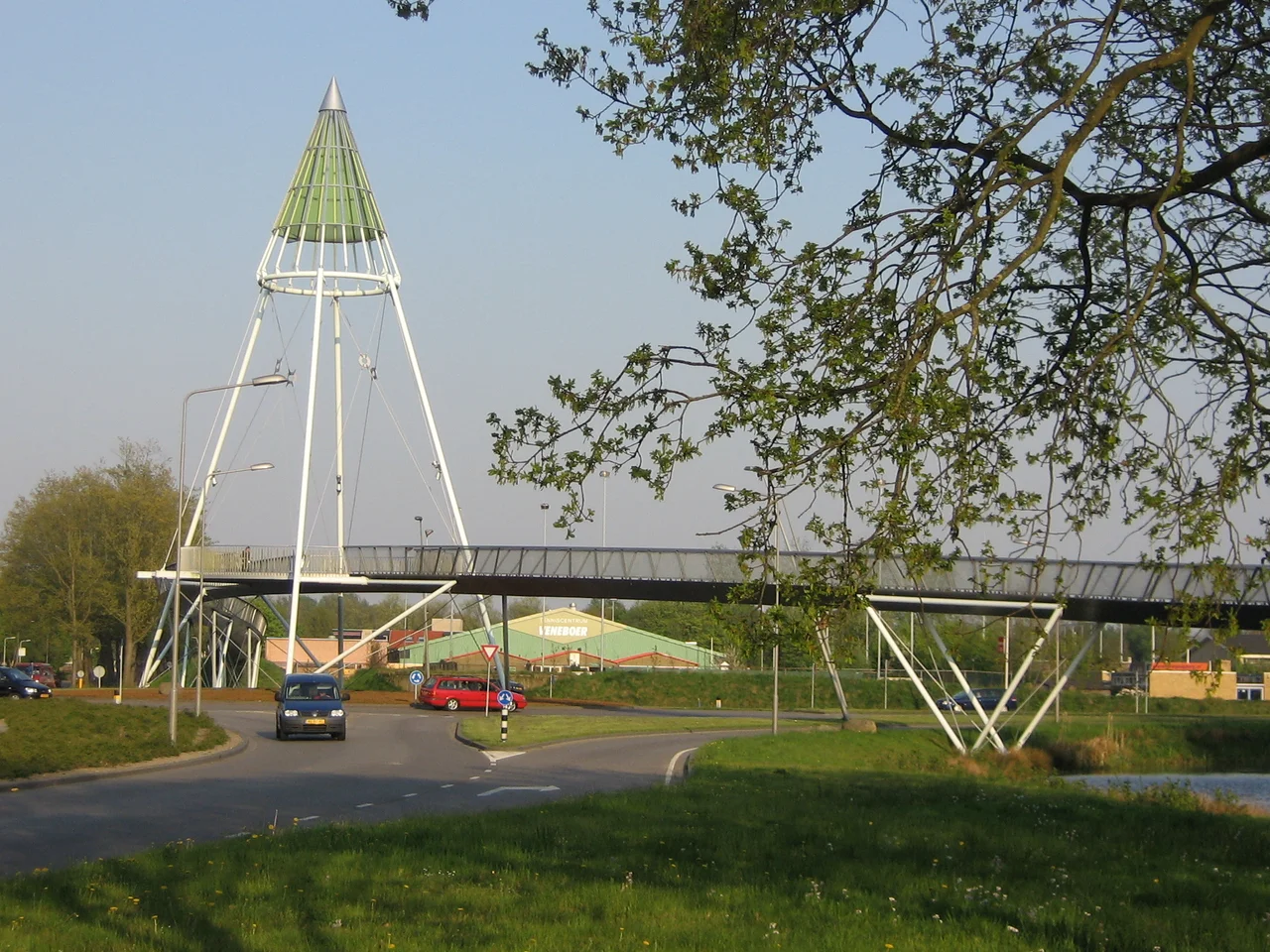
The Shared Space Experiment
Hans Monderman believed that traffic rules infantilize drivers. Tell people exactly what to do and they stop paying attention to one another; remove the rules and they begin to negotiate. Drachten gave him a stage. Around the Laweiplein, lights and signs vanished. The kerbs softened. Pedestrians, cyclists, cars, and buses were left to read one another's faces and intentions. Speeds dropped because the geometry encouraged caution rather than rule-following. Accidents collapsed. Visitors arrive expecting chaos and find something stranger: a kind of choreographed politeness, with drivers slowing for prams and cyclists weaving through gaps that legally do not exist. Monderman died in 2008, but the experiment in Drachten became one of the most cited examples in modern urban planning.
Frisian Roots, Modern Edges
Drachten sits in the municipality of Smallingerland, with Leeuwarden 35 kilometres northwest, Groningen 45 northeast, and Heerenveen 24 southwest. The A7 motorway hisses past on its way between those cities; there is no train station, an absence the town has worn for decades. Frisian is still spoken alongside Dutch, and the surrounding landscape of forests, peat moors, and lakes carries the older identity of a region that was bog before it was anything else. Among those born here are the poet and politician Fedde Schurer, the architect Sytze Wierda, and the meteorologist Gerrit Hiemstra. The pattern of the town - working factories, recovered canal, missing traffic lights - is itself a kind of Frisian sentence: practical, slightly contrary, more thought-through than it first appears.
From the Air
Located at 53.10°N, 6.10°E in the eastern Frisian lowlands. Best viewed from 2,000-4,000 ft AGL to pick out the geometric pattern of the Drachtstervaart canal cutting through the urban core. The A7 motorway runs east-west just south of the town and is the clearest navigational landmark. Nearest airports: Drachten Airfield (EHDR) for general aviation on the south edge, with Groningen Airport Eelde (EHGG) 35 km northeast and Leeuwarden Air Base (EHLW) 35 km northwest for instrument approaches. Coastal weather can roll in fast from the IJsselmeer to the west.
Nearby Stories
- Foxhol 2.8 km away
- Ernst-Wilhelm Modrow 5.6 km away
- Drenthse Veenkolonien 7.1 km away
- Schiermonnikoog 7.6 km away
- Aylvapoldermolen 9.5 km away
- Eemshaven Railway Station 10 km away
- Low-Frequency Array 13 km away
- West Sole Gas Field 297 km away