
Dubh Artach
Between 1800 and 1854 some thirty ships went onto the rocks here. The skerry was not even on most charts as a named hazard - it was simply one black tooth in a long row of teeth that included the Torran Rocks to the north and the open Atlantic to the west. Then on her maiden voyage in 1863, the steamer Bussorah hit the reef and went down with all thirty-three hands. Two years later, on the night of 30-31 December 1865, a single storm wrecked twenty-four vessels in the same patch of water. Lloyd's of London, which paid the insurance claims, decided something had to be built here. The problem was that nothing could be built here.
The Black Rock
Dubh Artach means the Black Rock - dubh for black, artach an obsolete Gaelic word for stony ground that survives in this one place name. The skerry itself is small: 240 feet long, 130 feet wide, rising 35 feet above the sea at its highest point. It is made of basalt, hardened lava from the great Tertiary volcanic episode that also built the Giant's Causeway, Staffa, and Rathlin Island. Submarine surveys show that Dubh Artach sits at the eastern end of an underwater valley that stretches eighty miles into the Atlantic. The valley funnels swells from the open ocean directly toward the rock. This is why, on a calm day with light winds in the Sound of Mull, the swells at Dubh Artach can still be running at 20 feet. Saint Adamnan of Iona, writing in the seventh century, called it the Black Stack of the West. An older Gaelic phrase translates as the black deadly one. Sailors had a more pragmatic name: St John's Rock, after some lost piety nobody now remembers.
The Stevensons
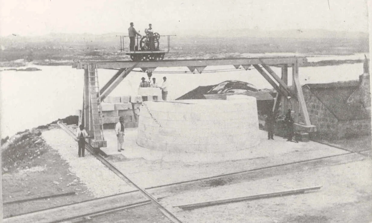
There is one family in the history of British engineering that shows up almost every time a lighthouse needed to be built somewhere impossible. The Stevensons of Edinburgh - Robert, his sons Alan and David and Thomas, his grandsons and great-grandsons - built almost every Scottish offshore light between 1790 and 1940. Bell Rock, Skerryvore, Muckle Flugga, Ardnamurchan. Dubh Artach was Thomas Stevenson's commission. He started work in 1866 with his brother David, and the engineering on site was led by Alan Brebner. The shore station went up on the isle of Erraid, a tiny island just off the Ross of Mull where the masonry blocks would be shaped, fitted, and barged out to the rock. Thomas Stevenson's son, who was sixteen when the work started, helped on Erraid during summer holidays. The son would never become a lighthouse engineer himself - to his family's enduring disappointment - but he watched the work for three summers, and he never forgot it. Decades later Robert Louis Stevenson would write about Dubh Artach, in passages that captured what no engineering report could.
The Roof Test
The iron barrack the workmen lived in during construction sat on Dubh Artach 77 feet above sea level. A summer gale in 1868 delivered a wave that broke fully over the roof. Fourteen men, including Brebner, were trapped inside for five days. At one point seawater poured in through the trapdoor, swirled through the cramped interior, and exited carrying what remained of their food supply. The structure held. Robert Stevenson observed grimly that the wave had reached the same height above the sea "as the glass panes in the lantern of Smeaton's lighthouse" - the famous Eddystone light in the English Channel. The implication was clear: at Dubh Artach, what would be the safe top of a normal rock lighthouse was barely the bunkhouse. The finished tower had to be different. Its base alone weighs 1,840 tons and rises 64 feet above the sea before the tower proper begins - more than twice the base height of the previous record-holder, the Stevensons' own Skerryvore. Above the base, the masonry rises in 77 courses of dressed granite to a height of 101 feet.
Inside the Light
Dubh Artach was the first isolated rock light in Britain to use paraffin - kerosene - rather than oil. The lantern, optical apparatus, and fog bell were installed in 1872. The light went into service that summer. The keepers came in shifts and stayed for weeks. Landing was, and remains, almost impossible: at low tide the landing stage is 40 feet above a boat, and even calm-day landings required a derrick and ropes lowered to whoever was unlucky enough to be standing in a pitching boat below. Robert Louis Stevenson wrote, of the rock itself: "An ugly reef is this of the Dhu Heartach; no pleasant assemblage of shelves and pools and creeks about which a child might play for a whole summer without weariness... but one oval nodule of black-trap." He also recorded what the sea did, in the calmest weather: "roared and spouted on the rock itself." Some keepers served happily here for years. One had to be physically prevented from diving overboard and trying to swim to the mainland. In 1890 the tower got a distinctive red band painted around its middle to tell it apart from Skerryvore, 20 miles to the northwest. In 1971 it was automated. The keepers went home. The light is still there, monitored from Edinburgh, still flashing into the Atlantic dark.
From the Air
Dubh Artach lies at 56.13°N, 6.63°W, 15 nautical miles southwest of the Ross of Mull and 18nm west of Colonsay. From the air the skerry appears as a tiny dark dot in open Atlantic water with a slim white-and-red tower rising from it - distinctive once you know what you are looking at. Best visibility in clear weather; haze and swell can hide the rock entirely. Oban (EGEO) is the obvious diversion 35nm to the northeast; Islay (EGPI) sits 35nm to the southeast; Tiree (EGPU) is 25nm northwest. Expect strong winds and rapidly changing conditions over the open Atlantic between Mull and Islay; this stretch produces some of the worst sea states in British waters.
Nearby Stories
- Isle of Mull 3.1 km away
- Jura Distillery 7.3 km away
- Fingal's Cave 10 km away
- Jura, Scotland 17 km away
- Bruichladdich Distillery 17 km away
- Skerryvore 19 km away
- HMS Audacious 47 km away
- Barra Head 54 km away