Duke of York Islands
On 15 August 1875, the Reverend George Brown stepped ashore on a small island in St George's Channel and became the first Methodist missionary in the Bismarck Archipelago. The Tolai people who greeted him had their own ideas about what this meeting meant. Brown had brought Fijian and Samoan teachers with him - Islanders converting Islanders, in a pattern that shaped Pacific Christianity for a generation. Within three years, in response to the killing of four of those teachers, Brown would lead an armed reprisal that ended careers, triggered investigations in Sydney, and haunted him for the rest of his life. The Duke of York Islands sit quietly now in the channel between New Britain and New Ireland - thirteen low islands covering just 58 square kilometres - but they were once the front door of the Pacific mission field, and that door opened both ways.
A Prince's Name, A People's Home
The name on the chart is Hanoverian. Philip Carteret, sailing HMS Swallow through these waters in 1767, honoured Prince Edward - son of Frederick, Prince of Wales, and younger brother of the future George III. The man the islands commemorated never saw the Pacific. He died in Monaco in 1767, the same year Carteret was drawing his line across the ocean. But the islands the British captain was naming had been inhabited for thousands of years by Austronesian-speaking peoples whose descendants, the Tolai, still live here. In their languages the places have other names - Mioko, Ulu, Kerawara, Makada, Kabakon, Mualim - words that predate any prince. Duke of York Island itself is the largest of the thirteen, its palm-fringed coast rising gently to a low interior where villages cluster around sago stands and garden plots.
The Missionary's Gamble
George Brown was thirty when he arrived. He had already spent fifteen years in Samoa, and he understood that the Tolai would not be won by a lone Englishman. So he brought nine teachers from Samoa and Fiji and settled them in villages around the channel. The strategy worked until it didn't. In April 1878, four of the Fijian teachers were killed at Kabakon. Brown's response was to lead a punitive expedition with armed trader allies, burning villages and killing at least ten people. He justified the action as necessary for the safety of remaining mission staff. The Colonial Office in Sydney was less certain. He was investigated, cleared, and transferred - but the reputation followed him. He spent the rest of his life writing about it, defending it, wondering about it. The Duke of York Islands are where a good man did something he could never quite reconcile.
The German Beachhead
The traders came before the flag. In 1872, agents of the Hamburg firm J. C. Godeffroy and Sohn sailed into the channel from the Caroline Islands. By 1876 they had built a permanent trading station on Mioko - thatched storehouses stacked with copra, beche-de-mer, and trade tobacco. When Germany formally annexed the region in 1884, the Duke of York Islands became the administrative nucleus of what Berlin called the Bismarck Archipelago. Mioko was briefly the capital of German New Guinea before power shifted to Rabaul on New Britain. The Hernsheim family, rival traders, built a house on Matupi. Richard Parkinson, the ethnographer-planter who would write one of the first serious studies of Tolai culture, settled here with his wife Phebe, a remarkable woman of Samoan descent who became the effective chatelaine of colonial society in the Bismarcks.
A War Grave Offshore
For more than a century, HMAS AE1 was the Royal Australian Navy's oldest mystery. The E-class submarine, Australia's first, vanished on 14 September 1914 somewhere between New Britain and the Duke of York Islands while supporting the capture of German New Guinea. All 35 men on board were lost. Thirteen search missions over the following century found nothing. Then, in December 2017, a survey vessel working with sonar located the wreck intact at a depth of 300 metres. The Australian government has not disclosed the exact location. The site is treated as a war grave. A diving accident is now considered the likely cause - the boat descending too steeply, water flooding the hull before anyone could react. Somewhere under the channel that separates these islands, thirty-five young men are still aboard their boat.
Water Rising
The islands are low. The highest point on Duke of York Island barely reaches twenty metres. Two tectonic plates grind beneath the channel - earthquakes are ordinary, tsunamis a recurring dread. On 28 November 2000, the Papua New Guinean government announced the evacuation of roughly a thousand islanders to New Britain, citing rising sea levels that were already making gardens saline and wells undrinkable. It was one of the earliest coordinated climate relocations in the Pacific. The families who left were Tolai, descendants of the people who met George Brown in 1875 and the traders before him. Some returned. Most did not. The channel continues to fill. The coconut palms that line the beaches have shallow roots and do not fare well in salt water, and the coast is measurably closer to the villages than it was a generation ago.
From the Air
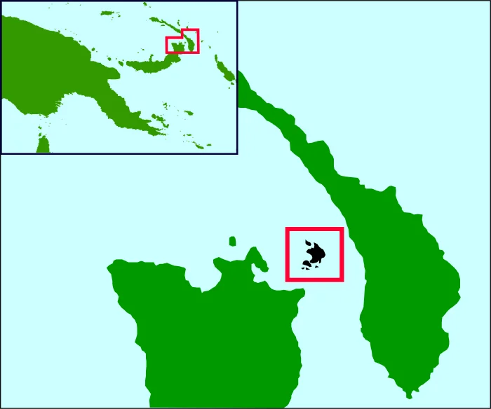
Coordinates: 4.17°S, 152.45°E. The Duke of York Islands cluster in the middle of St George's Channel between New Britain and New Ireland, with Rabaul (AYTK, Tokua) about 45 km to the southwest on New Britain and Kavieng (AYKV) roughly 250 km to the northwest on New Ireland. Best viewed from 3,000-5,000 feet to pick out the thirteen-island pattern scattered across the channel. Look for Duke of York Island as the largest, with Mioko, Ulu, and Kerawara as distinct smaller islands. The wreck of HMAS AE1 lies somewhere in these waters at 300 m depth. Weather in the channel is typically humid and tropical, with afternoon buildups possible over New Britain's volcanic peaks to the southwest.
Nearby Stories
- Battle of Bita Paka 12 km away
- Mining in Papua New Guinea 35 km away
- New Ireland 55 km away
- Ulawun 94 km away
- Operation RY 124 km away
- New Ireland Province 133 km away
- Battle of the Green Islands 143 km away
- Raikoke 5799 km away