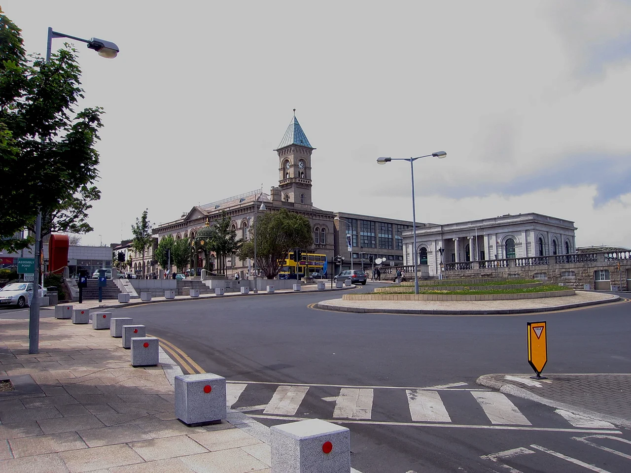

Dún Laoghaire
It took forty-two years to build the harbour. Two granite piers, each over a kilometre long, curved out into Dublin Bay to enclose what is still one of the largest artificial harbours in Ireland. The men who quarried the stone from Dalkey a few miles up the coast, who fitted each cubic block by hand, who watched a generation of their working lives disappear into the sea wall -- they were building a refuge from a single disaster. On the night of 18-19 November 1807, two troopships, the Prince of Wales and the Rochdale, were driven onto rocks between Blackrock and Dun Laoghaire in a winter gale. Nearly four hundred soldiers and crew drowned within sight of land. The scandal that followed convinced Parliament that Dublin Bay needed an asylum harbour. The town that grew around the works went by three names in a century: Dunleary, then Kingstown after George IV's 1821 visit, then -- in 1920, on the eve of independence -- the original Irish form Dun Laoghaire, the fort of Loegaire.
The Fort of Laoghaire
The name reaches back fifteen centuries. Loegaire mac Neill -- pronounced 'Leery', anglicised over the centuries to Dunleary -- was a 5th-century High King who used the headland here as a sea base for raids on Britain and Gaul. Some of the original fortification stone is kept in the National Maritime Museum a few streets inland. The medieval village marked on a 1686 map of the bay was called Dun Lerroy; by 1728 the cartographers were writing Dunlary, and a small fishing village had grown up around what is now the Purty Kitchen pub, near the old harbour the West Pier was later built beside. Salt mining left its trace in the nearby Salthill. The 1821 visit of George IV, the first reigning British monarch to come to Ireland in two centuries, triggered the renaming to Kingstown -- a name that stuck for ninety-nine years and now survives mostly in the name of George's Street, the main shopping thoroughfare.
Ireland's First Railway
On 17 December 1834, six and a half miles of standard-gauge track opened between Dublin's Westland Row and the old Dunleary harbour. It was Ireland's first railway. Tickets cost a shilling first class, sixpence third. The journey took 15 minutes. Within a decade the line had been extended south, briefly, by the Dalkey Atmospheric Railway -- a now-forgotten experiment that used air pressure to propel carriages through a cast-iron tube laid between the tracks. The atmospheric line ran from 1844 to 1854 and was the world's first practical pneumatic railway, before mechanical reliability issues and rodent damage to the leather sealing flaps killed it off. The railway turned Kingstown into a Victorian commuter suburb and seaside resort. Granite Italianate terraces went up along the seafront. The Royal Marine Hotel opened in 1863 and would later host Frank Sinatra, Laurel and Hardy and Charlie Chaplin. Electrification arrived in 1984; today the same route is the DART, the Dublin commuter network's spine.
The Mailboat
For most of the 19th and 20th centuries, Dun Laoghaire was Ireland's principal passenger ferry port. The Holyhead route across the Irish Sea -- 80 nautical miles to North Wales -- carried millions: tourists, emigrants, soldiers, civil servants on transfer. The Carlisle Pier, extended in 1859, was the boat train terminus. On 10 October 1918, the mailboat Leinster left Kingstown bound for Holyhead with 771 passengers and crew. A German U-boat, UB-123, fired three torpedoes at her over the Kish Bank; two struck and sank her. She sank in a few minutes. Over five hundred died -- the largest single loss of life in the Irish Sea, and the deadliest event in Dun Laoghaire's history. The anchor of the Leinster, recovered from the wreck, now stands as a memorial beside the Carlisle Pier. The Stena Line ferry service finally ended in 2015 after years of decline; competition from Ryanair and Aer Lingus had hollowed the route out. The Carlisle Pier itself has stood largely unused since.
Joyce's Disappointed Bridge
James Joyce opens Ulysses on a Martello tower in Sandycove, on the coast immediately south of Dun Laoghaire. Buck Mulligan shaves on the roof, the sea below is 'snotgreen' and 'scrotumtightening', and the day that will become twentieth-century literature begins. Joyce had actually stayed in the tower in September 1904 with Oliver St John Gogarty; the friendship soured within weeks and he left. The tower, now the James Joyce Museum, contains his death mask, first editions and a waistcoat. In the second Ulysses chapter, Stephen Dedalus looks out and calls Kingstown Pier 'a disappointed bridge' -- a phrase Dubliners still quote when looking at the empty Carlisle. Samuel Beckett, who grew up in nearby Foxrock, claimed his great artistic epiphany happened on the end of the East Pier in a winter storm. He alluded to it in Krapp's Last Tape; a small bronze plaque now marks the supposed spot. The East Pier itself, which featured in Neil Jordan's 1996 film Michael Collins, remains one of the great Sunday walks in greater Dublin: 1.3 kilometres straight out into the bay, with a Victorian bandstand still in use halfway along.
The Water Wag
Yachting in Dun Laoghaire is a serious matter. Four major sailing clubs -- the Royal St George Yacht Club, the Royal Irish, the National, and the Irish Youth Sailing Club -- line the harbour, several dating from the 1830s and 1840s. The 820-berth Dun Laoghaire Marina, opened in 2001, is the largest in Ireland. But the town's most original contribution to world yachting is the Water Wag, a class of small centreboard sailing punts founded in Kingstown in 1887. Its constitution included a then-revolutionary idea: every boat in a race should be identical, so the contest tested sailors not pocketbooks. This was the first one-design class in the history of sailing. Every Olympic dinghy class -- every Laser, every 470, every 49er -- traces its design philosophy back to those Victorian Kingstown amateurs. The Water Wag club still races in the harbour on Wednesday evenings from late April to mid-September. The boats look much as they did 138 years ago. Some of the wooden hulls actually are 138 years old.
From the Air
Dun Laoghaire sits on Dublin Bay's southern shore at 53.300N, 6.140W, around 12 km south-east of Dublin city centre. From altitude the town is dominated by its harbour -- the two granite arms of the East and West Piers enclose a near-rectangular basin roughly 1 km wide, unmistakable from the air. The marina fills the inner harbour with rows of yacht masts. The Sandycove Martello tower (James Joyce Museum) is visible to the south as a small round structure on the headland, and the Forty Foot bathing place sits beside it. The DART line runs along the coast. Nearest airport: Dublin (EIDW), 16 km north-west. The town lies under the southern departure paths from EIDW.
Nearby Stories
- Wicklow Mountains 12 km away
- Mornington 14 km away
- German submarine U-1051 16 km away
- Abbey of Kells 18 km away
- Irish Military Intelligence Service 20 km away
- HMS Manners (K568) 37 km away
- Templemore 42 km away
- Irish Sea Bridge 43 km away