Eastern Cordillera Real Montane Forests
Fifteen hundred kilometers long and sometimes only thirty kilometers wide, the Eastern Cordillera Real montane forest is a green ribbon unspooling along the eastern slopes of the Andes, from southern Colombia through Ecuador into northern Peru. On paper it looks like a minor ecoregion. In botanical terms it may once have been the single richest forest on Earth - home, by some estimates, to 30,000 to 40,000 plant species, more than grow in the entire Amazon basin below. That superlative is staggering when you consider how narrow the band is. Everything the ribbon holds is squeezed into the slopes between about 900 and 2,100 meters, where moist air rising off the Amazon meets cold Andean rock and condenses into near-perpetual cloud.
A Ribbon Through Three Countries
The ecoregion occupies the eastern spine of the central Andes, covering 10.2 million hectares - about 25 million acres, or roughly the area of Iceland. In Colombia it runs along the southern Cordillera Oriental. In Ecuador it drapes the eastern face of the Cordillera Real. In Peru it continues down the northern Andes, where an unusual geographic twist extends part of the ecoregion onto the Pacific slope. To the north it fades into the Magdalena Valley and Cordillera Oriental montane forests. On its lower edge it merges into Napo moist forest to the east and Northwestern Andean montane forest to the west. Its upper boundary brushes Northern Andean paramo and Cordillera Central paramo. The southern end trails into the drier Maranon and Tumbes-Piura forests.
The Huancabamba Gap
Near the southern end of the ecoregion the Andes nearly break. The Huancabamba Depression is the lowest pass in the entire Andean chain - about 2,000 meters above sea level - and it functions as a biological bridge between worlds. Species from the Amazon can cross here into the Pacific lowlands; Pacific species can climb east into the rainforest. The consequences for evolution have been profound. The depression has concentrated endemism, accelerated speciation, and shaped the flora and fauna of the surrounding forests into a mix that has elements of Amazon, Pacific-dry, and Inter-Andean ecosystems. The Cajamarca Region of Peru, straddling the depression, is one of the most endemism-rich zones in the whole ecoregion. The mountains north and south of the gap formed on different geological clocks - Miocene origins for the southern mountains, Pliocene to Pleistocene for the northern.
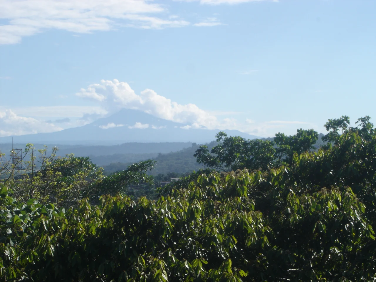
Cloud Forest, Elfin Forest, Ceja
The vegetation reads like a vertical ecology textbook. At the lower elevations the ceja de montana (eyebrow of the mountain) is a closed, exuberant forest where trees grow tall and the canopy absorbs almost all the light. Climb higher and the trees shrink. The air cools. Mist condenses on leaves as reliably as rain falls, and the cloud forest begins - branches dripping with bromeliads, orchids in improbable shapes, mosses a foot deep on every horizontal surface. Higher still, wind and cold push the trees into elfin forest: knee-high, twisted, blanketed in lichen, each tree a bonsai sculpted by decades of fog. Specialization is extreme. Many species occupy altitude bands only a few hundred meters thick, and plants that cannot cross a ridge or valley become endemic simply through physical isolation.
Fauna of the Slopes
The mammal list reads like a Latin American fever dream: Venezuelan red howler monkeys, white-fronted capuchins, the critically endangered yellow-tailed woolly monkey, spectacled bears - the only bear species in South America - taruca deer, guanacos in the drier zones, kinkajous, and possibly the mountain tapir. A 1982 study of bats found that 37 percent of the species on the western slopes were endemic. Endangered mammals include the equatorial dog-faced bat, the giant otter in the lower river systems, the mountain tapir, and the white-bellied spider monkey. Bird life includes masked mountain tanagers, chestnut-bellied cotingas, cinnamon screech owls, neblina metaltails, and the unmistakable Andean condor drifting on thermals. Endangered endemics include the white-breasted parakeet, the coppery-chested jacamar, the bicolored antvireo, the royal sunangel, and the black-and-chestnut eagle.
Frogs and Disappearance
The most striking biodiversity in the Eastern Cordillera Real may be amphibian. Scientists have catalogued dozens of endangered frogs in the ecoregion - Kingsbury's rocket frog, multiple Atelopus stubfoot toads, glass frogs you can see the heart beat through, Pristimantis robber frogs by the dozen, water frogs specialized to single valleys. The genus Pristimantis alone accounts for many of the endangered species; these small terrestrial frogs skip the tadpole stage entirely, laying eggs that hatch as tiny froglets. The specializations make them exquisitely vulnerable to habitat loss. The World Wide Fund for Nature lists the ecoregion as "Vulnerable." The forest is accessible - too accessible. Commercial logging of Podocarpus and Prumnopitys conifers has eaten into ancient stands. Large areas have been cleared for pasture and subsistence farming. Protection rests on a handful of reserves: Cayambe Coca in Ecuador, Podocarpus National Park in the south, the Noroeste Biosphere Reserve, and whatever the steep terrain itself refuses to give up.
From the Air
Coordinates near 1.93 deg S, 78.13 deg W for a representative central point - the ecoregion spans some 1,500 km north to south along the eastern Andes. Elevations in the ecoregion range from 900 to above 2,100 m, with some extension onto the Pacific slope in Peru. Expect extreme orographic weather: persistent cloud cover, sudden valley fog, high rainfall (1,500-4,500 mm annually), and turbulent lee-side flow over ridges. Mountain VFR demands situational awareness - terrain features often disappear inside minutes. Nearest major airports vary by latitude along the ribbon.
Nearby Stories
- Alausi 14 km away
- Chimborazo 15 km away
- Pailón del Diablo 21 km away
- Santiago de Bolivar 32 km away
- Ecuadorian Amazon 124 km away
- Oriente (Ecuador) 146 km away
- Borja, Peru 263 km away