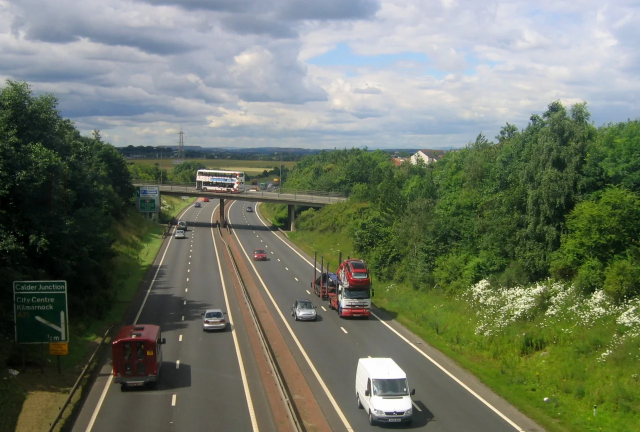

Edinburgh City Bypass
It is the only junction on the bypass that still stops you. Eleven other interchanges along the A720 are grade-separated - flyovers, underpasses, slip roads peeling off and rejoining without anyone having to brake. But at Sheriffhall, on the southeastern arc of Edinburgh, traffic crawls to a halt at a set of red lights every day, twice a day, because a geological fault runs under the road there and once upon a time the area had active coal mines beneath it. Engineers in the 1980s decided they couldn't safely build a bridge across that ground. So Sheriffhall stayed a roundabout. Forty years and £120 million of planning later, the flyover meant to fix it is still on the drawing board.
The Ring That Isn't a Ring
The A720 is sometimes called a ring road, but it isn't quite. It curls around the southern half of Edinburgh in a long arc, from the Old Craighall junction with the A1 in the east to the Gogar roundabout on the A8 in the west. North of the city the Firth of Forth does the job a road would otherwise have to do. The bypass is dual carriageway throughout, classified as a special road in law - the same legal category as a motorway, though without motorway signage or the M-prefix. It carries the European route E15, a designation that runs all the way from Inverness in the Highlands to Algeciras on the Strait of Gibraltar, more than 2,400 miles of road threading the continent. The Edinburgh section is one bend on a very long line.
Built in Pieces
The bypass was assembled over nine years and four governments. The first section to open, in 1981, was the Colinton stretch between the A702 and Baberton, with a connection at Dreghorn following around 1985. In late 1986 the Sighthill section linked Baberton to the A8 at Gogarburn, completing the western arc. 1988 brought two more sections - the Burdiehouse stretch between the A702 and the A701 in summer, and in autumn the eastern piece between the A68 at Sheriffhall and the A1 at Old Craighall. The final segment, around Gilmerton, was finished in 1989. By then Edinburgh had a continuous southern bypass for the first time, and the through-traffic that had been forcing its way along urban streets could be routed around the city instead.
What Each Junction Connects
The eleven interchanges feed in and out of an entire transport network. Old Craighall in the east meets the A1, the trunk road that runs all the way south to Newcastle and London. Sheriffhall, the problem child, connects the A7 - which carries traffic south to Carlisle along an old Roman route - and the former A68 to Dalkeith. Further west, the Straiton junction serves the retail parks at Costco and IKEA. Lothianburn meets the A702, which crosses the southern uplands to join the A74(M) for Glasgow and the M6 to Manchester. Hermiston Gait, near the western end, is where the M8 to Glasgow finally arrives - the bypass forms the M8's eastern terminus. From there a driver can swing north to the Queensferry Crossing and the Highlands, or west to Edinburgh Airport, all without setting tyre on a city street.
The Sheriffhall Problem
Sheriffhall has been the bottleneck since the day the bypass opened. Putting a traffic-light roundabout on a major trunk road that connects to the A7, the A68 and the A6106 was always going to cause queues, and it always has. In 2015 Transport Scotland prepared an upgrade with four options for grade separation. By 2020 the chosen plan - a flyover for through traffic on the A720 - was costed at £120 million. The Scottish Greens opposed it, arguing it would simply induce more demand. The flyover is now expected to open in 2027, though the project remains contested. In the meantime, drivers from Carlisle to Edinburgh sit at the same set of red lights they have been sitting at since 1989, watching the lights cycle, watching the queues build, and waiting for the next chapter of a forty-year story to finally be written.
The Railway Underneath
In 2013 a stretch of the bypass between Millerhill and Sheriffhall had to be temporarily diverted while engineers built a new underbridge. The reason was the Borders Railway, which reopened in September 2015 after decades of campaigning. When the bypass was built in the 1980s, the original Edinburgh-Galashiels line had been closed for years - shut down in the 1969 Beeching cuts - and the highway was simply laid over the abandoned track bed. The decision to bring rail back to the Borders meant unpicking that, threading a new line under the bypass it had been buried beneath. The railway now runs from Edinburgh Waverley through Newcraighall, Shawfair, Eskbank, Newtongrange, and on to Galashiels and Tweedbank, and the bypass at that point literally bridges over its own past.
From the Air
Located at 55.892 N, 3.184 W, encircling the southern half of Edinburgh in a 23-mile arc. From the air the bypass is visible as a near-continuous dual carriageway curving from the A1 in the east, past the Pentland Hills foothills in the south, to the A8 near Edinburgh Airport in the west. Visible reference points: Edinburgh city centre to the north, the Pentland Hills rising to the south, and the long arc of the road itself which makes a useful navigation reference. Nearest airport: Edinburgh (EGPH), inside the bypass loop at the Gogar end. Recommended viewing altitude 3,000-5,000 ft AGL for full bypass visibility.
Nearby Stories
- Bannockburn 3.2 km away
- Wishaw 5.2 km away
- Oliver Castle 7.1 km away
- Bass Rock Lighthouse 11 km away
- Yester Castle 11 km away
- Kirkcaldy 11 km away
- Battle of Ancrum Moor 13 km away
- New Cumnock 26 km away