
English Riviera Geopark
The word Devonian, the name of an entire geological period stretching back roughly 400 million years, comes from rocks in Devon. More specifically, it comes from shell deposits at Lummaton Quarry on the edge of Torquay. The English Riviera Geopark sits on a stretch of coast where the deep time underneath the towns is so varied, so well exposed, and so well understood that UNESCO recognised the whole thing as a Global Geopark in 2007. There are over 240 such Geoparks worldwide, ten in the United Kingdom, and only two of those are urban. This is one. Children eat ice cream on stromatoporoid reefs that grew when the area lay south of the equator. The desert that was Roundham Head crossed Yorkshire too. The story is everywhere; you just have to know what you are looking at.
The Tropical Sea That Was Devon
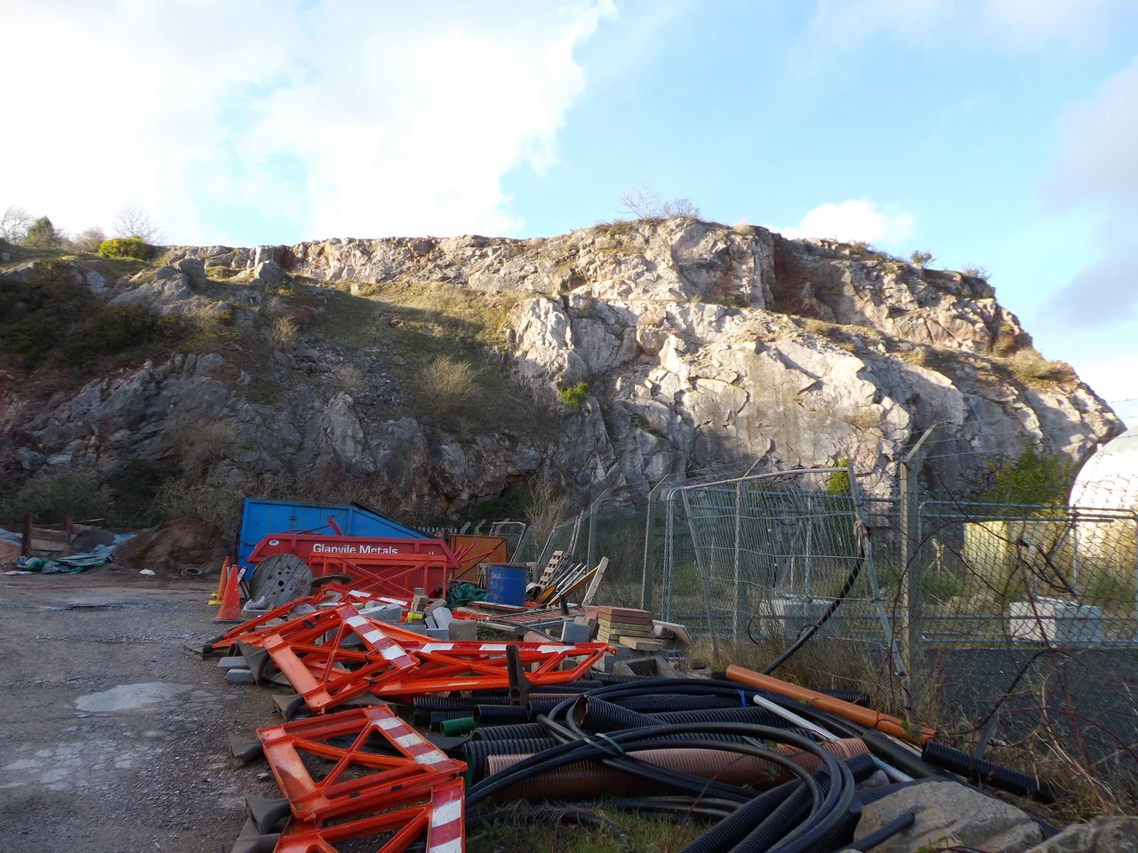
The oldest rocks in the Geopark were laid down during the Devonian period, when the area sat south of the equator in a warm, life-rich shallow sea not unlike today's Caribbean. The Torbay limestones and sandstones come from that water, with volcanic ash layers in the mix from eruptions that periodically blanketed the seafloor. Modern coral reefs, the kind divers visit, did not yet exist; what cemented the Devonian reefs together were stromatoporoids, hard sponges that built reef structures across vast warm shorelines. Around them lived early corals, crinoids on stalks waving like underwater flowers, gastropods, brachiopods, trilobites, and goniatites, the early ammonoid cephalopods coiled into shells the size of fists. Lummaton Quarry, where these fossil shells first attracted serious attention, is the type locality from which the Devonian period took its name. Long Quarry preserves a stromatoporoid reef in growth position, the ancient sponges still where they grew. Dyers Quarry is rich in coral fossilised exactly as it lived.
Mountains Rise and Tilt the World
During the Carboniferous period the Devonian limestones and sandstones were forced upward by the Variscan Orogeny, a mountain-building event that affected what are now Devon, Cornwall, and the granites of Dartmoor, but which also stretched east to what is now the Czech Republic and west into North America. The Atlantic Ocean did not yet exist. The collision tilted the layered sediments of Torbay and produced what is now the beautiful fold visible on the small island of Ore Stone, where bands of contrasting rock have been bent into great curves by enormous pressure. From the cliff you can sometimes pick out the structure by eye, especially in raking light. Standing on Babbacombe Cliffs you see another effect: upside-down layering, where the slates and limestones have been overturned by Variscan forces. The Earth bent and reset itself, and what had been level seafloor became inclined cliffs.
The Desert at Roundham Head
Around 280 million years ago, in the Permian, continental collision had pulled Torbay into the centre of the supercontinent Pangaea, into the middle of a vast desert at a similar latitude to the modern Sahara. That desert is preserved here in two distinct forms. Fine, wind-blown sandstones make up Roundham Head: rocks deposited grain by grain in dunes that crossed an empty landscape under blazing sun. Breccia is the other half of the story: jumbled angular fragments deposited by flash floods after rare, violent storms swept across the parched desert. These rocks stretch across the UK and as far afield as Yorkshire; they are collectively known as the New Red Sandstone. The red colour, which stains the soil and the cliffs and even the underlying grey Devonian limestone where groundwater has moved through it, comes from iron in the sediments altered to haematite by desert chemistry. The Sahara's chemistry runs through the cliffs of Torbay.
Caves, Gold, and Lost Eras
Through the Triassic, Jurassic, Cretaceous, and Tertiary periods, sediments may have been deposited over the Geopark, but later erosion has stripped them away, leaving no trace. Events elsewhere left fingerprints: the collision of Africa and Europe that built the Alps also propagated stresses to this corner of England, leaving the bay crisscrossed with faults. In the Quaternary, with the limestones now exposed and rainwater slightly acidic, water dissolved the rock from below and formed caves. Speleothems, the dripstone shapes of stalactites and stalagmites, grew over the ages. The most important cave in the Geopark is Kents Cavern, where bones of the extinct woolly rhinoceros and cave lion have been found along with some of the earliest evidence of modern humans in Britain. Brixham Cavern preserved similar Pleistocene mammals. Hopes Nose, near the tip of the headland north of Torquay, has gold and palladium deposits, left by hydrothermal fluids percolating through the rock; it is also a key site for studying Quaternary stratigraphy and sea level change. Crystal Cove holds a 25-metre-wide zone of pure calcite. Between Berry Head and Sharkham Point, exposed marine cave systems open in the cliffs.
A Geology Tour With Ice Cream
What makes Torbay extraordinary is not any one fact about its rocks, but the density of facts. Walk a few hundred metres along a single beach and you cross hundreds of millions of years. Babbacombe to Anstey's Cove gives you the Variscan upheaval and the largest outcrop of igneous rock in Torbay between Black Head and Anstey's. Saltern Cove is a regionally important unconformity, where rocks of very different ages meet across a buried surface where time itself is missing. Roundham Head sells the desert. Hopes Nose holds the gold. Kents Cavern carries the woolly rhinoceros. The Geopark, in 2007 admitted to the Global Geoparks Network, covers 6,200 hectares of land and 4,100 hectares of seabed. It is one of only two urban Geoparks in the UK and one of ten in the country. Torbay Council and partner bodies were granted the status partly because they had worked to teach the geology to the community through education programs and signage. The point is not to fence off the rocks but to make them legible. Tourists come for the beaches. The beaches are made of the most extraordinary history in the country, and now they say so.
From the Air
The English Riviera Geopark covers the Torbay coastline at approximately 50.44 degrees north, 3.55 degrees west. From the air, look for the broad shallow arc of Tor Bay between Hope's Nose to the north and Berry Head to the south, with the towns of Torquay, Paignton, and Brixham strung along the shore. Key geological sites visible from the coast include Babbacombe Cliffs and Long Quarry north of Torquay, Roundham Head between Torquay and Paignton, and the cliffs east of Brixham toward Berry Head. Exeter Airport (EGTE) is roughly 25 nautical miles north-northeast. A coastal track at 2,000-3,000 feet gives the best view of the bay's structure; the red Permian cliffs are particularly striking in low afternoon light.
Nearby Stories
- St Germans Priory 7.6 km away
- Launceston, Cornwall 9.6 km away
- Castle Drogo 12 km away
- HMS Formidable (1898) 17 km away
- Siege of Lyme Regis 19 km away
- Battle of Plymouth (1652) 40 km away
- German Submarine U-672 48 km away
- Goonhilly Satellite Earth Station 69 km away