
Excavations at Stonehenge
In the 1620s the Duke of Buckingham, favourite of King James I, decided he wanted to know what was buried under Stonehenge. He hired men with shovels and dug a great pit in the middle of the circle. He found nothing important and went home. Forty years later the antiquarian John Aubrey could still see the central sunken hollow where the duke's pit had been hastily filled in. That impatient hole is the first recorded archaeological excavation at the most studied prehistoric monument in the world.
Gentlemen with shovels
Dr William Harvey, the physician who discovered the circulation of the blood, dug at Stonehenge with a man named Gilbert North in the early 17th century. Inigo Jones, the architect, dug there too while writing his survey, the one that gave the Altar Stone its name. They were followed by William Cunnington and Richard Colt Hoare, the great Wiltshire antiquaries, who in 1798 investigated the pit beneath a recently fallen trilithon and in 1810 excavated under the Slaughter Stone, concluding it had once stood upright. In 1839 a Captain Beamish dug around the Altar Stone. Most extraordinary of all, in the same period Charles Darwin received permission from the Antrobus family, who owned Stonehenge, to conduct a small dig there. He was testing a theory that earthworms slowly bury ancient structures by churning the soil beneath them. He was right.
New Year's Eve, 1900
On 31 December 1900 Stone 22 of the outer sarsen circle toppled over, dragging its lintel down with it. Public outrage followed. William Flinders Petrie, the Egyptologist who had spent years documenting Egyptian temples, wrote to The Times demanding that the monument be properly recorded before more was lost. The owner, Edmund Antrobus, relented. He hired a mining engineer named William Gowland to oversee remedial work and record what came out of the ground. Gowland had no archaeological training but produced what are still some of the finest excavation records ever made at Stonehenge. He established that the holes for the great stones had been dug with red-deer antler picks and that the stones themselves had been shaped on site, dressed and finished where they stood.
The most generous wife in archaeology
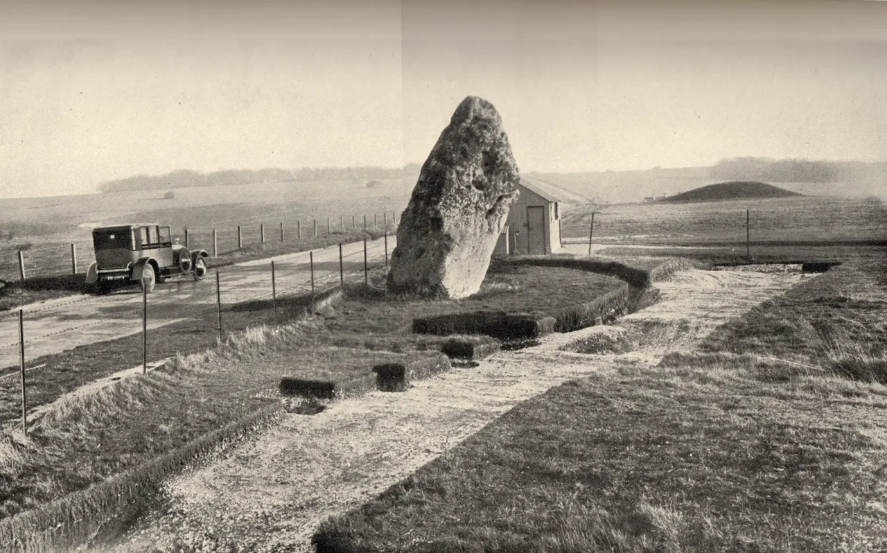
On 21 September 1915 a barrister and breeder of shire horses named Cecil Chubb walked into a Salisbury auction. He paid 6,600 pounds for Stonehenge and thirty acres of land, reportedly on a whim, supposedly as a gift for his wife Mary. Mary was not delighted, and three years later she persuaded her husband to donate Stonehenge to the nation. The transfer in 1918 made Stonehenge a state monument and unleashed a long programme of excavation. From 1919 to 1926, Colonel William Hawley and his assistant Robert Newall worked at almost every feature of the site. They were the first to prove Stonehenge was multi-phase, built and rebuilt over centuries rather than thrown up in a single project. In 1950 the Society of Antiquaries sent in Richard Atkinson, Stuart Piggott and John FS Stone, who recovered scores of cremation burials and produced the chronology that still anchors most popular books.
The healing place
Since 2003 Mike Parker Pearson has run the Stonehenge Riverside Project, treating the whole landscape around the stones as one connected ritual complex. In 2008 Tim Darvill of Bournemouth University and Geoff Wainwright excavated a small area inside the circle to date the earliest stone structure. The same year, they suggested Stonehenge had been a place of healing, an ancient Lourdes. Burials nearby showed unusual trauma and deformity. The bluestone circle, dated to between 2400 and 2200 BCE by radiocarbon, may have drawn the sick and injured to its supposedly magical stones. Just up the road, at a spring called Blick Mead, Professor David Jacques of Buckingham University has since 2005 been uncovering a Mesolithic settlement that runs from 7900 to 4050 BCE. People were drinking from that spring four thousand years before the first stone was raised. The monument did not appear in an empty landscape. It grew out of one already saturated with meaning.
From the Air
Coordinates 51.1789 N, 1.82667 W. The Stonehenge monument and its surrounding excavation landscape occupy several square miles of open Salisbury Plain, 8 nm north of Salisbury and 2 nm west of Amesbury. From altitude you see the dark ring of stones, the curving Stonehenge Avenue extending to the south-east, the Cursus running east-west to the north, and dozens of round barrows on the surrounding ridges. The A303 passes south of the stones. Blick Mead and Bluestonehenge lie near the River Avon at the eastern edge of the landscape. Nearest airports: Boscombe Down (EGDM) is 6 nm south-east; Old Sarum (EGLS) is 7 nm south; Bournemouth (EGHH) is 30 nm south.
Nearby Stories
- Sherborne Castle 4.4 km away
- Highclere Castle 10 km away
- Camper and Nicholsons 11 km away
- Museum of the Great Western Railway 12 km away
- Wells Cathedral 13 km away
- Severn Bridge 17 km away
- Abingdon-on-Thames 21 km away
- 1958 BOAC Bristol Britannia Crash 26 km away