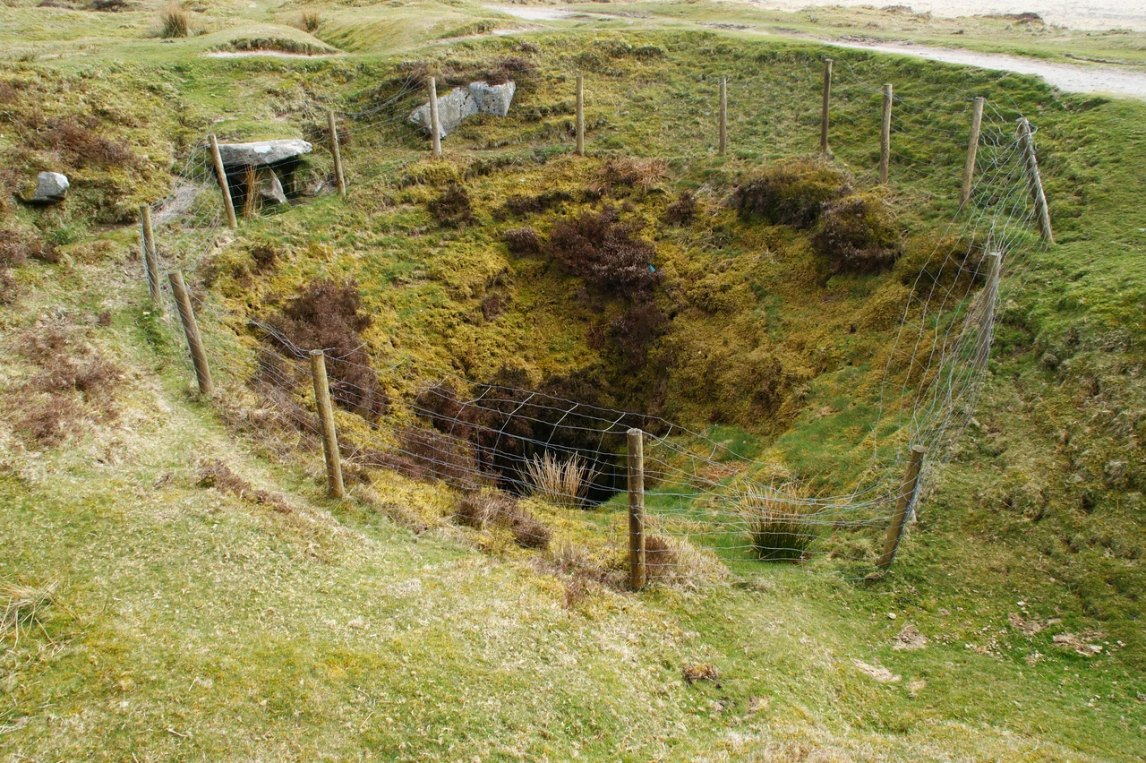

Eylesbarrow Mine
The owner liked to entertain. William Crossing recorded the detail in his Dartmoor book: a man named Deacon, proprietor of the Eylesbarrow tin mine in the 1820s, kept a small boat on the mine's reservoir and rowed visitors out across the water for an afternoon's amusement. Below them, in three roughly parallel lodes running east-northeast through the granite, a few dozen miners chased cassiterite by candlelight. Above them, on the rounded summit of the hill called Eylesbarrow itself, two Bronze Age barrows had been holding their dead for some three thousand years. The mine took its name from those barrows. Everything in this corner of southern Dartmoor sits on top of something older.
Three Lodes in Soft Granite
Eylesbarrow's country rock is the standard Dartmoor granite, but the tin lodes here came with a useful bonus. As the mineralizing fluids forced their way through, they triggered extensive metasomatism in the surrounding rock - chemical alteration that turned much of the plagioclase feldspar into kaolinite, a soft clay mineral. The walls of the lodes were therefore significantly easier to dig than unaltered granite would have been. The lodes themselves were narrow, no wider than about 2.4 feet, but the ore in the early years was sometimes extraordinarily rich. Three lodes did almost all the work. Between 1822 and 1831, the mine sent about 276 tons of white tin down off the moor to be coined at Tavistock, the nearest stannary town. The peak year was 1825, when 403 blocks weighing more than 1,220 hundredweight in total were stamped and taxed. The total value may have reached almost £30,000.
The Old Men and the New
Long before the 19th-century shafts went in, generations of earlier tinners had worked the same ground. The valley floor of the upper Plym and its tributaries is torn open by streamworks, the parallel ridges of overturned gravel that mark centuries of washing the riverbeds for cassiterite. Openworks cut down the lines of the lodes themselves. Hundreds of prospecting pits, leats, and small reservoirs dot the slopes. The Dartmoor miners called these earlier workers "the old men," a phrase that respected the labor without claiming the people. When the new company arrived around 1814 to drive proper shafts and adits, they were not opening virgin ground - they were continuing a project that had been going on under the same hillsides since the medieval period or earlier.
Adits and the Wheel of 1849
Four adits - horizontal drainage tunnels - are named in the mine documents. Shallow Adit and Deep Adit both date from about 1815. Shallow Adit is blocked now, its position marked only by a stream that issues from the hillside south of the main track. Deep Adit is still open, its mouth lined with sturdy granite slabs, 2.2 meters high and 0.9 meters wide. Two Brothers Adit, dug in the 1840s, still pours an abundant stream of water into the gulley around it. A fourth adit, Deacon's Adit, never appears on the ground and may have stayed on paper. In 1849 the mine's second great waterwheel began turning - 50 feet in diameter, 3 feet across, almost certainly the largest on the moor. Captain Spargo had proposed it two years earlier. It replaced the original 1815 wheel and took advantage of better water - the adit outflow, the rerouted Engine Leat from the Plym, and several hillside runoff leats to the north.
Power Sent Sideways
A waterwheel works best when bolted directly to the pump it drives. The Eylesbarrow geography did not permit it. The wheel had to sit lower on the hillside where the water was, and the pump had to sit at the shaft head where the mine was, and these were thirty meters apart. The 19th-century answer was the flatrod system. A crank on the waterwheel converted the wheel's circular motion into the back-and-forth motion of a series of linked iron or wooden rods running along the ground. Heavy weights called balance bobs, pivoted at intervals, kept the rods under tension and at the shaft head converted horizontal motion back into the vertical strokes that worked the pump. The Eylesbarrow rods ran across the open hillside on stone pillars whose ruined remains - double rows of grooved granite blocks - still trace the route today.
A Mine Without a Map
Eylesbarrow ran in several different shapes through the first half of the 19th century, and by the late 1840s it was running out of money. The lodes had thinned at depth, in the way most Dartmoor lodes did. A company called Aylesborough tried again in 1848 with a few men and a deepened shaft, sold over £50 of black tin that year, and held on for several more years before finally giving up. Despite the mine's importance in its prime, no detailed underground plans survive. There are only the surface records, the coining ledgers from Tavistock, and the physical remains in the field - the wheelpits, the leats curving around the contours, the flatrod pillars, the open mouth of Deep Adit still draining water from workings that no living person has fully mapped. About half of the visible shafts can now be tied with reasonable confidence to names mentioned in the documents. The rest are anonymous holes in the moor.
From the Air
Eylesbarrow mine sits at roughly 50.48N, 3.97W, on the southern shoulder of Eylesbarrow Hill less than a mile northeast of Drizzlecombe in the upper Plym valley. Recommended viewing altitude 1,500-2,500 feet AGL to pick up the wheelpits, the linear flatrod pillar tracks, and the disturbed valley floors of the Plym and Langcombe Brook. The two Bronze Age barrows on the hilltop above are useful navigation references. Nearest airport Plymouth (EGHO) about 9nm south-southwest; Exeter (EGTE) about 25nm east-northeast. Note military training areas nearby - check NOTAMs. The flatrod stone tracks read best in low morning or evening sun.
Nearby Stories
- Bodmin Moor 4.1 km away
- South Devon Railway sea wall 4.8 km away
- Tiverton Castle 12 km away
- Hope Cove Lifeboat Station 14 km away
- Caerhays Castle 20 km away
- Holsworthy 22 km away
- HMS Formidable (1898) 32 km away
- HMS Montagu 41 km away