
First Battle of Rappahannock Station
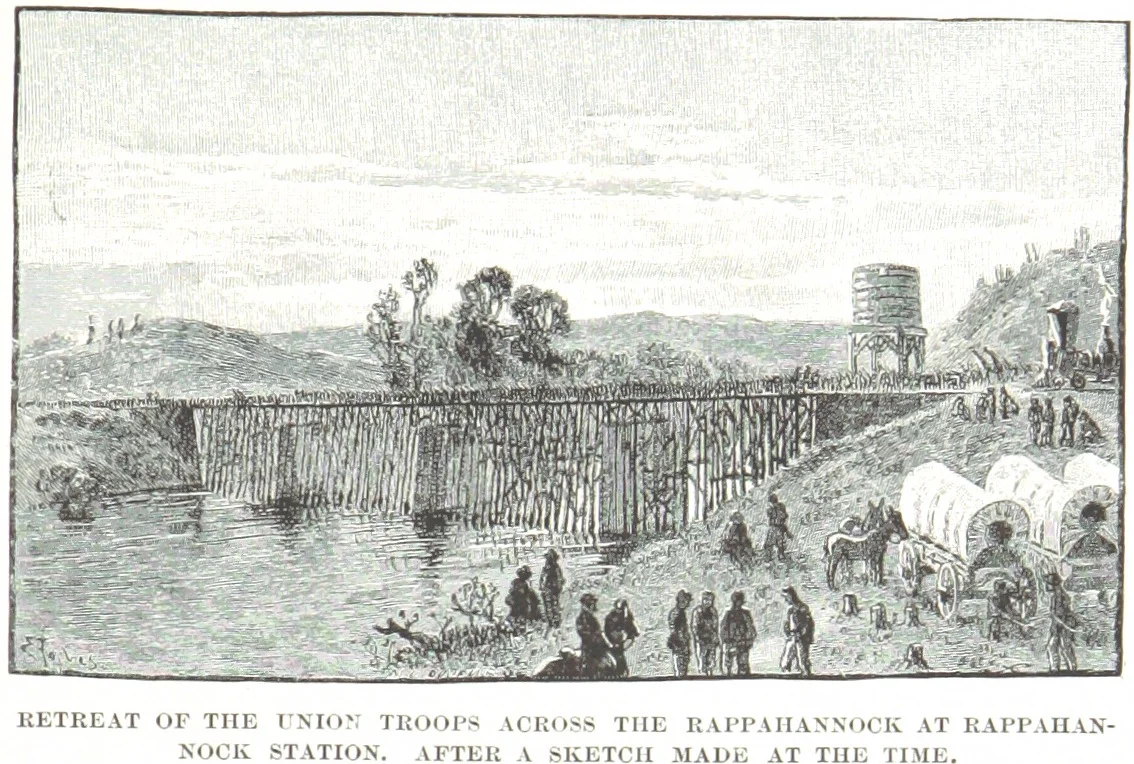
Three hours, fifty cannon, one wooden railroad bridge. On the morning of August 23, 1862, the nineteen guns of the Washington Artillery of New Orleans opened fire on a Union battery posted on a small knoll on the south bank of the Rappahannock River. The Union artillery on the north bank answered. Within minutes the river crossing at what is now Remington, Virginia, was the center of one of the fiercest small artillery duels of the entire Civil War. The railroad bridge - the key prize - was set on fire by retreating Union engineers. The men who died on the south bank knoll included a New Orleans Confederate artilleryman whose remains were not recovered until a Smithsonian team uncovered them in 1989.
How the Armies Got Here
In early August 1862, Robert E. Lee read the troop movements coming out of the Virginia Peninsula and concluded that George B. McClellan's army was being pulled back to reinforce John Pope, the Union general advancing south from Washington. Lee shifted James Longstreet's wing from Richmond north to join Stonewall Jackson near Gordonsville and took personal command on August 15. Pope, sensing the gathering Confederate strength, withdrew on August 20 and 21 to the line of the Rappahannock River, spreading his army along the north bank from Kelly's Ford up to just above the railroad bridge at Rappahannock Station - the modern town of Remington. Each side tried to flank the other to the north along the river. For two days they sidestepped together in what one historian described as a waltz. Lee finally decided to send Jackson far upriver to cross above Pope, and to use the railroad bridge crossing as the pivot to protect his own flank.
The Artillery Duel
Storms on August 22 raised the Rappahannock enough to make most of the fords useless. The bridge at Rappahannock Station became the only practical crossing point on Lee's right. Union artillery on the high north bank, plus a small infantry-and-gun detachment on the south bank knoll, controlled it. On August 22, Confederate batteries arrived under Longstreet's orders to drive the Union force away. Nathan Evans's South Carolina Brigade and George T. Anderson's Georgia Brigade moved up in support. At first light on August 23 the Washington Artillery of New Orleans - nineteen guns, one of the most famous Confederate artillery units of the war - opened fire on the south bank knoll. The duel that followed involved nearly fifty cannon firing across the river for three hours. The Union battery on the knoll was overrun first; the Union engineers blew up the railroad bridge as they retreated. Confederate infantry under Evans tried to occupy the abandoned knoll, but Union counter-battery fire dislodged them quickly. Around noon Union guns moved slightly upriver to bring fire onto the Confederate bottomland; the South Carolina and Georgia infantry took heavy losses as they fell back.
What the Battle Set Up
By mid-afternoon, additional Confederate artillery had arrived and forced the Union defenders to set fire to the buildings in the small town and retreat. Tactically the engagement was a draw. Strategically it was a Confederate success - it pinned Pope's army to the river, distracted Union attention from upriver, and bought the time Lee needed. On August 25, Stonewall Jackson rose at 3 a.m. and started his wing on a forced march. He crossed the Rappahannock at Hinson's Mill Ford well upriver of Pope's position, swept through Thoroughfare Gap on August 26, captured Bristoe Station, and destroyed the massive Federal supply depot at Manassas Junction. Pope's army, suddenly cut off from its supply line and facing Jackson in its rear, swung around to fight what would become the Second Battle of Manassas on August 28-30. Longstreet's wing followed Jackson's route three days behind. The fighting at Rappahannock Station on August 23 was the diversion that made the whole movement possible.
The Artilleryman from New Orleans
In 1989, a Smithsonian Institution archaeological team excavated the ruins of St. James Episcopal Church near Rappahannock Station as part of an evaluation for the National Register of Historic Places. They found the remains of a Confederate soldier. Identification placed him as a member of the Washington Artillery, a New Orleans native killed during the August 23, 1862, artillery duel. His body had lain in the ruined church for 127 years. The Smithsonian team's reinterment was conducted at St. James Cemetery in Brandy Station, Virginia. The Washington Artillery, originally a New Orleans militia unit, served from First Manassas through Appomattox; some of its battle flags still hang in New Orleans. The man recovered in 1989 left his city in 1861 with the rest of the unit and never returned. The cemetery where he now rests is just a few miles from where he fell.
What Survives on the River
The American Battlefield Trust and its partners have preserved 869 acres of the First Rappahannock Station battlefield as of November 2021. The preserved ground includes visible earthworks along the Rappahannock, the ruins of mills along the river, and the abutments of the railroad bridge that the Washington Artillery's first shells helped destroy. From the air, Remington appears as a small town on the south side of the river, with the preserved battlefield extending in both directions along the banks. The railroad - now Norfolk Southern - still crosses the Rappahannock at the same point. The Blue Ridge rises about 15 miles to the west. Culpeper sits about 7 miles southwest, Warrenton about 12 miles northeast. The river between Remington and Kelly's Ford is now quieter than at any time since the war. The bridge has been rebuilt twice. The artillery positions are marked with interpretive signs.
From the Air
The First Battle of Rappahannock Station battlefield sits at 38.527 N, 77.830 W, at present-day Remington, Virginia, where Norfolk Southern's rail line crosses the Rappahannock River. Recommended viewing altitude is 2,500 to 4,000 feet AGL for the best look at the river crossing, the small town of Remington, and the preserved battlefield acreage extending along both banks. The nearest airport is Warrenton-Fauquier (KHWY), about 8 nm to the northeast. Culpeper Regional (KCJR) lies 7 nm southwest. The Blue Ridge rises about 15 nm to the west. Brandy Station Battlefield and Cedar Mountain Battlefield both lie within 8 to 10 nm to the south. Best light for the river and earthworks is mid-morning.
Nearby Stories
- Skyline Drive 6.7 km away
- Battle of Vienna, Virginia 9.6 km away
- Mallows Bay-Potomac River National Marine Sanctuary 14 km away
- Battle of Middleburg 17 km away
- Orange County, Virginia 18 km away
- John Wilkes Booth 23 km away
- Albemarle Barracks 27 km away
- Hardy County, West Virginia 44 km away