
Flinders Island
Sit at exactly 40 degrees south and the wind never really stops. This is the latitude sailors named the Roaring Forties, where the westerlies sweep unbroken around the bottom of the globe, and Flinders Island sits squarely in their path, a 1,333-square-kilometre wedge of granite and dune rising out of Bass Strait northeast of Tasmania. Mount Strzelecki throws its 782-metre peak into that wind. Lagoons pool along the eastern shore. And the island carries a human story almost beyond reckoning: people walked here at least 35,000 years ago, across a land bridge that no longer exists. Flinders is beautiful, remote, and layered with memory both ancient and raw.
Walking Across a Vanished Land
There was a time when you could walk to Flinders Island without getting your feet wet. During the last ice age, lower sea levels exposed a land bridge connecting Tasmania to the Australian mainland, and Aboriginal people crossed it to live here at least 35,000 years ago. Then the ice melted, the sea rose, and the bridge drowned to become Bass Strait, stranding the island's people. That first population endured for tens of thousands of years before vanishing around 4,500 years ago, when an acute climate shift, tied to El Niño patterns, brought a drought their isolated world could not survive. The granite they lived among is among the oldest exposed rock in the region, and it still defines the island's bones today.
The Charts and the Names
European sails arrived in 1773, when Tobias Furneaux, commanding a support vessel on James Cook's second voyage, recorded some of the southern islands of the group that now bears his name. The decisive survey came in 1798, when a young navigator named Matthew Flinders charted these waters from the open boats of a tiny schooner, then returned in the sloop Norfolk to finish the job. With George Bass, Flinders went on to circumnavigate Tasmania, proving it an island and confirming the strait between. Flinders called the big island simply "Great Island" and named a row of peaks the Three Patriarchs; a noisy seabird rookery to the east he dubbed Babel Island. Only later did Phillip Parker King rename the whole island for Flinders himself, the surveyor finally written into the map he had drawn.
Sealers, Exile, and Wybalenna
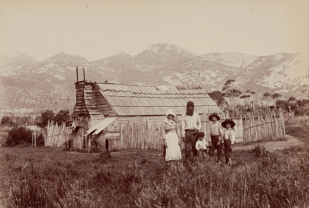
The late 1700s brought sealers, and with them one of the strait's darker chapters: many lived alongside Aboriginal women, the majority taken by force from their mainland clans. The seal colonies collapsed within a generation, the last permit issued in 1828, but those families stayed, raising children and living off cattle and muttonbirds. Then, from 1831, the island became a place of exile. The surviving Aboriginal Tasmanians were brought here, first to The Lagoons near Whitemark, then in 1833 to the Wybalenna Aboriginal Establishment. Around 180 people were held there; roughly 130 died. In 1847, after a famous petition to Queen Victoria, the 47 survivors were removed to Oyster Cove. The Aboriginal community of Flinders Island today descends largely from those sealing-era families, and they have never left.
A Sanctuary of Wings
For all its hard history, Flinders is a haven for the living. More than 800 plant species grow across the Furneaux Group, and the island is the last refuge of a distinct subspecies of common wombat. Birds are the real spectacle. Two stretches of the island are recognised as Important Bird Areas: a tract near Whitemark holds breeding colonies of the endangered forty-spotted pardalote, one of Australia's rarest birds, while the full 70-kilometre eastern coast shelters fairy terns, hooded plovers, and more than one percent of the world's chestnut teal and pied and sooty oystercatchers. Tasmania's island endemics, the green rosella, the black currawong, the dusky robin, flit through the eucalypt woodland that crowns the higher ground, while Strzelecki National Park guards the granite heights in the southwest.
Island Life at the Edge
Roughly a thousand people live across Flinders and neighbouring Cape Barren Island, and the number has been climbing, a quiet reversal for a place so often described as emptying out. The main town, Whitemark, holds the airstrip and a few hundred residents; Lady Barron anchors the south. The mild oceanic climate keeps rainfall under 800 millimetres a year, with summers drier than the cloud-wrapped winters. Getting here still means a small plane from Launceston or Essendon, a 25-minute hop over the strait, or a freight ferry hauling food across the water. Telstra's towers reach across both islands now. But the essential fact of Flinders Island has not changed in 35,000 years: it is a place apart, holding its weather, its wildlife, and its people against the endless press of the Forties.
From the Air
Flinders Island sits at 40.00°S, 148.12°E, the largest island in the Furneaux Group at the eastern end of Bass Strait, about 54 km from Cape Portland on the Tasmanian mainland. The granite peak of Mount Strzelecki (782 m) in the southwest is the dominant visual landmark and a reliable navigation reference; the long eastern coastline of dunes and lagoons makes a clean leading line. Flinders Island Airport (ICAO YFLI) at Whitemark is the main field, with regular service from Launceston Airport (YMLT, ~25 minutes) and Essendon Airport (YMEN) in Victoria. Expect strong, gusty westerlies year-round in the Roaring Forties, mechanical turbulence in the lee of the ranges, and fast-changing visibility as showers track through. Recommended sightseeing altitude is 3,000-5,000 ft for the coast, higher and well clear when crossing the Strzelecki massif.
Nearby Stories
- Bay of Fires 99 km away
- Beaconsfield Mine Collapse 127 km away
- Bass Strait 141 km away
- Snowy River 216 km away
- Walhalla, Victoria 224 km away
- Bundian Way 305 km away
- Parliament House, Canberra 522 km away
- 2003 Fiordland Earthquake 1580 km away