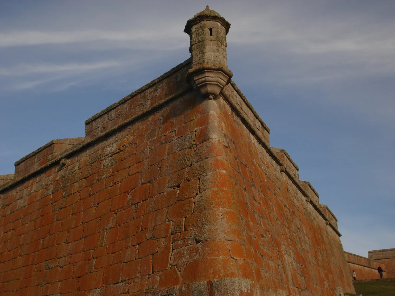

Fortaleza de Santa Teresa
The Portuguese laid the cornerstone on October 6, 1762, and barely six months later they lost it. Spanish forces under Pedro de Cevallos captured the half-built fortress by capitulation on April 19, 1763, taking the Portuguese commander Tomás Luis de Osorio and a hundred-odd defenders along with the unfinished walls. The fort changed hands almost before it was a fort at all. That single exchange tells you everything about Santa Teresa: this pentagon of granite was never a peaceful place but a contested key, set down at the exact point where two empires pressed against each other on the edge of South America.
The Only Way Through
Geography chose this spot, not whim. The eastern coast of what is now Uruguay was a barrier of marshes and shifting dunes, nearly impassable, and a single dry corridor threaded through it: the Camino de la Angostura, the narrow pass to the sea. Whoever held the pass held the road north toward Brazil. The fort was raised on a rocky outcrop 58 meters above sea level, commanding that chokepoint. Its builders shaped it as an irregular pentagon with a projecting bastion at each of its five angles, the perimeter running 652 meters around roughly a hectare of ground. The walls were built of massive granite blocks, cut strictly to size and fitted precisely, rising in places to 11.5 meters and backed by earthen embankments up to seven meters wide. This was not decoration. It was a machine for controlling a coastline.
Three Forts in Thirteen Years
What stands today is really the last of several attempts. Between 1762 and 1775, three successive forts rose on or near this ground as the war and the diplomacy lurched back and forth. The Portuguese began the first under engineer Gomez de Mello, dragging timber some 30 kilometers from Fuerte San Miguel across countless streams and swamps, a brutal task for the era. When the Spanish took over, they tore into the existing work, reused its materials, and built anew to their own designs. The final fortification, raised between 1765 and 1775 under engineer Bartolome Howel, was completed largely by an ex-Jesuit named Lucas Marton working alongside Guarani laborers. The Treaty of San Ildefonso in 1777 finally confirmed Spanish possession, ending fifteen years of seizing, rebuilding, and reinforcing the same stubborn pass.
Who Lies Beneath the West Wall
A short distance from the western wall is the cemetery, and it holds the truest record of who built and held this place. The ground received soldiers of the Spanish garrison, but also Portuguese, enslaved people, and Indigenous Guarani, buried side by side across the latter half of the eighteenth century and beyond. Among the named are Agustin Lipopisi and Felix Sayobi, two Guarani chiefs and missionaries, and Cecilia Marona, daughter of a Spaniard and a Portuguese woman, her parentage a small map of the borderland's tangled lives. The enclosure was built, like the fort itself, by convict labor and Guarani hands under Lucas Marton. Its original stone crosses still stand. The people remembered here were not statistics in a colonial ledger; they were the laborers, soldiers, and families whose work and burials made this remote outpost a living settlement.
Cattle, Bats, and a Second Life
Once Uruguay became a nation in 1828, the fort lost its purpose and, for nearly a century, the state lacked the means to keep it. It served briefly as a watchtower during the civil wars of the 1830s and 1840s, then as a prison in 1895, and finally as little more than a shelter for cattle and bats. Those bats, oddly, sparked its revival: their presence moved President Baltasar Brum to write a piece based on a local Indigenous legend, and his interest helped set restoration in motion. In 1921 the historian Horacio Arredondo proposed rescuing Santa Teresa along with nearby San Miguel; in 1928 the work began in earnest. Since the 1940s the restored fortress has housed a museum, one of the very few colonial-era bastions still standing in Uruguay, its granite walls now guarding memory instead of empire.
From the Air
Fortaleza de Santa Teresa sits at roughly 33.97 degrees south, 53.55 degrees west, in Rocha Department about 36 km south of Chuy and 305 km northeast of Montevideo, just inland from the coast at Playa la Moza within Santa Teresa National Park. From the air the fort is a distinctive five-sided stone fortress set on a rocky rise about 58 m above sea level, surrounded by the dark green planted forest of the national park and ringed by coastal dunes and wetlands. Its pentagonal geometry makes it an unmistakable landmark. Best viewed at low altitude in clear conditions. The nearest airfield is at Chuy near the Brazilian border to the northeast; Laguna del Sauce International (SULS) near Punta del Este lies roughly 180 km to the southwest, and Montevideo's Carrasco International (SUMU) about 300 km west-southwest.
Nearby Stories
- Fuerte San Miguel (Uruguay) 9.6 km away
- Cabo Polonio 21 km away
- Laguna de Rocha 41 km away
- Treinta y Tres 62 km away
- Cerro Catedral (Uruguay) 64 km away
- Taim Ecological Station 144 km away
- Praia do Cassino 220 km away
- South Georgia Island 2570 km away