
Laguna de Rocha
A few times each year, the sand gives way. A narrow bar separates Laguna de Rocha from the Atlantic for most of the calendar, holding back a brackish sheet of water that stretches across 7,200 hectares. Then a storm rolls in, or the lagoon swells with rain, and the ocean breaks through. Salt water floods in, the level drops, fish and birds rearrange themselves around the new geography, and for a while the barrier becomes an island rather than a peninsula. It is one of the few places where you can watch a landscape decide, in real time, what shape it wants to be.
The Bar That Breathes
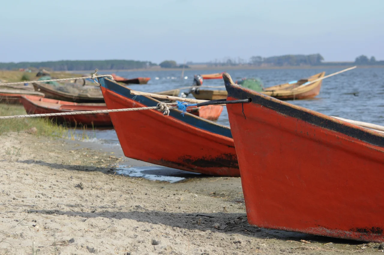
The opening and closing of the sandbar is the engine of everything here. When the bar is shut, the lagoon turns fresher and rises; when it breaks, the Atlantic pours in and the water turns briny. This rhythm, which happens naturally three or four times a year, drives the whole ecosystem. Brackish water suits a particular cast of creatures, and the constant flushing keeps the shallows productive. Local fishermen read the bar like a calendar, knowing that when it opens, the fish move with the tide. They work the lagoon from small boats, rowing or poling rather than motoring, because engines are banned on the water. It is a quiet way to fish, governed by a barrier of sand that no one fully controls.
More Than 200 Wings
Stand at the shore at the right hour and the count begins: more than 200 bird species have been recorded here, and on a still morning the lagoon seems made of them. Flamingos wade the shallows in loose pink ranks. Herons stalk the edges, patient and angular. Owls hunt the surrounding grasslands at dusk. The biodiversity runs deeper than birds alone, with dozens of species of fish, amphibians, reptiles, and mammals sharing the wetland, including capybaras and coypu rustling through the reeds. This abundance is why the lagoon earned international protection. In 2015, Uruguay designated Laguna de Rocha as a Ramsar site, a wetland of recognized global importance, and it forms part of the larger Bañados del Este Biosphere Reserve.
Protected by Emptiness
What makes Laguna de Rocha unusual among parks is how little has been done to it. Across more than 20,000 hectares, there is almost no infrastructure built for visitors, and that is deliberate. The protected area was first set aside in 1977, then re-designated as a protected landscape in 2010 under SNAP, Uruguay's protected-areas agency. The point was never to draw crowds. A single marked trail, the Sendero la Laguna, runs roughly five kilometers across flat grassland and marsh, walkable in about two hours. Beyond that, you walk where you like. There are no stores, no lifeguards, no campsites with hookups, just grassland, coastal forest, and the long open beach. People come here to find solitude, and the lagoon obliges. The restraint is itself a kind of design philosophy: keep the footprint small, let the wildlife dictate the terms, and trust that the emptiness is the attraction. For a country whose Atlantic coast is increasingly built up with resort towns, a protected expanse this large and this undeveloped is a deliberate counterweight, a stretch of shore left to operate on its own schedule.
Where Sand Meets Open Ocean
The barrier itself is the dramatic edge of the place: roughly seven kilometers of soft, dune-backed beach where tall grasses lean in the wind and the surf rolls in unbroken from the South Atlantic. On one side lies the still, shifting lagoon; on the other, the open ocean. Walking the bar, you feel the strangeness of standing on a thin line of sand that the sea is always testing. The nearest town, Rocha, sits a short drive north, reachable in about three hours from Montevideo by bus or car, and it is where visitors stock up before heading in. Everything else is grass, water, sky, and the patient traffic of birds along a coast that has not been smoothed over for anyone's convenience.
From the Air
Laguna de Rocha sits at 34.62 degrees south, 54.29 degrees west, on Uruguay's Atlantic coast roughly 20 km south of the city of Rocha. From the air it reads as a large pale lagoon hugging the coastline, separated from the dark Atlantic by a thin pale ribbon of sandbar; watch for the channel opening that periodically breaches the barrier. The flat grasslands and coastal forest offer little vertical relief, so the lagoon's outline against the ocean is the primary visual landmark. Best viewed at low to medium altitude in clear weather. Nearest airfields are the small Rocha aerodrome to the north and Laguna del Sauce International Airport (SULS) near Punta del Este, roughly 90 km to the west-southwest; Montevideo's Carrasco International (SUMU) lies about 200 km west.
Nearby Stories
- Maldonado 16 km away
- Punta del Diablo 35 km away
- Minas 41 km away
- Isla de Lobos 57 km away
- Santa Teresa National Park 64 km away
- Fortaleza de Santa Teresa 78 km away
- Cerro Chato 134 km away
- South Georgia Island 2545 km away