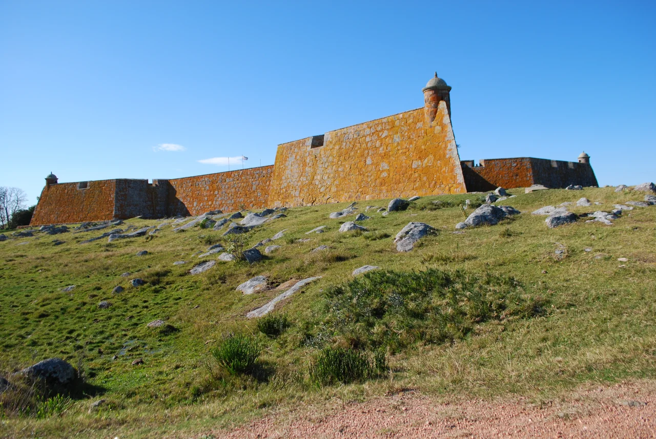

Fuerte San Miguel (Uruguay)
By 1891 a palm tree was growing out of one of its corners. The fort that empires had fought over - Portugal against Spain, garrison against garrison - had been left to the weeds, its walls cracking, its bastions claimed by the vegetation of the Rocha lowlands. Fuerte de San Miguel might have dissolved entirely into the hillside. Instead it was hauled back from oblivion: rebuilt from original plans, declared a national monument, and restored to the four-pointed stone star it had been when soldiers manned its ramparts. Today it crowns the Sierra de San Miguel, thirty-five metres above the marshes, looking exactly as a frontier fort should.
A Fort on a Contested Frontier
The Portuguese raised San Miguel in 1737, after abandoning an earlier attempt to fortify Maldonado. They built with large, heavy stones - tall bastions, thick walls, sturdy ramparts - meant to withstand the wars they knew were coming with Spain. A garrison of about a hundred men used it as a watchpost, tracking Spanish movements across the wetlands. This was deep in the disputed borderland between two empires, and the fort's job was simply to see and to hold. The treaties of the era - Madrid in 1750, El Pardo in 1761 - kept redrawing who owned this corner of South America, and San Miguel sat squarely on the seam, a small stone outpost whose control mattered out of all proportion to its size.
Changing Hands
In October 1762, Spanish governor Pedro de Cevallos seized Colonia del Sacramento, and the following April his forces took San Miguel as well. The Spanish improved it considerably, turning a Portuguese watchpost into a fully functioning fort. In 1775, the engineer Bernardo Lecocq reinforced its structure as a British invasion loomed. The Treaty of San Ildefonso in 1777 legally confirmed Spanish possession, and by 1797 the fort reached its peak strength, fortified yet again in anticipation of war. Through these decades the design matured into a Vauban-style star: four pentagonal bastions, internal walls, service buildings, a chapel on the mound, and a deep well. Access came by a drawbridge over a flooded moat - the classic geometry of European fortification, transplanted to a South American frontier.
Ruin and Rescue
Uruguay won independence in 1828, and the fort lost its purpose almost at once. Deactivated and abandoned, San Miguel slid into ruin. By the end of the nineteenth century, plants had taken the walls and a mountain palm grew in one corner. The turnaround came in the twentieth century. A committee that included the historian Horacio Arredondo - who devoted himself to rescuing Uruguay's colonial forts - began the work. From 1933 the structure was rebuilt according to its original plans, using period techniques, restoring the command house, the chapel, the kitchen, and the troop barracks. In 1937 the fort was declared a National Monument of Uruguay. What had been a crumbling shell became one of the country's most evocative historic sites, raised from the rubble with deliberate care.
What Stands Today
The restored fort is administered by the Uruguayan Army and open to visitors, housing a Museum of Military History. Its collection traces the evolution of the garrison's uniforms and the broader history of the army's dress, a small but vivid window into the soldiers who once held this lonely post. The setting carries its own drama: the fort sits on its hill six kilometres south of the vast Laguna Merín and eight kilometres west of the border town of Chuy, in a country of wide valleys and shallow wetlands. From the ramparts, the land rolls open in every direction - the same long sightlines that made the hill valuable to the men who built here, watching for an enemy across the marsh nearly three centuries ago.
From the Air
Fuerte San Miguel stands at 33.69°S, 53.54°W, atop the Sierra de San Miguel near the small town of Dieciocho de Julio in eastern Uruguay's Rocha Department. The fort rises about 35 metres above the surrounding wetlands - a deliberately commanding position - 6 km south of the Laguna Merín and 8 km west of the border town of Chuy, just off Route 19. From the air, the four-pointed star plan of the bastions is distinctive against the green hilltop, with the broad expanse of Laguna Merín to the north and the Atlantic coast to the east as natural reference points. There is no nearby commercial airport; the closest international field is Capitán de Corbeta Carlos A. Curbelo International at Punta del Este (ICAO: SULS, IATA: PDP), roughly 200 km southwest, with Carrasco International at Montevideo (ICAO: SUMU) the main gateway. Best viewed at low altitude in clear conditions, when the fort's geometry and its hilltop perch over the wetlands stand out sharply.
Nearby Stories
- Fortaleza de Santa Teresa 7.9 km away
- Treinta y Tres 29 km away
- Cerro Catedral (Uruguay) 71 km away
- Quebrada de los Cuervos 87 km away
- Jaguarão 95 km away
- Taim Ecological Station 108 km away
- Praia do Cassino 185 km away
- Battle of the River Plate 377 km away