
Jaguarão
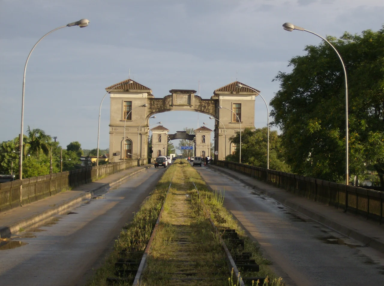
You can walk out of Brazil and into Uruguay over your lunch hour, and nobody will ask for your papers. In Jaguarão, the border is a river and the river is crossed by a single graceful stone-and-iron bridge, and the people of this town and its Uruguayan twin, Río Branco, drift back and forth across it as if it were any other street. The catch comes only if you want to travel deeper into either country: then you must hunt down the passport office, set inconveniently far from the water on each side. For a town that simply wants to live next to its neighbor, the line on the map barely exists.
The Bridge They Made a Monument
The bridge that ties the two towns together is no ordinary crossing. The Ponte Internacional Barão de Mauá, opened in 1930 after nearly four years of construction, runs more than two kilometers from end to end, with its central span reaching 340 meters over the Jaguarão River. It carries a strange origin: Uruguay paid for it, settling an old war debt to Brazil with concrete and steel rather than cash. Decades later the bridge earned a distinction no other structure in South America holds. In 2011 it became the first binational property ever listed by Brazil's heritage institute, IPHAN, jointly protected by both nations, and it was later certified as the first cultural heritage site of Mercosul. A border crossing, by definition a place of division, recognized instead as something two countries share.
A Town That Time Forgot to Demolish
Most Brazilian cities long ago bulldozed their nineteenth-century centers. Jaguarão did not. Its historic core survives nearly whole, more than 300 buildings registered and protected by IPHAN, layered across architectural styles: colonial townhouses, ornate eclectic facades, art deco lines, even modernist experiments, standing shoulder to shoulder around plazas and along streets that have changed little in a century. Preservationists describe it as a heritage ensemble without equal in Rio Grande do Sul for both its size and its state of conservation. Walking these blocks, you read the whole arc of a frontier town's prosperity written in stone and stucco, an era when border commerce made Jaguarão rich enough to build grandly and, just as importantly, never rich enough afterward to tear it all down.
Life Along the Frontier
The rhythm of Jaguarão is the rhythm of the line itself. The town grew up as a military and customs outpost on a contested edge of empire, where Portuguese and Spanish ambitions ground against each other for generations. That tension hardened into stone fortifications and barracks, and then softened, over time, into the easy daily traffic of two communities that decided to be one. Spanish and Portuguese blur together in the markets. A car can fill its tank on whichever side fuel is cheaper that week. The frontier here is not a wall but a seam, the place where two countries are stitched rather than separated, and the stitching has held for a very long time.
Reaching the Edge of Brazil
Jaguarão sits at the southern foot of Rio Grande do Sul, reached by the long BR-116 highway running down from Pelotas and the state capital, Porto Alegre, to the north. The road delivers travelers to a town that feels like a destination precisely because it is an endpoint, the last Brazilian streets before the bridge hands you to Uruguay. Intercity buses pull in near Praça Comendador Azevedo, in the heart of the old quarter, leaving visitors a short walk from the protected facades and the river beyond. For many who arrive, the surprise is not that a border town exists here, but that it turned out to be so beautiful, and so quietly, durably open.
From the Air
Jaguarão lies at approximately 32.57°S, 53.38°W on the right bank of the Jaguarão River, which forms the Brazil–Uruguay border in the far south of Rio Grande do Sul, directly opposite the Uruguayan town of Río Branco. The unmistakable landmark from the air is the Ponte Internacional Barão de Mauá, a long low bridge spanning the river between the two towns, with Jaguarão's dense grid of historic streets fanning back from the Brazilian bank. The broad valley of the Jaguarão widens downstream toward Lagoa Mirim to the southeast. Nearest airport with scheduled service is Pelotas–João Simões Lopes Neto International (ICAO SBPK) roughly 140 km to the northeast via BR-116; smaller regional aviation is served from Rio Grande / Gustavo Cramer (ICAO SJRG, formerly SBRG). Recommended viewing altitude 2,500 to 4,000 feet to follow the river and pick out the bridge linking the twin towns. Skies are often clear, but the open campo can bring strong south winds and winter river fog.
Nearby Stories
- Taim Ecological Station 20 km away
- Melo, Uruguay 45 km away
- Praia do Cassino 57 km away
- Quebrada de los Cuervos 63 km away
- Santa Vitória do Palmar Meteorite 72 km away
- Pelotas 107 km away
- 1957 Bagé VARIG Commando Crash 111 km away
- Battle of the River Plate 369 km away