
Pelotas
The sweets come first to most visitors: trays of quindim glowing yellow with egg yolk, pé-de-moleque cracking with peanuts, bem-casados wrapped like little gifts. Pelotas calls itself the National Capital of Sweets, and every June the city throws Fenadoce, a two-week festival devoted to its confectionery. But the sugar is the soft surface of a harder story. The opulent mansions that line these streets, the neoclassical and neogothic facades, the wealth that built it all, came from dried beef and from the enslaved people forced to make it.
The City Salt Built
Founded in 1812 on the western shore of the Lagoa dos Patos, Pelotas grew rich on charque, the salted, sun-dried beef that fed plantations, ships, and armies across the Atlantic world. The processing yards were called charqueadas, and through the mid-nineteenth century Pelotas became the leading charque center in Rio Grande do Sul, exporting its meat to Cuba, to ports across Brazil, and beyond. Money poured in. The ranchers and barons who controlled the trade built European-style mansions to announce their fortunes, and today, with around 320,000 residents, Pelotas remains the state's fourth-largest city. Its Centro Histórico is best seen on foot, a compact grid where preserved squares and grand townhouses make the past feel close enough to touch.
The Hands That Were Not Counted
Charque was brutal work, and it was overwhelmingly the work of enslaved Africans. The summer killing season turned the charqueadas into scenes of blood, salt, and exhaustion, and the people who labored there did so under coercion, their suffering the true cost of the city's elegance. The census of 1872 counted roughly 3,590 enslaved people in Pelotas, a population whose forced labor underwrote the mansions visitors now photograph. When Brazil abolished slavery in 1888, the labor-intensive charque economy, built on that injustice, faltered and declined. To walk the Charqueada São João today, where the production process is preserved, is to stand where that history happened, and to remember the men and women whose names the ledgers rarely bothered to record.
Grandeur in Stone
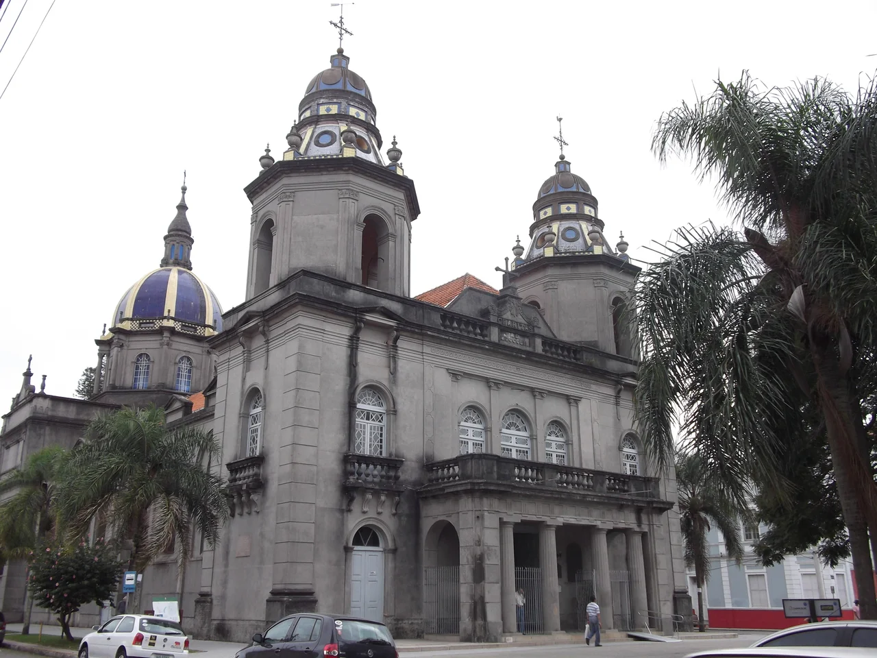
What the charque era left behind is one of the finest collections of nineteenth-century architecture in southern Brazil. At the city's heart rises the Cathedral of São Francisco de Paula, a baroque landmark of intricate detail, twin bell towers, and a grand dome. The Museu da Baronesa, set in a beautifully kept mansion, opens a window onto the lavish domestic world of the elite, its rooms still furnished with their portraits and possessions. And the Mercado Central anchors daily life, a bustling hall of produce, handicrafts, and of course the doces de pelotas piled high at the sweet stalls. The styles range from neoclassical to art deco, a layered record of a city that kept building long after the killing yards fell quiet.
Lagoon Light
For all its history, Pelotas is also a city of soft edges and open water. The Praia do Laranjal stretches along the Lagoa dos Patos, a freshwater shore where families walk, cycle, and picnic beneath the greenery, the lagoon so wide it reads as an inland sea. The climate is humid subtropical and forgiving: summers warming toward thirty degrees Celsius but cooled by the breeze off the water, winters mild, with frost only on the coldest fronts and snow almost unheard of. Football runs deep here too, split between Esporte Clube Pelotas, one of Brazil's older clubs, and Brasil de Pelotas, whose Bento Freitas stadium carries its own weight of memory in a region that has known both triumph and tragedy on the pitch.
From the Air
Pelotas lies at 31.77 degrees south, 52.34 degrees west, on the southwestern shore of the Lagoa dos Patos near the São Gonçalo Channel. From the air the city reads as a dense historic grid set against the enormous pale sheet of the lagoon, with the Praia do Laranjal marking the waterfront and flat ranching country fanning out inland. The municipal airport is João Simões Lopes Neto International (SBPK), a small single-terminal field about 7 km from downtown, served by regional flights from Porto Alegre and São Paulo. Rio Grande and its port (SBRG) sit roughly 50 km southeast across the channel; the major regional gateway is Salgado Filho International in Porto Alegre (SBPA), about 260 km north via the BR-116. Conditions are humid subtropical with even rainfall; watch for coastal fog and frontal cloud reducing visibility in winter.
Nearby Stories
- 1989 Santa Elmira Massacre 11 km away
- Lagoa dos Patos 45 km away
- 2009 Brasil de Pelotas Bus Disaster 47 km away
- Lagoa do Peixe National Park 87 km away
- Jaguarão 88 km away
- 1957 Bagé VARIG Commando Crash 131 km away
- Bagé 137 km away
- Battle of the River Plate 335 km away