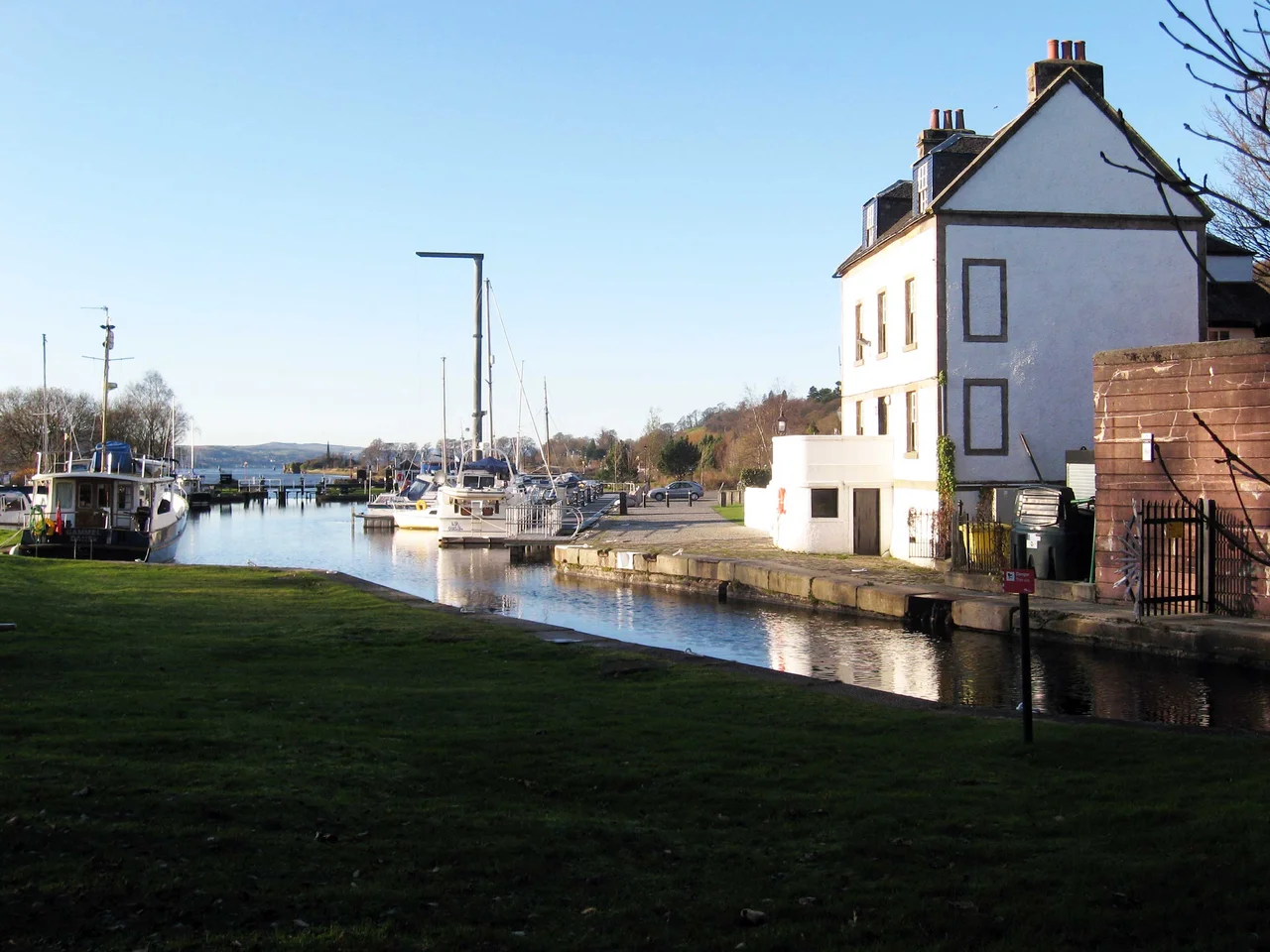

Forth and Clyde Canal
On the day the Forth and Clyde Canal opened in 1790, the engineers performed a small piece of theatre. They drew a hogshead of water from the Forth, carried it thirty-five miles across central Scotland, and emptied it into the Clyde at Bowling. East met west. The Atlantic and the North Sea, separated everywhere else by a continent or a country, were now joined by a single ribbon of fresh water cutting through the narrowest waist of the Scottish Lowlands. Seagoing vessels could sail from Leith to Glasgow without rounding the north of Scotland. It was the largest infrastructure project in the country since the Romans had built the Antonine Wall along nearly the same line, sixteen centuries earlier.
Smeaton's Line
John Smeaton, often called the father of civil engineering, designed the canal. Construction began in 1768 and stretched on for twenty-two years, repeatedly delayed by funding troubles. The geologist James Hutton became deeply involved between 1767 and 1774, contributing site inspections and his early understanding of the rock formations the diggers were cutting through, while also serving as both shareholder and management committee member. Sir Lawrence Dundas, 1st Baronet, provided much of the rescue capital after the initial fundraising stalled. At one point Smeaton fell out with the proprietors and walked away, the work passed to contractors who promptly failed, and progress halted in 1775 for several years with the canal six miles short of the Clyde. The canal that eventually emerged ran thirty-five miles from the River Carron at Grangemouth to the River Clyde at Bowling, with thirty-nine locks lifting it 155 feet to its summit and then dropping it 156 feet back down to sea level.
Aqueducts and Forty-Three Bridges
Priestley's 1831 description of the works gives a sense of the engineering ambition. Thirty-three drawbridges. Ten large aqueducts and thirty-three smaller ones. The Kelvin aqueduct alone was 429 feet long and 65 feet above the river, then one of the largest masonry aqueducts in Britain. The Glasgow merchants, fearful that a canal bypassing their city would ruin them, secured the construction of a branch to Port Dundas just north of the city centre, financed by their own subscriptions. Reservoirs in the Kilsyth Hills - one at Townhead, fed by an aqueduct from a purpose-built reservoir at Birkenburn - supplied the summit level with water. The locks were 74 feet long and 20 feet wide, dimensions that fixed the size of every commercial vessel ever to cross Scotland by this route.
Decline and Backfill
The canal worked well for its first half-century, then was slowly defeated by larger seagoing ships that could no longer fit through its locks, and by railways that could move bulk freight faster overland. By the 1930s the canal was effectively dormant. The closure decision came in the early 1960s, ostensibly because the maintenance cost of the bridges crossing it exceeded its revenue, but railway subsidies had also helped tip the economics. Closure in 1963 ended the seasonal migration of east-coast Forth fishing fleets that used the canal to reach the Irish Sea. Most damagingly, the Grangemouth section was drained and backfilled before 1967 - unusual for a major canal - to provide new road access to the port. The M8 motorway took over part of the alignment near Glasgow. For the next thirty-seven years, the Forth and Clyde existed in fragments: stretches of weed-choked water, infilled sections built over by housing estates, the whole route severed by culverts and embankments.
Millennium Link
Then, against all expectation, the canal came back. The Forth and Clyde Canal Society was formed in 1980 and built a petition of 30,000 signatures for reopening. National Lottery funds, channelled through the Millennium Link project that started work in 1999, restored both the Forth and Clyde and the parallel Union Canal that runs east to Edinburgh. The two canals had originally been connected at Falkirk by eleven locks that had been filled in and built over in the 1930s. Rather than rebuild the locks, engineers designed something new: the Falkirk Wheel, a rotating boat-lift that swings craft 24 metres between the two canals in a single graceful turn. The wheel opened on 24 May 2002 and has since become a tourist attraction in its own right. The Dalmuir Drop Lock, near the western end, takes boats below a fixed bridge by lowering the water level rather than passing them through gates. There are 39 locks in total today, plus the wheel.
Walking the Towpath
The reopened canal is no longer a commercial route - the ruling dimensions of 68 feet long, 19 feet beam, and 6 feet draught are too tight for modern cargo. Instead it functions as a long linear park, a corridor for walkers, cyclists, paddleboarders, narrowboat holidaymakers, and the occasional charter trip. The Forth to Firth Canal Pathway runs much of its length. At Bowling, the canal widens into a basin and locks down to the Clyde through the sea lock, the same place where Smeaton poured his ceremonial hogshead in 1790. The canal roughly follows the line of the Antonine Wall through Kilsyth and Twechar. Two great trans-Scottish projects, eighteen centuries apart, picked the same narrow valley because that is where the geography lets you cross the country without climbing a mountain.
From the Air
The Forth and Clyde Canal runs east-west across the Central Lowlands of Scotland between Grangemouth (River Carron) at the eastern end (~56.02N, 3.71W) and Bowling on the River Clyde at the western end (~55.93N, 4.50W). From altitude, the canal appears as a thin ribbon of water roughly tracing the Antonine Wall through Falkirk, Kilsyth, Kirkintilloch, Bishopbriggs, and Maryhill. The Falkirk Wheel (~56.00N, 3.84W) is a distinctive circular landmark. Best viewed at 3,000-5,000 ft AGL. Glasgow International (EGPF) lies south of the western end; Edinburgh (EGPH) sits south of the eastern end. The route crosses or skirts multiple controlled airspaces - coordinate with Scottish ATC. Nearest GA fields: Cumbernauld (EGPG) near the middle of the route.
Nearby Stories
- Holy Loch 0.7 km away
- Falkirk Wheel 2.2 km away
- Battle of Loup Hill 2.4 km away
- Tullibardine Distillery 5.1 km away
- Loch Katrine 7.5 km away
- New Lanark 8.5 km away
- Stewarton 8.9 km away
- HMS Dasher (D37) 12 km away