
Fortifications of Guernsey
Stand on any headland in Guernsey and you can see a fortification. Look closer and you can usually see three. The 78-square-kilometer island has been fortified continuously for roughly four thousand years - longer than England has been a kingdom. Iron Age ramparts at Jerbourg dating from 2000 BC, medieval castles at Vale and Castle Cornet, fifteen Napoleonic loophole towers, three Martello towers, the great Georgian star of Fort George, Victorian batteries, and finally the German concrete that buried it all in 1942: every wave of military technology has left its sediment on the coast. Almost nothing built here has ever been entirely demolished. The new defenders simply built on top.
Iron Age Refuges
The earliest Guernsey defences were not so much forts as places to flee. Jerbourg Point, the narrow headland at the island's southeast tip, was sealed off with three ditches and earth banks around 2000 BC, a Bronze Age refuge for islanders running from raiders. Three other strongholds joined it: the lost Castel fortress, possibly Roman or Viking and now thought to lie under Castel parish church; the Chateau des Marais (locally 'Ivy Castle'), thrown up on a 12th-century marsh; and Vale Castle, also called the Castle of Saint Michael, an Iron Age hill refuge that became a medieval keep. The Jerbourg ramparts were strengthened over centuries with stone, wooden palisades, and finally a tower. None of it saved the headland from French invaders in 1338. The pattern was already set: build, lose, rebuild.
Castle Cornet and the Coming of Gunpowder
Castle Cornet, started in the late 13th century on a tidal islet off St Peter Port, became the island's keystone fortification. Between 1545 and 1548 it was remodeled for gunpowder warfare, its walls thickened to absorb cannon fire. During the Third English Civil War, while the rest of Guernsey declared for Parliament, Castle Cornet held out for Charles I for nine years - the longest Royalist siege in the British Isles, ending in 1651. In 1672 the castle's keep was destroyed by a gunpowder explosion. Charles II's 1680 King's Survey of the Channel Islands, conducted by Colonel Legge, found the island's defences in serious disrepair. They would not stay that way.
Fifteen Towers, One Star Fort
The 18th century arrived with constant fear of France. The Seven Years' War, the American Revolutionary War, the French Revolutionary Wars - each pulled Guernsey closer to the front line. Between 1778 and 1779 the British put up fifteen Guernsey loophole towers, squat round stone watchposts spaced around the coast, in response to France declaring itself an ally of the Americans - two years before a French force landed on Jersey in January 1781 and forced the Battle of Jersey at Saint Helier. In 1780 work began on the massive Fort George above St Peter Port - a Georgian star fort that took 32 years to complete. Lieutenant Governor John Doyle, arriving in 1803, declared a state of emergency that lasted until 1815. Doyle built three Martello towers in 1804-05, drained the Braye du Valle marshes (1806-08) to remove the channel that cut the island in two at high tide, surfaced the roads to military standard, and ringed the coast with batteries. From 1793 to 1796 the island billeted French Royalist troops, then in 1799 it housed 6,000 Russian soldiers at Delancey - foreign units who could not legally be quartered on the British mainland.
616,000 Cubic Meters of Concrete
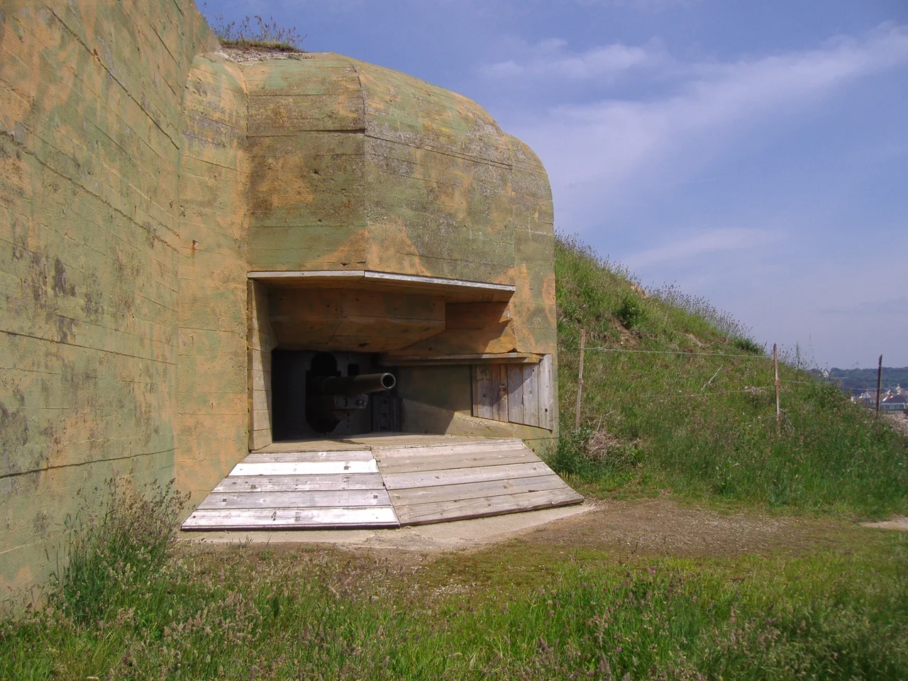
The story of Guernsey's fortifications might have ended with the Victorians, who replaced 24-pounders with 68-pounders and added bunkers and glacis. But in June 1940 the British government quietly demilitarized the Channel Islands and pulled the militia. Wehrmacht troops landed at the end of the month. For the next five years, German engineers turned Guernsey into the most heavily fortified coastline of its size on Earth. Up to 7,000 Organisation Todt laborers - including forced workers from across occupied Europe - poured concrete continuously between 1941 and 1943. The German staff record, the Festung Guernsey book, counts 616,000 cubic meters of concrete used on this single small island. That is almost 10 percent of the entire Atlantic Wall. The largest battery, Batterie Mirus on the west coast, mounted four 30.5 cm naval guns with a range of 51 kilometers - far enough to reach Cherbourg. After liberation on 9 May 1945, the islanders stripped the metal and buried what they could. The concrete is too vast to remove. It will still be here, half-buried in the gorse, when everything else is gone.
From the Air
The fortifications of Guernsey ring the entire 50 km coastline. Key anchor points: Castle Cornet (49.45°N, 2.53°W) at St Peter Port, Fort George (49.45°N, 2.53°W) on the high ground south of Town, the three Martello towers - Fort Hommet (49.47°N, 2.61°W), Fort Saumarez (49.44°N, 2.65°W) and Fort Grey (49.42°N, 2.67°W) - along the western coast, and the massive Batterie Mirus position on the west coast. From cruising altitude the coastline reads as a string of bumps and scars. Guernsey Airport (EGJB) is centrally located at 49.43°N, 2.60°W. Best flown in low side-light, when the German bunkers cast distinctive shadows.
Nearby Stories
- Pallot Steam, Motor & General Museum 29 km away
- HMS Affray 29 km away
- Operation Donnerkeil 29 km away
- German Submarine U-672 35 km away
- Action of 18 June 1793 60 km away
- Mont Saint-Michel: The Abbey That Becomes an Island Twice a Day 78 km away
- Basilica of Sainte-Therese, Lisieux 209 km away
- 1941 Santander Fire 642 km away