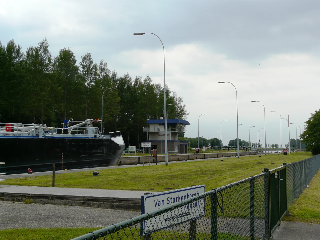
Gaarkeuken Lock
The name means cheap kitchen. Three hundred years before anyone poured concrete here, a gaarkeuken was the kind of inn where bargemen ate when they could not afford anywhere else, and the one that gave this place its name stood beside a small wooden lock on the old Hoendiep canal. The lock outlived the inn. So did the name, which now belongs to one of the most important pieces of inland shipping infrastructure in the northern Netherlands, a 190-meter concrete chamber where every freighter moving between the IJsselmeer and the German border has to stop and wait for the water levels of two provinces to agree.
A 27-Centimeter Seam
There is a line drawn across the northern Netherlands that no map shows and no boundary marker honors, and it runs straight through the middle of Gaarkeuken Lock. On the Frisian side, the water sits at minus 0.66 meters below the Amsterdam Ordnance Datum, the elevation reference the Dutch use to make sense of a country mostly below sea level. On the Groningen side, it sits at minus 0.93. That 27-centimeter difference is enough to require a complete machine: miter gates 16 meters wide, a chamber long enough for two pushed barges, and a steel screen driven 11 meters into the earth beneath the lock to stop groundwater from quietly leaking from one province to the other. The official Friesland-Groningen border is six kilometers west at Stroobos. The water knows a different border.
Layers of Locks
The current lock opened on 17 October 1980, and beside it run the ghosts of every lock that came before. The first was the 1680s wooden structure that gave the inn its market. In 1806, a renovation cut a temporary bypass canal so shipping could continue. In 1864, the province built a stone lock big enough for 300-ton barges, the standard of the era when draft horses still hauled freight against contrary winds. In 1924 came the giant: two connected chambers, 18 meters wide at the upper end, with iron doors that hung from overhead rails so ice could not jam them shut. Each replacement was a bet on the next generation of barges, and each was outgrown faster than its builders expected. The 1980 lock was built to handle 2,000-ton vessels and to let tugboats push two barges in tandem. The tandem traffic never quite materialized in the north. The lock is still oversized for what passes through it, which is the kind of mistake an engineer prefers.
Thirty-Two Bombs in November
On 11 November 1944, with the German occupation in its final winter, Allied aircraft made a run on Gaarkeuken Lock. They dropped thirty-two bombs of 250 kilograms each, because the lock sat on one of the main supply routes the occupiers used to move bulk goods between Holland and the Ruhr. The strike worked. Traffic stopped. By January 1945, Dutch crews had patched the chamber well enough to pass a few barges, but the deeper damage never really came out. The brickwork around the gates had been shaken in ways that no postwar repair could fully reverse. For the next thirty-six years, the 1924 lock kept working with cracks that engineers monitored but could not heal. When the 1980 replacement finally opened, it was as much an act of mercy toward an exhausted machine as it was a response to bigger barges.
What the Numbers Show
Lock-keepers have been counting boats at Gaarkeuken for more than a century, and the ledgers tell a quiet story about how Dutch freight grew up. In 1878, total tonnage was 500,000 tons a year. By 1898 it had hit 1.25 million. By the mid-1990s it was around 18 million, with the average barge nudging steadily upward: 964 tons in 1992, over 1,250 tons by 2004. The boats got bigger; their crews got smaller; the lock-keeper's job got more about radio coordination and less about ropes. Coastal trading vessels once made the same passage, German coasters threading inland to swap cargoes with Ruhr industry, peaking at 2,281 ships in 1957 before highway and rail took most of that work back. The barges remain, because nothing else moves grain and sand and steel more cheaply across the flat Dutch north.
From the Air
Coordinates 53.249N, 6.311E. Cruise altitudes 3,000-5,000 ft AGL offer the cleanest view of the lock complex, the parallel sluice canal to the south, and the perfectly straight Van Starkenborgh Canal slicing east-west across the Friesland-Groningen border country. Groningen Eelde (EHGG) lies about 25 km southeast; Drachten airfield (EHDR) sits 30 km southwest. Visibility is rarely an issue here in the agricultural flatlands, but low haze on still autumn mornings can obscure the canal's geometry until the sun climbs.
Nearby Stories
- Foxhol 2.8 km away
- Ernst-Wilhelm Modrow 5.6 km away
- Drenthse Veenkolonien 7.1 km away
- Schiermonnikoog 7.6 km away
- Aylvapoldermolen 9.5 km away
- Eemshaven Railway Station 10 km away
- Low-Frequency Array 13 km away
- West Sole Gas Field 297 km away