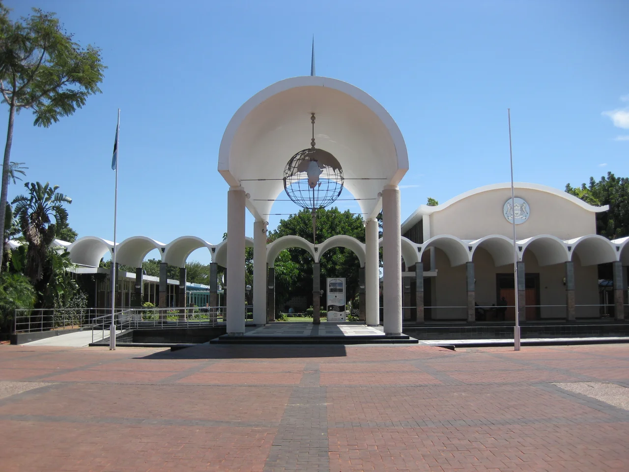

Gaborone
The name is a small joke about modesty. Gaborone comes from a Setswana phrase meaning, roughly, that something does not fit badly - it is not unbecoming. The city took the name of Kgosi Gaborone, a chief of the Tlokwa whose village sat across the river from the colonial Government Camp, and who is said to have lived more than a century, into the 1930s. When Botswana needed a capital in the 1960s, planners chose this spot near his old village and gave it his name. A nation that was about to be born would govern itself from a place whose very name shrugged: this will do.
A City Built on Purpose
Almost nothing of Gaborone existed before 1964. When the Bechuanaland Protectorate had been run from Mafeking, far to the south and outside its own borders, the absurdity demanded a fix. So a capital was designed from scratch, a planned city in the mold of Brasilia, laid out around a Government Enclave with parliament, ministries, and the curve of Khama Crescent at its core. In 1965 the seat of government moved here from Mafeking, a year before independence. The town was first called Gaberones; the name was trimmed to Gaborone in 1969. From a dusty outpost it has grown into a metropolitan area of more than half a million people in barely two generations.
The Logic of Blocks and Extensions
Newcomers get lost quickly, and not from the size. Gaborone is organized by a vocabulary all its own: blocks, extensions, phases, and wards, often with several names attached to the same patch of ground. The Extensions fan out east of the railway from the Government Enclave, with Extensions 9 and 11 among the wealthiest addresses. The Blocks march south to north on the western side, except Block 9, which sits stubbornly at the bottom. Street names barely matter here; directions come by plot number, by landmark, by the name of a familiar shop. To navigate Gaborone is to learn a local grammar that no map fully captures.
Malls, Mopane Worms, and Modern Africa
Shopping centers sprawl across the city, so many that they dilute the old downtown entirely. South African chains dominate the shelves, which makes Gaborone an expensive and sometimes uninspiring place to shop, though the trade-off is a city that simply works. Food tells the same story of borrowing and belonging. The traditional Botswanan dish seswaa - meat boiled and pounded until tender, served with maize porridge - shares menus with imported franchises, and the adventurous can still find mopane worms, a protein-rich Southern African delicacy harvested from the mopane tree. Beneath the retail gloss, the local culture holds its ground in arts villages, craft workshops, and the rhythm of daily Batswana life.
Where the Land Pushes Back
For all its planning, Gaborone never fully tamed the bush around it. Drive toward the edges and cattle wander into the road; herds of goats halt traffic; wildlife claims the verges at dusk. Kgale Hill rises on the southwestern flank, a granite landmark that locals climb for the view across the valley. The Gaborone Dam holds back the Notwane River and supplies the thirsty city in a region where water is never guaranteed. Beyond the suburbs, lodges sit out in the open veld only fifteen kilometers from downtown, close enough to commute, wild enough to hear jackals at night.
The Capital of a Quiet Success
Gaborone is not built for spectacle, and it does not pretend to be. It is clean, functional, and overwhelmingly safe by the standards of the region, a place where the visitor advice runs more toward common sense than fear. That ordinariness is itself the achievement. This is the working capital of one of Africa's most stable democracies, the nerve center of a country that turned diamond wealth into roads, schools, and clinics rather than chaos. The chief whose name the city carries would recognize the modesty if not the skyline. Gaborone does not fit badly. It never claimed to do more than that, and quietly, it has done a great deal more.
From the Air
Gaborone sits at roughly 24.66 degrees south, 25.91 degrees east, in southeastern Botswana about 15 km from the South African border. From the air the planned grid is unmistakable against the surrounding bushveld, with Kgale Hill and the Gaborone Dam as obvious visual anchors. Sir Seretse Khama International Airport (ICAO: FBSK, IATA: GBE) lies 15 km north of the city center and is the country's busiest airport, opened in 1984. Elevation is about 3,300 feet above sea level. Best viewing is at 6,000 to 10,000 feet in the dry winter months (May to September), when skies are clear and the dust of the late dry season has not yet risen.
Nearby Stories
- Limpopo River 58 km away
- Jwaneng diamond mine 65 km away
- Oppikoppi 80 km away
- Pilanesberg National Park 81 km away
- Siege of Mafeking 101 km away
- Marakele National Park 180 km away
- Battle of Rooiwal 208 km away
- Botswana 298 km away