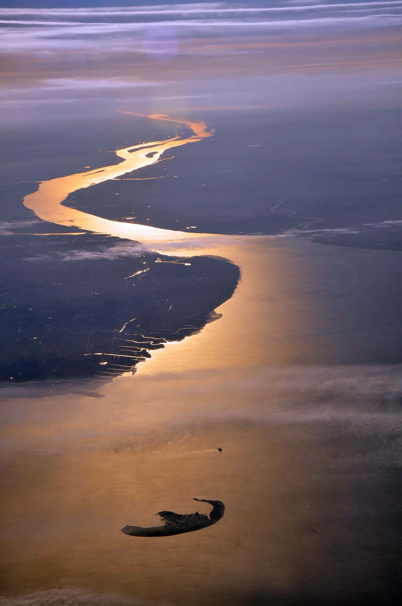
,_Elbe,_Trischen.jpg)
German Bight
Most people who know the name German Bight have never seen the place. They heard it just before midnight or at quarter past five in the morning, read out in a low even voice on BBC Radio 4 as part of the Shipping Forecast: 'Viking, North Utsire, South Utsire, Forties, Cromarty, Forth, Tyne, Dogger, Fisher, German Bight...' The litany is one of the strangest acts of public-service broadcasting still on the air, half practical safety message for fishermen, half ambient poem for insomniacs. The water that the words describe is real, of course - a corner of the North Sea bounded by the Netherlands and Germany to the south, Denmark to the east, the great submerged plateau of the Dogger Bank to the north. The area used to be called Heligoland on the broadcast. The name changed in 1956. The voice did not.
Geography of an Inlet
The German Bight is the southeastern bight of the North Sea - bight being an Old English word for a shallow recess in a coast, the kind of feature a chart-maker recognizes but a coastline-walker barely notices. Its boundaries are loose. To the south, the Frisian and East Frisian islands stretch in an east-west chain off the German and Dutch coast. To the east, the Jutland peninsula of Denmark closes it off. To the north, the Dogger Bank rises so close to the surface that fishing fleets have worked it since the Middle Ages and submarines surfaced there to dodge convoys in two world wars. Within the bight sit the smaller Heligoland Bight to the south and the small red-sandstone island of Heligoland itself near the bay's mouth. The Wadden Sea fringes the southern shore - ten to twelve kilometers of intertidal mudflat at the typical width, twice that in places.
Wadden Sea
Three German national parks - Lower Saxon, Schleswig-Holstein, and the small Hamburg park around the island of Neuwerk - together protect the Wadden Sea coast of the bight. UNESCO inscribed the area as a World Heritage site for its biological value: this is one of the largest unbroken stretches of intertidal sand and mud on Earth, host to millions of migrating waders each spring and autumn. Local guides lead Wattwanderungen across the flats at low tide, with strict rules about turning back before the tide turns. The mudflats are dangerous to people who do not know them and irreplaceable to the birds that do. Offshore, the small island of Trischen marks the southeastern corner of the bight; further out, Germany's only offshore oil rig, Mittelplate, pumps from a sandbank under license, and the Alpha Ventus wind farm spins its blades in the steady seaward breeze.
Shipping Forecast
The Shipping Forecast has been on British radio since 1924. Until 1956 the area now called German Bight was named Heligoland - the small German island that sits near its center. The change happened during the Cold War, partly to remove a slightly awkward British holdover from when the island had been ceded to Germany in 1890, partly because German Bight matched the German hydrographic chart name. The format of the bulletin is rigid: gale warnings, then the general synopsis, then sea area conditions in a fixed clockwise order. The voice is reading not for entertainment but for trawler skippers and yachtsmen who genuinely need to know whether German Bight will be 'southwest 5 to 7, occasionally gale 8, rain then showers, moderate or good.' That millions of people who have never set foot on a boat also listen is a peculiar British accident. The names became part of the national soundscape.
The Working Sea
Step away from the radio and the German Bight is one of the busiest working seas in Europe. The Port of Hamburg, Germany's largest, draws its container traffic up the Elbe through this water. Bremerhaven and Bremen handle car exports - many from the Volkswagen plant at Emden, which builds models for global markets. The JadeWeserPort at Wilhelmshaven is Germany's only deepwater port, deep enough to take the post-Panamax ships that cannot reach Hamburg. Shipping channels here run through Priele - tidal channels in the sandbanks - and they need constant dredging to keep up with ever-bigger keels. The East Frisian islands run their own ferries on tide-dependent schedules. Some of the Halligen, the tiny salt-marsh islands off Schleswig-Holstein, are connected to the mainland by narrow-gauge railways that are usable only at low tide, with island residents running diesel and battery-electric draisines along the rails. Where the lines were built for ferries before the 1920 plebiscites, the island of Sylt now hangs off the Hindenburgdamm causeway. Everything here is shaped by tide.
From the Air
Located at 54.45 N, 7.21 E - approximately the geographic center of the German Bight, open water about forty nautical miles west-northwest of the mouth of the Elbe. Cruising altitude of 6,000-10,000 feet on a clear day reveals the full layout: the Dutch and German coast and the East Frisian island chain to the south, the Danish coast and the Jutland peninsula to the east, the long arc of the bight opening into the wider North Sea to the north and west. Heligoland's red cliffs sit twenty-five nautical miles south. The Dogger Bank, though too deep to see from the air, is the great underwater shoal to the north. Nearest airports: Heligoland (EDXH), Wangerooge (EDWG), Norderney (EDWY), Sylt (EDXW) on the Schleswig-Holstein coast, and the major hubs at Bremen (EDDW), Hamburg (EDDH), and Esbjerg (EKEB) on the Danish side.
Nearby Stories
- Battle of Heligoland (1864) 13 km away
- HMS Undine (N48) 14 km away
- Alpha Ventus Offshore Wind Farm 15 km away
- Heligoland 27 km away
- SM UB-22 31 km away
- Hörnum 37 km away
- Rantum Loran-C Transmitter 72 km away
- Battle of Jutland 231 km away