
Gla
The ancient name of this place has been lost. What survives is the fortress itself: 2.8 kilometers of Cyclopean walls enclosing some 23.5 hectares of a flat-topped limestone outcrop that once jutted into, or rose as an island within, the waters of Lake Copais. No other Mycenaean citadel comes close in area — not Tiryns, not the Acropolis of Athens, neither of which approaches even a tenth of Gla's enclosed space. Yet Homer, who catalogued dozens of Boeotian communities in the Iliad, either ignored it or could not identify it. The site the locals call Palaiokastro — "the old fortress" — stands as one of Bronze Age Greece's most imposing and most enigmatic monuments.
An Island in a Vanished Lake
Lake Copais, which once covered much of the central Boeotian plain, was a shallow but extensive body of water fed by several rivers and drained — with great difficulty — by ancient drainage channels and sinkholes. In the Bronze Age, before the Mycenaean drainage works reshaped the basin, the limestone ridge at Gla rose from the lake like a natural platform, its flat top elevated some 38 meters above the surrounding water and marsh. The outcrop measures roughly 900 by 575 meters at its widest points. When the Mycenaeans chose this site for construction around 1300 BC, they were selecting a naturally defensible position that required only walls, not the cliff-cutting and terracing demanded by inland citadels. The lake itself provided the moat.
Walls That Outlasted Their City
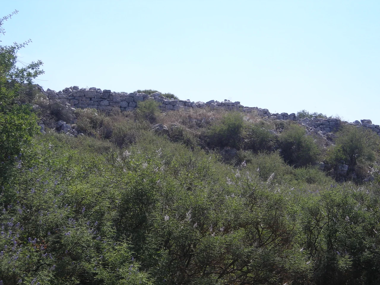
The fortification walls were built from Cyclopean masonry — enormous limestone blocks fitted together without mortar, their sheer mass providing stability. Three meters thick and running for 2.8 kilometers, they enclosed about 23.5 hectares (235,000 square meters) of land. Where the rock face dropped away naturally, the builders ran the walls directly along the cliff edges. Four gates pierced the circuit, an unusually large number for a Mycenaean fortification — north, west, south, and southeast — each approached by elaborate built ramps. Dating places the construction in early Late Helladic III B, around 1300 BC. The walls were always visible above ground — they proved impossible to quarry away completely — and the site was called Palaiokastro by local people long before modern archaeology arrived to measure it.
Palace, Garrison, or Granary?
Within the walls, excavations revealed a large complex once thought to be a palatial compound — the standard interpretation for a major Mycenaean citadel. More recent analysis has shifted toward a different reading: the interior buildings show extensive storage capacity and characteristics more consistent with a military installation or administrative center than a residential palace. Whether Gla served as a garrison controlling the Lake Copais drainage system, a redistribution hub for agricultural surplus from the newly drained plain, or some combination of these functions remains an open question. The drainage of Copais itself was a significant engineering achievement, and Gla may have been the administrative and defensive heart of that project — the fortress from which the entire system was managed and protected.
A Name with No Answer
Despite decades of speculation, no one has convincingly matched Gla to any of the place-names in Homer's Catalogue of Ships. The site has sometimes been linked to the unidentified city of Arne — also claimed by other locations — but the archaeologist George Mylonas and others have disputed this connection. The modern name Gla derives from the Arvanitic word goulas, meaning tower, which is itself borrowed from the Turkish kulle. A settlement on the south shore of the former lake is still called Goulas. These layered etymologies — Greek, Arvanitic, Turkish — trace the succession of cultures that looked at the same limestone rock and needed a name for it, never suspecting that the Bronze Age people who built its great walls had left no name at all.
What the Pottery Tells Us
Gla was not occupied continuously. Finds from the site include Neolithic and Byzantine pottery, suggesting intermittent human presence across millennia — people drawn back to the defensive advantages of the outcrop long after the Mycenaean walls fell silent. During the Archaic, Classical, and Roman periods, however, the site appears to have been uninhabited. That gap is itself suggestive: Gla was a Bronze Age creation, bound up with a specific moment in Mycenaean civilization, and when that civilization collapsed around 1200 BC, the fortress was simply abandoned. Unlike Thebes or Athens, Gla had no urban tradition independent of Mycenaean power. When the power ended, so did the city — whatever it was called.
From the Air
Gla lies at approximately 38.48°N, 23.18°E, rising above the flat agricultural plain that was once Lake Copais. From the air the site is immediately recognizable: a distinctly elevated limestone outcrop standing alone amid the drained Boeotian basin, its perimeter walls still visible as a dark line following the cliff edges. The entire former lake basin — now farmland — spreads around it to north, south, and west. Recommended viewing altitude: 1,000–2,500 m to see the full extent of the outcrop and its relationship to the surrounding plain. The nearest major airport is Athens International Eleftherios Venizelos (LGAV), approximately 90 km to the southeast.
Nearby Stories
- Aulis (ancient Greece) 4.3 km away
- Pleistos 4.6 km away
- Doris (Greece) 5.9 km away
- Corinth Rail Disaster 6.9 km away
- Daphni Monastery 16 km away
- Loutraki 19 km away
- Saint George Monastery, Aidipsos 23 km away
- Skopelos 51 km away