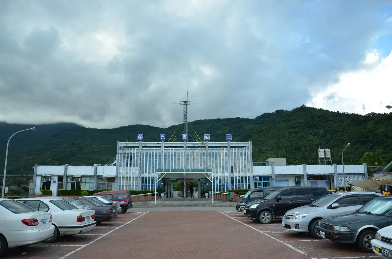

Guangfu, Hualien
The name Guangfu carries a specific meaning in Taiwanese history — it means 'retrocession' or 'restoration,' and it was given to commemorate the return of Taiwan from Japanese colonial rule to the Republic of China in 1945. A township named for a historical moment of homecoming sits appropriately in the mid-Huatung Valley, one of the most fertile corridors in eastern Taiwan. Flanked by the Central Mountain Range to the west and the Hai'an Range to the east, the valley floor here is flat and broad, suited to agriculture in a way that coastal Hualien rarely is. Guangfu has never been famous. It has simply been busy — growing food, keeping traditions, working the land that the valley provides.
A Valley Floor Built for Farming
The Huatung Valley runs most of the length of Hualien and Taitung Counties, one of the longest rift valleys in East Asia. Guangfu occupies a central stretch, where the valley is wide enough to support intensive agriculture — sugar cane historically, and now fruit orchards, rice paddies, and specialty crops. Fourteen villages are spread across the township, home to a population of nearly 12,000 people, and the landscape between them is patterned farmland broken by rivers and tree lines. Provincial Highway No. 9, the main artery linking Hualien city to Taitung, runs through the township, giving it connectivity that some of its more isolated neighbors lack. The Taiwan Railway also serves the area, with Guangfu Station sitting at the edge of town — a small but functional stop on the line that hugs the valley.
The Amis and the Life of This Land
Roughly half of Guangfu's population is Amis — Taiwan's largest indigenous group, with a long presence across the Huatung Valley. The Amis have been farmers, fishers, and forest people here for generations, and their culture marks the township in visible ways: in ceremonies held at village squares, in the architecture of community gathering spaces, in the foods grown and prepared by methods passed down within families. Agriculture is not just the township's economy; for the Amis, land is also lineage. The sugar factory that dominated the local economy for much of the twentieth century drew both indigenous and Han laborers, and the resulting community is mixed and layered — Amis traditions surviving alongside, and sometimes intertwined with, the township's more recent history.
The Weight of Typhoon Toraji
In July 2001, Typhoon Toraji struck eastern Taiwan with unusual intensity. Guangfu was one of the two most severely affected areas in the entire country. Twenty-one people died in and around the township, and approximately thirty more were reported missing. Mudslides swept away bridges and mountain roads. Floodwaters carried houses from their foundations. The Agriculture Council of Taiwan estimated damage to land, livestock, and agricultural districts at around four million US dollars — a figure that does not capture what was lost beyond crops and infrastructure: neighbors, belonging, the ordinary rhythms of a farming community torn apart. Recovery was slow and uneven, as it often is in places that depend on terrain that is also capable of destroying them.
A Mountain Lake Breaks Its Banks
In July 2025, Tropical Storm Wipha triggered a massive landslide near Matai'an Creek, forming a barrier lake — a natural dam of debris-blocked water — in the mountains above Guangfu. For weeks the lake held. Then in late September 2025, as Typhoon Ragasa brought heavy rains, the barrier failed. Sixty million tonnes of water discharged from the lake's total volume of roughly 91 million tonnes, sending a wall of mud and floodwater down toward the valley floor. A bridge on Provincial Highway 9 was swept away; vehicles were carried off by the current. Flooding reached Guangfu, Fenglin, and Wanrong Townships. At least 19 people were killed across the affected area, 107 were injured, and six were missing. Around 5,200 residents — roughly 60 percent of Guangfu's population — were forced to shelter in the upper floors of their homes. Four thousand people lost access to water supply. Officials described what happened as 'a typhoon from the mountains.' The phrase captures something true: the disaster arrived not from the sky directly, but from the terrain itself, which had been storing catastrophe since July.
Roots and Resilience
Guangfu has been remade by external forces more than once: colonial settlement, post-war renaming, typhoons, corruption scandals, and floods. In 2011, the sitting mayor was arrested for election fraud, accused of paying bribes of NT$1,000 per vote during the 2010 mayoral election; two other candidates faced charges as well. A by-election was held, and local governance continued. Communities absorb these disruptions differently than institutions do. The Amis families who have farmed and fished this valley for generations carry a longer memory than any single political moment. The sugar factory that defined the twentieth century is now a heritage site and tourist destination. The valley floor is still planted. The railway still stops here. Life in Guangfu insists on continuing.
From the Air
Guangfu Township is centered at approximately 23.64°N, 121.42°E in the mid-Huatung Valley, Hualien County. From the air, the flat valley floor between the Central Mountain Range to the west and the Hai'an Range to the east is a distinctive landscape feature — a broad cultivated corridor running north-south. The patchwork of farmland, sugarcane fields, and villages is visible at lower altitudes. The nearest airport is Hualien Airport (RCYU), approximately 30 km to the north. Guangfu Station is a visible landmark on the Taiwan Railway's Taitung line. Recommended viewing altitude is 3,000–4,000 feet to distinguish township features from valley floor.
Nearby Stories
- Paper Dome 4 km away
- Liyu Lake 5.2 km away
- Hai'an Range 11 km away
- Xitou Nature Education Area 15 km away
- Namasia District 25 km away
- Twin Forts of Romblon 1201 km away
- Sinking of MV Sewol 1209 km away
- Sibuyan Island 1250 km away