
Guerguerat
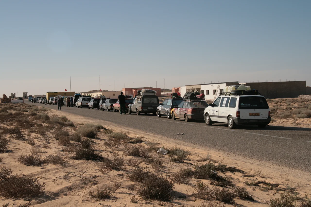
On a map it is almost nothing: a cluster of buildings on a strip of empty desert, a few kilometres short of the Mauritanian border and a few from the Atlantic. But this small village in the far southwest of Western Sahara holds a weight wildly out of proportion to its size. The road that runs through Guerguerat is the only safe overland route connecting all of North Africa to the countries south of the Sahara. Trucks loaded with Moroccan vegetables, traders, migrants, and travellers funnel through this single point, because every other path across the desert is closed by conflict.
The Only Road
Geography made Guerguerat indispensable. To the east, the Sahel is wracked by insurgency and banditry, the routes through Mali and onward all but impassable for ordinary commerce. The Atlantic coast road, by contrast, is paved and patrolled, and it bottlenecks here at the southern edge of Western Sahara before crossing into Mauritania and on toward Nouadhibou and the rest of the continent. For Morocco, which controls the territory, this is the artery for its exports south and its only land link to another African nation. A driver hauling crates of tomatoes toward Mauritanian markets has, in practice, nowhere else to go.
A Disputed Crossing
That same chokepoint makes Guerguerat a pressure valve in one of the world's longest-running territorial disputes. Western Sahara has been claimed since the 1970s by both Morocco and the Polisario Front, which seeks an independent state, the Sahrawi Arab Democratic Republic. For the Polisario, this crossing is the one place where it can squeeze Morocco, by threatening to sever its lifeline to the south. A United Nations-monitored buffer strip runs through the area, the residue of a ceasefire meant to keep the two sides apart. The dispute is real and unresolved, and people of good faith disagree about who holds the rightful claim; what is not in dispute is that ordinary lives and livelihoods depend on this road staying open.
The Standoff of 2020
In October 2020, Sahrawi protesters set up camp on the road inside the buffer zone, halting traffic and stranding lines of trucks. Morocco accused the Polisario of strangling trade with the rest of Africa; the Polisario framed the blockade as legitimate protest in occupied land. On 13 November, Moroccan forces moved into the buffer strip to clear the protesters and reopen the crossing. The Polisario declared the 1991 ceasefire dead and announced a return to armed struggle, ending nearly three decades of uneasy quiet, while Morocco insisted no real clashes had occurred and the truce held. For the families and drivers caught between the two positions, the practical question was simpler: when would the road reopen?
Concrete and Quiet After
Since the standoff, Morocco has worked to bind Guerguerat more firmly to itself, building the apparatus of a permanent town on the sand. A Great Mosque opened in March 2023, nearly 3,800 square metres with room for 520 worshippers, raised on a budget of 8.8 million dirham. A seawater desalination plant came online in late 2023, two units pulling fresh water from the Atlantic for a place that has none of its own. There are plans for football pitches at Guerguerat and neighbouring Bir Gandouz. The investments are partly practical and partly political, the slow turning of a contested checkpoint into a settled fact, one mosque and one water tank at a time.
From the Air
Guerguerat sits at 21.43 N, 16.96 W, near the Atlantic coast at the far southern tip of Western Sahara, just north of the Mauritanian border. The nearest major airport is Nouadhibou International (GQPP) across the border to the south; Nouakchott (GQNN) lies further down the coast. From altitude, look for the single paved coastal road threading through otherwise featureless desert toward the border, with the ocean a few kilometres to the west. The terrain is flat, pale, and largely empty; the road and the small clustered settlement are the only clear human marks. Clear, dry skies are the norm, with excellent visibility broken mainly by blowing dust.
Nearby Stories
- Nouadhibou 20 km away
- Arguin 55 km away
- Afonso Gonçalves Baldaia 70 km away
- Banc d'Arguin National Park 132 km away
- Agounit 355 km away
- SS Noemijulia 361 km away
- Sao Miguel 1948 km away
- Rocas Atoll 3315 km away