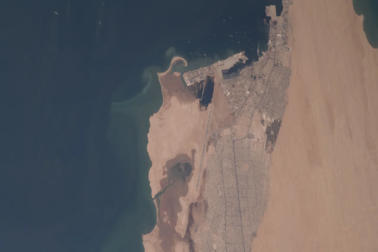

Nouadhibou
The town's name means Place of the Jackal, after the animals that once came to drink from a well here. The jackals are long gone, but Nouadhibou has kept its frontier feel. This is a working city on a thin spit of desert between the Atlantic and the Sahara, where the air smells of salt and grilled fish, where ore dust settles on everything, and where one of the longest trains in the world rumbles in from the interior loaded with iron. Few places concentrate so much of a country's economy into so narrow a strip of sand.
Port-Étienne to Place of the Jackal
Before independence the French called this town Port-Étienne, named for Eugène Étienne, the French Minister of the Colonies who championed France's West African empire. When Mauritania became independent in 1960, the town took the name Nouadhibou. The city grew in distinct pieces, each with its own story. Cansado, whose name means tired in Spanish, was built by the French in 1960 for the workers of the SNIM mining company, and still has its hotel, tennis courts, and pétanque grounds. Keran, the city center, dates from 1958 and holds the banks, customs, and central market. Numerowatt, the sprawling district where most people now live, rose in the early 1980s, its water piped in from an underground lake ninety kilometers away at Boulenoir.
The Iron Road
Nouadhibou would not exist as it does without SNIM, the national mining company, and the railway it built in the 1960s. The line carries iron ore from the mines at Zouerat down to the coast aboard trains that stretch more than two kilometers. A single passenger car is sometimes coupled to one of these ore trains, but the real experience, free of charge, is to ride atop the open hopper itself. You will want a scarf wrapped tight against your face: the dust is relentless, and the train lurches hard when it brakes and accelerates. It is one of the great rough journeys left in the world, equal parts adventure and endurance.
A Bay of Wrecks
Off Nouadhibou's shore lies one of the strangest seascapes on Earth: the world's largest ship graveyard. At its peak, over three hundred rusting hulls crowded the shallow bay, abandoned over decades because dumping a ship here cost less than scrapping it honestly. The biggest and most recent wreck rests near the tip of the peninsula. What began as an environmental scandal has had an unexpected second act. The decaying hulls became artificial reefs, drawing fish back to waters that overfishing had stripped, and giving the local fishing fleet new grounds to work. At the Port Artisanal, Senegalese boats land their catch amid the salt air and the cries of gulls, life clustering around the bones of dead ships.
The Tip of the Peninsula
Follow the peninsula south to its absolute tip, Cap Blanc, and you reach a small national park where, for a modest fee, you can watch the bay meet the open Atlantic. This is monk seal country, home to several of the rarest seals on Earth. Keep your distance: some have been known to be aggressive, and these are among the last of their kind anywhere. Nearby stand the ruins of an old French coastal gun emplacement, fifteen-meter towers linked by underground tunnels, built to guard the French colony from the Spanish border just a few kilometers west. Some of those tunnels drop off without warning, so bring a torch and watch your footing. Across the border lies the ghost town of La Güera, its Spanish buildings half-claimed by sand.
Salt Air and Camel Milk
For all its industry, Nouadhibou rewards the patient traveler. The city center can be crossed on foot in fifteen minutes, and taxis announce themselves with a honk rather than a sign. Senegalese cooks serve fresh fish and rice for a few coins; the bay offers sea trout to anglers and steady year-round wind to kiteboarders. At the edge of town, where camel herds gather, herders sell fresh camel milk toward evening, startlingly refreshing in the heat. A word of real caution stays with you, though: do not wander across the train tracks, because many areas near them have never been cleared of landmines, and only the surfaced roads are guaranteed safe.
From the Air
Nouadhibou sits at the northern tip of the Cap Blanc (Ras Nouadhibou) peninsula at roughly 20.91°N, 17.05°W, on Mauritania's Atlantic coast. From the air, look for the long iron-ore rail line running inland toward Zouerat, the rusting wrecks scattered across the shallow bay, the three ports along the eastern shore, and the desert-meets-ocean line of the peninsula running south toward Cap Blanc and La Güera. The airport is Nouadhibou International (GQPP); Nouakchott lies about 470 km south. Saharan dust often hazes the air; clearest views follow a sea-breeze shift.
Nearby Stories
- Arguin 26 km away
- Guerguerat 38 km away
- Banc d'Arguin National Park 57 km away
- Chami 120 km away
- Inal, Mauritania 164 km away
- SS Noemijulia 307 km away
- Sao Miguel 2003 km away
- Rocas Atoll 3267 km away