Forty Thousand Hills
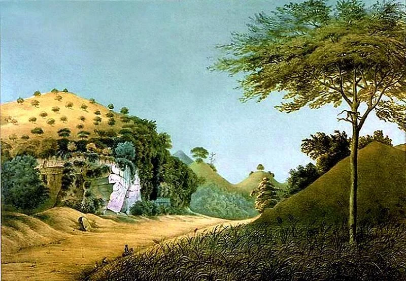
From the air, the landscape looks wrong. Tens of thousands of nearly identical cone-shaped hills crowd the southern coast of Java like the bumps on a golf ball, each one a limestone peak worn smooth by millennia of tropical rain. This is Gunung Sewu -- the "Thousand Mountains" -- though the actual count approaches forty thousand. UNESCO recognized the region as a Global Geopark in 2015, but the geological forces that shaped it have been at work for far longer. These hills are the lifted bones of an ancient seafloor, and beneath them lies a world of caves, underground rivers, and stone tools left behind by some of the earliest humans to walk this part of the Earth.
When the Seafloor Rose
The science is straightforward but the scale is not. Thousands of years ago, tectonic forces pushed the ocean floor upward along what is now Java's southern coast, creating a vast limestone plateau that stretches across three regencies: Gunung Kidul and Wonogiri in Central Java, and Pacitan in East Java. Rain went to work immediately. Water, slightly acidic from dissolved carbon dioxide, carved the soft limestone into a karst landscape unlike almost any other on earth. The surface -- what geologists call the exokarst -- bristles with those conical hills, separated by dry valleys and punctuated by seasonal karstic lakes. Below the surface, the endokarst took shape: at least 119 documented caves filled with stalactites and stalagmites, threaded by underground rivers that flow in darkness for kilometers. In 1993, the International Union of Speleology proposed classifying the entire karst system as a natural world heritage site.
Echoes from Deep Time
The caves are not empty. Excavations have uncovered human fossils dating to the early Stone Age, approximately 1.8 million years old, alongside the crude stone tools that those ancient inhabitants used for hunting. These finds place Gunung Sewu among the most significant paleoanthropological sites in Southeast Asia, a region that continues to reshape what scientists understand about early human migration. The caves also preserve more recent cultural layers -- evidence of Neolithic habitation and the gradual shift from nomadic hunting to settled agriculture. For archaeologists, the geopark functions like a vertical timeline: dig deeper, go further back, and the story of human presence in Java unfolds from the surface down through bedrock.
A Caver's Labyrinth
Local tradition divides the caves into two kinds. Vertical shafts, called luweng in Javanese, plunge straight down into the earth. Horizontal caves stretch laterally, sometimes for remarkable distances -- Cerme cave, for instance, has its entrance in Bantul Regency and runs eastward beneath the hills until it emerges in Panggang subdistrict, a journey that crosses an entire administrative boundary underground. The most famous among them are Jomblang and Grubug, both located in the Semanu subdistrict of Gunungkidul. Jomblang is a collapsed sinkhole cave where a shaft of sunlight punches through the canopy to illuminate the cave floor far below, creating a scene that has drawn speleologists and photographers from around the world. Several caves contain underground rivers navigable by inflatable tubes, turning geological wonders into accessible -- if decidedly wet -- adventure.
Volcanoes, Cliffs, and Puppet Rocks
The geopark is not all caves. At Nglanggeran, a primeval volcano rises just 600 meters above the surrounding terrain, but the views from its peak reach north to the smoking cone of Mount Merapi and south across the entire Javanese coastline. Scattered around its slopes are massive granite and andesite formations the locals call watu wayang -- puppet rocks -- named for their fanciful resemblance to the characters of traditional Javanese shadow puppetry. The hike from the Pendopo Kali Song entrance to the summit takes about three hours. Along the coast, Siung Beach offers a different kind of verticality: the bay itself is only 300 meters long and too dangerous for swimming, but the surrounding limestone cliffs support over 200 rock-climbing routes. Just 200 meters east, the Jogan waterfall tumbles in tiers directly into the sea during the rainy season, a sight best caught when the water runs high.
Living on Limestone
The human story here is ongoing. Farmers work the thin soil between the hills, coaxing crops from land that drains fast and holds water poorly. Villages cluster in the valleys, and the relationship between people and limestone is as practical as it is ancient. Caves serve as shelters, water sources, and -- increasingly -- as tourist attractions that bring outside income to communities with few other options. The UNESCO designation formalized what the local caver groups and speleological societies had long argued: that this karst landscape is globally significant, not just for its geology but for the way human life has adapted to its peculiarities over a span of nearly two million years. Seventy kilometers from Yogyakarta, the geopark remains close enough for a day trip but remote enough to feel like a different world entirely.
From the Air
Gunung Sewu stretches along Java's southern coast at approximately 8.04S, 110.78E, spanning parts of Gunung Kidul, Wonogiri, and Pacitan regencies. From cruising altitude, the distinctive karst topography is unmistakable: tens of thousands of nearly uniform conical hills in tight formation. Adisucipto International Airport (ICAO: WARJ) in Yogyakarta lies roughly 70 km to the northwest. The coastline to the south features dramatic cliffs and small bays. Mount Merapi is visible to the north on clear days.
Nearby Stories
- The School That Gave Itself Away 9.7 km away
- Ganjuran Church 11 km away
- The Train Builders of Madiun 16 km away
- The River Runway 17 km away
- Mendut: The Temple That Was a Bamboo Forest 23 km away
- Shaken Foundations: The 2021 East Java Earthquake 123 km away
- The Ghost Boat That Built an Empire 168 km away
- Meru Betiri: The Last Forest on Java's Southern Edge 320 km away