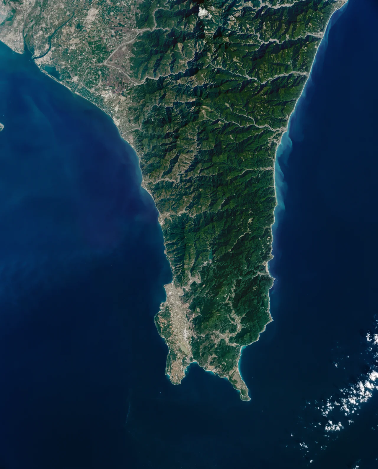

Hengchun Peninsula
Taiwan narrows to a point at its southern end, and that point is the Hengchun Peninsula. Three bodies of water meet here — the Taiwan Strait to the west, the Pacific Ocean to the east, and the Bashi Channel to the south, which separates Taiwan from the Philippine island of Luzon. On a clear day at Cape Eluanbi, the island's southern tip, you can feel the wind shifting as it finds no obstacle between here and the open Pacific. This is the end of the island, and it has a quality of genuine remoteness even as tourists fill the roads to Kenting.
Three Seas and a Narrow Neck
The peninsula connects to the main island of Taiwan only at its northern end, where the Central Mountain Range descends to a lower threshold before the terrain opens into the peninsula's own gentler topography. Most of the Hengchun Peninsula sits below 800 meters in elevation — considerably lower than the towering peaks of central Taiwan — and this relative flatness allows the sea breezes from three directions to move through with unusual ease.
That airflow shapes everything: the climate is humid and moderated by the ocean's thermal mass, meaning the peninsula rarely reaches the extremes of either heat or cold that Taiwan's central and northern regions experience. Locals and meteorologists both note that the peninsula has its own microclimate, distinct enough from the rest of Taiwan to deserve its own attention. The name Hengchun — "constantly spring" — was given to the main township by a Qing administrator in the 1870s, and while there was political motivation behind the choice, the climate it describes is genuine.
The Landscape Below the Mountains
To the north, the boundary of the Hengchun Peninsula is marked by Fangliao, where the terrain changes as you follow the Linbian River upstream. The eastern edge tracks the slope of Mount Dawu, where cypress forests begin — the lower limit of mid-altitude vegetation that distinguishes the Central Mountain Range from the coastal zones below. To the east, the Zhiben River marks another boundary before the land opens to the Taitung coast.
Within these edges, the peninsula's landscape varies considerably. The western coast facing the Taiwan Strait tends toward sandy beaches and coral flats. The eastern Pacific coast is rockier, more exposed to ocean swells. The interior rises through subtropical forest and grassland, with open stretches that draw migrating raptors in season. Kenting National Park — Taiwan's first national park, established in 1984 — covers much of the peninsula's southern portion, protecting coral reef systems offshore and forest ecosystems onshore. The park draws millions of visitors annually, making parts of the peninsula feel crowded while the hill villages and forest trails remain quiet.
Wind and Typhoon Country
The maritime location that moderates the climate also makes the Hengchun Peninsula one of Taiwan's most typhoon-prone areas. Storms moving northwest across the Pacific strike the eastern coast of the peninsula directly, and the Bashi Channel to the south has historically been one of the primary corridors for typhoons approaching Taiwan and the Philippines.
The Luzon Strait wind — known locally as the luoshui — is a distinctive feature of the peninsula, driven by pressure differences between the Pacific and the Taiwan Strait. It blows strongest in autumn and winter, strong enough to shape the vegetation at the cape and famous enough among sailors and locals to have its own name and reputation. The Hengchun meteorological station, one of Taiwan's oldest continuous weather observation points, has recorded this wind for well over a century.
For centuries of seafarers, Cape Eluanbi and the waters around it were marked by navigational hazard — uncharted reefs, strong currents, and poor visibility in the persistent sea haze. The Rover shipwreck in 1867 was one incident among many. The lighthouse at Cape Eluanbi, built in 1883, was a belated answer to those dangers.
Where History Collected
The Hengchun Peninsula's combination of strategic position, difficult terrain, and indigenous Paiwan sovereignty made it a focal point of 19th-century conflict. The events here — the Rover incident in 1867, the American Formosa Expedition that followed, the killing of Ryukyuan sailors in 1871, the Japanese expedition of 1874 — were not random. They reflected the peninsula's position at a junction of empires, trade routes, and the unresolved question of who governed Taiwan's southern frontier.
The Paiwan, who had managed the interior of this peninsula for centuries, found themselves at the center of each dispute without being party to any of the negotiations that followed. The walls of Hengchun went up between 1875 and 1879 as the Qing answer to all of these incidents. The Mudan Incident Memorial and Shihmen Battlefield further into the hills mark where the fighting actually happened.
Today the peninsula is known mostly for beach resorts and Kenting's summer crowds. That reputation is real — the water is clear, the coral is intact enough to be worth diving, and the sunsets at the western cape are as good as any in Taiwan. But underneath the resort economy is a landscape that has been contested, defended, and survived many times over, by people who understood its value long before the national park was gazetted.
From the Air
The Hengchun Peninsula begins where Taiwan's Central Mountain Range descends toward Fangliao in the north and terminates at Cape Eluanbi, at approximately 22.07°N, 120.82°E. From cruising altitude approaching from the north, the peninsula is unmistakable: a narrowing tongue of land extending south into the Pacific, flanked on three sides by open ocean. The Cape Eluanbi lighthouse is a useful visual waypoint at the southern tip. Kenting National Park occupies the southern half of the peninsula and is visible as dense subtropical forest broken by resort development. Nearest major airport is RCKH (Kaohsiung International), approximately 70 kilometers north of Cape Eluanbi. Descend to 3,000 feet for a clear view of how the Taiwan Strait and Pacific meet at the peninsula's edges, with the Bashi Channel opening to the south toward the Philippines.
Nearby Stories
- Fangliao 18 km away
- Orchid Island 25 km away
- Zhaori Hot Spring 41 km away
- Ten Drum Rende Creative Park 69 km away
- Barclay Memorial Park 102 km away
- Mavulis Island 102 km away
- 1991 Eruption of Mount Pinatubo 741 km away
- Scarborough Shoal 780 km away