
High Island (Hong Kong)
Two dams swallowed the channel between High Island and the Sai Kung Peninsula, and the sea became a reservoir. That engineering act, completed in 1979, ended High Island's 8.511-square-kilometre existence as a proper island — once the fourth largest in Hong Kong — but it could not end its remoteness. Even today, no public ferry calls here. A single minibus route reaches the East Dam, and beyond that the road thins to a track winding past abandoned fishing hamlets and hexagonal volcanic columns that look as though they were printed by a machine. High Island was never truly tamed, even after it was technically annexed to the shore.
A Sea Turned to Reservoir
The Kwun Mun Channel once threaded between High Island and the peninsula, carrying sampans from village to village. By 1979, that channel was gone — sealed by two massive dams that transformed a living seaway into one of Hong Kong's most important water sources. The transformation was dramatic but not instantaneous; construction ran from 1969 to 1979, demanding ten years and the lives of five workers whose names are commemorated on a memorial beside the East Dam. A smaller contingent of dams plugged side valleys, and aqueducts totalling five miles in length funnelled streams from across the Sai Kung Peninsula into the newly created basin. What had been a seascape became, in time, a still and viridian lake ringed by green hills, with the former island now simply the far shore.
Villages at the Margins
Along High Island's south coast, small Hakka villages had subsisted for generations on fishing and farming. Pak Lap, a single-surname Lau clan settlement, consisted of just 17 houses arranged in two neat rows — modest by any measure, yet considered a complete world by its inhabitants. By the time of the 1911 census, 164 people lived in Pak A alone. A century later, a few dozen residents remained scattered across Pak A, Tung A, Sha Kiu, and Pak Lap, with roughly a hundred more occupying licensed fish culture zones in the reservoir's sheltered waters. Seafood restaurants still operate on the shores. The villages did not die so much as quietly shrink, their futures contingent on the tides of Hong Kong's economy and the convenience of the minibus route that is their only lifeline.
A Temple, a Festival, a Parade at Sea
Built in 1741, the Tin Hau Temple between Pak A and Tung A is among the oldest on the island. Tin Hau — the Queen of Heaven, protector of fishermen — has been venerated along these coasts for centuries. What makes this particular temple exceptional is the marine parade it hosts to celebrate Tin Hau's birthday. The ceremony unfolds once every two years: a six-day religious ritual culminating in a procession of boats on the eve of the birthday, the hulls bright with lanterns and banners. Only one other temple in Hong Kong — at Tap Mun — holds such a parade, and that one only once a decade. High Island's biennial celebration draws worshippers who arrive by sea in wooden vessels, the way their grandparents did, because the road still does not reach everywhere.
Where Volcanoes Left Their Mark
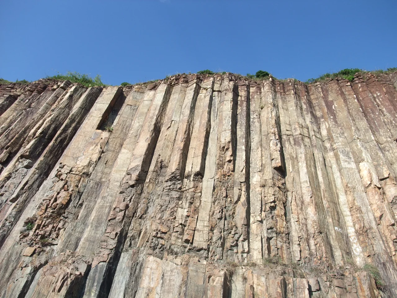
The eastern part of High Island belongs to the Sai Kung Volcanic Rock Region of the Hong Kong UNESCO Global Geopark. Here, Cretaceous-age volcanic rocks have fractured into hexagonal columns — polygonal jointing formed when ancient lava cooled slowly and contracted with geometric precision. The columns at the East Dam are considered internationally rare examples of acidic (rhyolitic) volcanic rock with this jointing pattern; most famous examples elsewhere, like the Giant's Causeway in Northern Ireland, are basaltic. High Island's columns are paler, finer-grained, and strangely beautiful against the blue-green water of the reservoir. The adjacent High Island Special Area, designated in 2011, protects 3.9 hectares including the stack islands Po Pin Chau and Conic Island, whose sheer faces display the same columnar geometry at a dramatic, sea-washed scale.
A Camp Grown Over with Grass
At the base of the West Dam, where the land flattens out before dropping to the water, there was once a refugee camp. The High Island Detention Centre housed Vietnamese boat people who reached Hong Kong in the 1970s and 1980s — people who had crossed the South China Sea in overcrowded vessels, risking everything for a shore that would accept them. The camp is gone now, its structures removed and the ground returned to pasture. Cattle graze there; a small pavilion marks the site. Nothing identifies it as a place where thousands of people once lived in difficult, uncertain circumstances. The grass grows without memory, though the history of what happened here has not been forgotten by those who lived it.
From the Air
High Island sits at approximately 22.358°N, 114.355°E on the southeastern fringe of the Sai Kung Peninsula, about 28 nautical miles northeast of Hong Kong International Airport (VHHH). At 5,000 feet, the reservoir is clearly visible as a bright inland sea enclosed by green ridgelines, with the East Dam's causeway-like road discernible in good visibility. The hexagonal volcanic columns at the East Dam are too small to see from altitude but the distinctive shape of Po Pin Chau stack island just offshore is a useful visual fix. Flight level should respect the surrounding terrain of Sai Kung East Country Park, which rises to around 700 metres on nearby ridges.
Nearby Stories
- Sha Chau and Lung Kwu Chau Marine Park 5.9 km away
- Wanshan Archipelago 22 km away
- Hong Kong 12 25 km away
- Second Battle of Chuenpi 27 km away
- Mount Guanyin (Dongguan) 43 km away
- Battle of Penghu 474 km away
- Penghu Air Raids 482 km away
- Checheng Fu'an Temple 592 km away