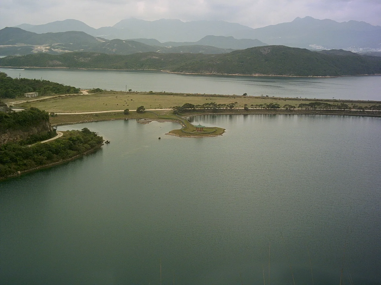

High Island Reservoir
In 1967, mainland China shut off part of the water supply to Hong Kong. The 1967 riots had already tested the colonial government's nerves; the water shutdown made clear how entirely dependent the territory was on goodwill it could not control. The government's answer was to look southeast to the Sai Kung Peninsula, where a long channel separated High Island from the mainland, and to decide: fill it. What emerged from that decision — after ten years of construction, an Italian construction contractor, five workers' lives lost, and enough concrete to seal a seaway — was the High Island Reservoir, opened in 1978, with a capacity of approximately 273 million cubic metres.
Engineering a New Geography
The Kwun Mun Channel had separated High Island from the Sai Kung Peninsula for as long as anyone could remember. Sealing it required two main dams: one anchoring High Island to the peninsula at its western end near Yuen Ng Fan, the other connecting the island's southeastern tip to the mainland near the stack island Po Pin Chau. Three additional smaller dams plugged tributary valleys. Five miles of aqueducts then channelled streams from across the peninsula into the new basin. Designed by Binnie & Partners as part of a comprehensive High Island Water Scheme, the project ran from 1969 to 1979 — ten years in which grouting and dam-sealing techniques were pushed to their limits. The roads built across the dams as access routes became, in time, the paths by which hikers and cyclists discovered one of Hong Kong's most dramatic landscapes.
The Cost Paid
A memorial stands beside the East Dam. It commemorates five workers who died during construction. Their names are not incidental to the reservoir's story — they are part of it, inscribed in stone next to a structure that hundreds of thousands of Hong Kong residents have depended on for drinking water. Large infrastructure projects tend to be remembered in the aggregate: so many years, so many cubic metres, so many millions spent. The East Dam memorial insists on the individual scale of what was built. Walk past it on the way to see the hexagonal columns and the view across the reservoir, and you pass through a quiet acknowledgement that this landscape was made at a price.
Columns of Ancient Fire
What draws most visitors to the East Dam is not the dam itself but what the dam's construction exposed: hexagonal columns of volcanic rock, stacked like an enormous bundle of pencils against the sea-cliff face. These are not basaltic columns of the kind found at the Giant's Causeway in Northern Ireland or Fingal's Cave in Scotland. High Island's columns formed from acidic rhyolitic lava — a composition that makes the jointing pattern here internationally rare. When the lava cooled some 140 million years ago during the Cretaceous period, it contracted so evenly that it fractured into six-sided prisms with an almost architectural regularity. The columns at the East Dam are part of the Sai Kung Volcanic Rock Region of the Hong Kong UNESCO Global Geopark, recognised as among the finest examples of this geological phenomenon anywhere in the world.
A Reservoir That Opened the Wilderness
Before the reservoir was built, the southeastern fringe of the Sai Kung Peninsula was reachable only by boat. The roads constructed as part of the High Island Water Scheme — crossing the West and East Dams — changed that. For the first time, a paved route reached a part of Hong Kong that had been genuinely remote, accessible to hikers, cyclists, and sightseers. The reservoir itself became a destination: the vivid teal-blue water enclosed by steep green ridges, a landscape that looks nothing like the city that depends on it. The 9A minibus from Sai Kung town to the East Dam carries hikers on weekends who have come to walk along the reservoir shoreline, look at the columns, and stand in a place that still feels, in some fundamental way, far from everything.
From the Air
The High Island Reservoir sits at approximately 22.375°N, 114.351°E, about 27 nautical miles northeast of Hong Kong International Airport (VHHH). From altitude, it is unmistakable: a vivid blue-green inland sea enclosed by the ridgelines of Sai Kung East Country Park, its two main dams visible as thin causeways at the western and eastern ends. The stack island Po Pin Chau appears just off the East Dam, providing a clear visual fix. Terrain in the surrounding Sai Kung hills reaches roughly 700 metres; maintain appropriate separation. Best viewed in morning light when the water reflects the sky.
Nearby Stories
- Sha Chau and Lung Kwu Chau Marine Park 5.9 km away
- Wanshan Archipelago 22 km away
- Hong Kong 12 25 km away
- Second Battle of Chuenpi 27 km away
- Mount Guanyin (Dongguan) 43 km away
- Battle of Penghu 474 km away
- Penghu Air Raids 482 km away
- Checheng Fu'an Temple 592 km away